
Thorong La Pass (5,416 m): Height, Difficulty and How to Cross It

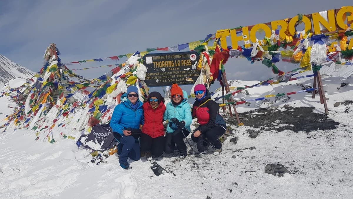
Short answer: Thorong La is 5,416 m (17,769 ft), the high point of the Annapurna Circuit, between Manang and Muktinath. Crossing day takes 7 to 10 hours. It is hard because of the altitude and the length of the day, not because of any technical climbing. Cross it on our Annapurna Circuit Trek (12 days), from USD 710 per person (Budget, 2 to 4 people), or WhatsApp me with your dates.
I am Shreejan. Thorong La is the day the Annapurna Circuit is known for, and most people who write to me about the Circuit want to know three things: how high it is, how hard it is, and what the day looks like. Below are plain answers, taken from our own trip pages. Updated 12 November 2026.
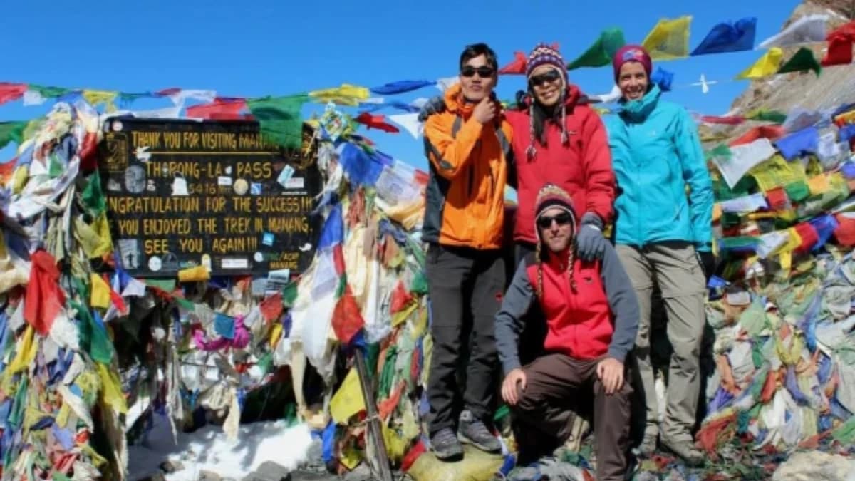
How high is Thorong La Pass?
5,416 m (17,769 ft). It is the highest point of the Annapurna Circuit, and the highest point of our 12-day trek. Here is how the heights build up on our route:
| Place | Height |
|---|---|
| Manang | 3,540 m / 11,614 ft |
| Yak Kharka | 4,018 m / 13,182 ft |
| Ledar | 4,250 m / 13,944 ft |
| Thorong Phedi | 4,525 m / 14,846 ft |
| Thorong High Camp | 4,900 m / 16,076 ft |
| Thorong La | 5,416 m / 17,769 ft |
| Muktinath | 3,800 m / 12,467 ft |
On pass day you climb about 500 m from High Camp to the top, then come down about 1,600 m to Muktinath. At this height the air holds roughly half the oxygen of sea level, so the climb feels much longer than 500 m. The big drop in one day is easy on the lungs and hard on the knees, so trekking poles help.
Where is Thorong La?
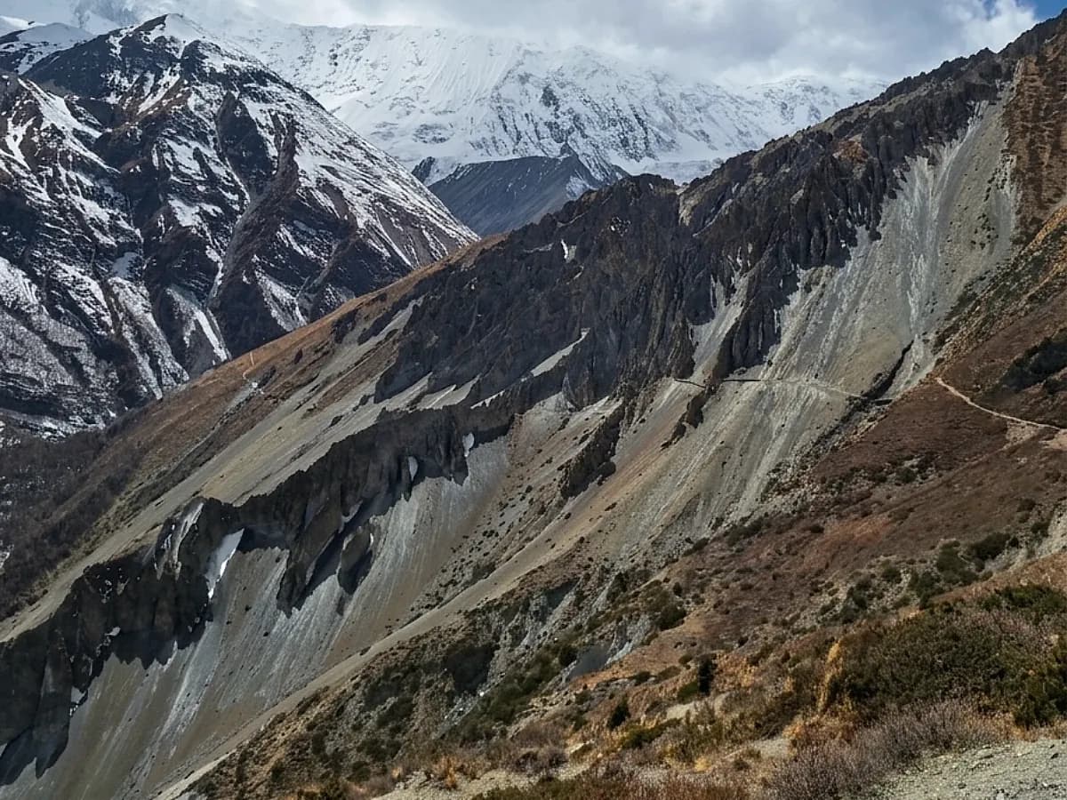
It is in the Annapurna Conservation Area of central Nepal. The pass joins the Manang valley on the east side with the Muktinath valley on the Mustang side to the west. For centuries traders and pilgrims crossed it with yaks. On the Manang side the land is forest, pine and stone villages. On the Muktinath side it is dry, bare and close to the Tibetan plateau in feel, and it is a surprise to people who only know the green side of Nepal.
How hard is Thorong La?
It is a strenuous day, and not a technical one. There is no rope work and no crampon work in normal conditions. The difficulty is made of four things.
- Altitude. Acute mountain sickness is a real risk. This is why we take a full rest day in Manang and sleep at Ledar (4,250 m) and High Camp (4,900 m) before the pass.
- The length of the day. It usually takes 7 to 10 hours from High Camp or Phedi to Muktinath, depending on weather, snow and your pace. From High Camp the pass is roughly 3 to 5 hours away.
- Cold and wind. You start in the dark. The wind at the top is the part people remember.
- The ground. Steep, loose stone, and snow in some years.
Fit, well-prepared trekkers cross it every season. The ones who struggle have usually rushed the days before. My longer piece on how difficult the Annapurna Circuit is goes through the whole route.
What does the crossing day look like?
This is a typical pass day on our trek from High Camp. The times move with your pace and the weather, and your guide decides when to turn back.
- 3 to 4 am: wake at High Camp, hot tea and porridge, boots on, headtorch on.
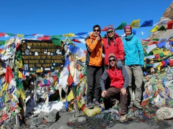
- Climb: slow and steady in the dark, up the switchbacks. Expect 3 to 5 hours to the prayer flags at 5,416 m.
- At the top: photographs, and not much time, because the cold makes standing still hard.
- Descent: a long steep drop of about 1,600 m to Muktinath, usually arriving in the afternoon.
Read about the night before: Thorong High Camp, and the base for the crossing, Thorong Phedi.
Thorong La itinerary on the 12-day Annapurna Circuit
From our package page. We walk anti-clockwise, so you gain height gently and cross the pass once.
| Day | Route | Night at |
|---|---|---|
| 1 | Drive Kathmandu to Bhulbhule | 845 m |
| 2 | Bhulbhule to Jagat | 1,300 m |
| 3 | Jagat to Dharapani | 1,860 m |
| 4 | Dharapani to Chame | 2,670 m |
| 5 | Chame to Upper Pisang | 3,300 m |
| 6 | Upper Pisang to Manang | 3,540 m |
| 7 | Rest and acclimatisation day in Manang | 3,540 m |
| 8 | Manang to Ledar | 4,250 m |
| 9 | Ledar to Thorong High Camp | 4,900 m |
| 10 | Cross Thorong La (5,416 m) down to Muktinath | 3,800 m |
| 11 | Drive Muktinath via Jomsom to Pokhara | 820 m |
| 12 | Drive Pokhara to Kathmandu | 1,400 m |
The road now runs far up the Marsyangdi valley, so I start the walk at Bhulbhule and not earlier. I wrote about what changed in the Circuit day by day. If you want Tilicho Lake as well, the 14-day trip adds it before the pass, and a jeep from Muktinath to Pokhara.
What is the best time to cross Thorong La?
Late October to mid November, and then March to April. The night lows at the pass below are averages for 2015 to 2024 from a weather model, taken from our best time month by month guide. Treat them as a guide to the cold, not a forecast for one week. Wind makes it feel colder.
| Month | Thorong La night low |
|---|---|
| March | -19 C |
| April | -13 C |
| October | -10 C |
| November | -15 C |
| December | -20 C |
| January | -25 C |
- October and November: dry and clear, and the busiest. Manang gets 38.9 mm of rain in October and 1.1 mm in November. See October and November.
- March and April: milder, with more cloud. See April 2027.
- December to February: snow can close the pass for days. Only with winter experience and spare days.
- June to September: monsoon. The pass is in the rain shadow, but landslides, leeches and cloud make the rest of the route hard.
What permits do I need, and what does the crossing cost?
Two permits, both inside our price on every tier: the Annapurna Conservation Area Permit (ACAP), NPR 3,000, and the TIMS card, NPR 2,000. That is NPR 5,000 for a foreign trekker. SAARC nationals pay NPR 1,000 for each. These are the Nepal Tourism Board figures I checked in October 2026. The Circuit is not a restricted area. More in Annapurna trek permits 2027.
Prices per person for the 12-day trek, from the package page:
| Trip | Budget | Standard | Luxury |
|---|---|---|---|
| Annapurna Circuit, 12 days | USD 710 | USD 1,525 | USD 2,720 |
| Circuit with Tilicho Lake, 14 days | USD 790 | USD 1,725 | USD 3,065 |
| Circuit with Tilicho Lake, 16 days | USD 870 | USD 1,930 | USD 3,345 |
| Solo, 12 days | USD 1,255 | USD 1,795 | USD 3,950 |
Larger groups pay less per person, and the full table is on the trip page. What changes by tier:
- Budget: shared rooms, local shared transport, guide and permits. No porter, so you carry your own bag. Meals are not included. In the teahouses plan roughly USD 15 to 25 a day.
- Standard: private twin rooms, three meals a day with tea or coffee, fruit at breakfast and 2 litres of hot water a day. One porter for every two trekkers, 10 kg each. If you book alone, the guide carries up to 10 kg of your bag.
- Luxury: private deluxe rooms, your own porter (up to 20 kg), three meals with fruit and nuts, and tea, coffee, juice and soft drinks carried for you.
Not included: international flights, Nepal visa, Kathmandu hotel nights, travel insurance and tips. A 10% deposit confirms your dates and you pay the balance in Kathmandu. Costs in full: what the Annapurna Circuit costs.
How do I avoid altitude sickness before the pass?
- Take the rest day at Manang and keep your climbs small once you pass 3,000 m. A climb of 300 to 500 m a day is the guide I use.
- Walk high, sleep low.
- Drink three to four litres of water a day, and avoid alcohol.
- Know the signs: a headache that will not shift, nausea, dizziness, no appetite, and being far more tired than the day should make you.
- If you have symptoms, do not go higher. If they get worse, go down. The pass will wait for another try.
Our guides check your oxygen level with a pulse oximeter every day. More in my altitude sickness guide.
What insurance do I need, and what if I am ill on the pass?
Buy travel insurance at home that covers trekking to 5,500 m and helicopter evacuation. I do not recommend insurance bought in Nepal. Please know one thing in advance: a helicopter cannot land on the Thorong La itself, so rescues are made from lower ground on either side. That is why we do not push on when someone is unwell, and why the plan is always to go down first.
Thorong La Pass FAQs
How high is Thorong La in feet?
17,769 ft (5,416 m).
How long does it take to cross Thorong La?
Usually 7 to 10 hours from High Camp or Phedi to Muktinath, with 3 to 5 hours from High Camp to the pass. It depends on weather, snow and your pace.
Is Thorong La dangerous?
The main risk is altitude sickness. There are also cold, wind, and snow in some years. With rest days, a guide who watches you, and a willingness to turn back, thousands cross every year. I will not push anyone over it.
Is Thorong La harder than Everest Base Camp?
They are different. Thorong La is one long day over 5,416 m with a drop of about 1,600 m, while Everest Base Camp keeps you at height for more days. I would not call either easy. My Everest Base Camp against Annapurna Circuit piece compares them.
Can a beginner cross Thorong La?
If you are fit and have walked long days, yes, with a guide and the rest day in Manang. I would suggest a lower trek first if you have never been above 3,000 m.
Do I need a guide for Thorong La?
We always go with a licensed guide. The Nepal Tourism Board lists the Annapurna Circuit among the routes that need a licensed guide and an agency-issued TIMS card.
Can you cross Thorong La in winter?
Sometimes, but snow can close it for days, and nights at the pass average about -20 C or colder from December to February. Only with winter experience and spare days.
What if Thorong La is closed by snow?
You wait at Phedi or High Camp, or turn back, and your guide decides. This is why I like spare days in a winter or shoulder-season plan.
Plan your Thorong La crossing
Tell me your dates and how fit you are and I will say honestly whether the 12-day trek suits you. See the Annapurna Circuit Trek (12 days). Related: Manang, Ledar, Tilicho Lake and Muktinath.
WhatsApp +977 9810351300. Email: info@theeverestholiday.com
Written by Shreejan Simkhada, CEO of The Everest Holiday and third-generation Himalayan guide. TAAN Member #1586.
Planning a trip to Nepal?
Drop us your details and tell us what you have in mind. We will put together a personalised plan and get back to you.
Take our free 2-minute quiz and get personalised recommendations based on your fitness, experience, and travel style.
Find your trekRelated trek packages
More from the travel blog
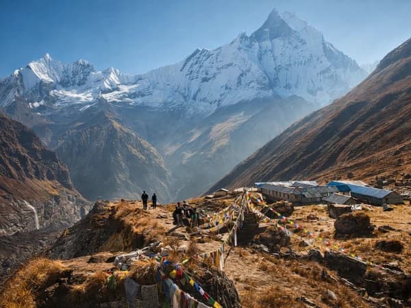
All stories and guides Nepal Travel Guide & Expert Trekking TipsAnnapurna Base Camp Altitude: How High Is ABC in Metres and Feet?Annapurna Base Camp is 4,130 m (13,550 ft). Here is the height of every night on our 9-day trek, how ABC compares with Everest Base Camp, and what to do about altitude.
- Nepal Travel Guide & Expert Trekking TipsEverest Base Camp Altitude: How High Is EBC in Metres and Feet?Everest Base Camp is 5,364 m (17,598 ft) high. Here is the height of every stop on the trek, what it feels like, and how we help you adjust.
- Nepal Travel Guide & Expert Trekking TipsWhere Is Mount Kailash? Location, Map Position and HeightMount Kailash is in Ngari Prefecture, Tibet, China, 6,638 m high, near Lake Manasarovar. Coordinates, map position, nearby rivers and how pilgrims reach it from Nepal.