Thulo Syabru: Langtang and Gosainkunda Village Guide, Day 7 of Our 13-Day Langtang Trek
Thulo Syabru is where our 13-day Langtang and Gosainkunda trek spends its seventh night, at 2,210 metres, on the day the route turns away from the Langtang valley and starts climbing towards the sacred lake. It is the village you reach after the long walk down from Lama Hotel and leave the next morning on a steady 1,444-metre climb. There is little written about it in English beyond trail notes, so this page sets out what our own itinerary says and what outside sources confirm.
Where is Thulo Syabru and what is it?
It is a hillside village in Rasuwa District, north of Kathmandu. Volunteer map data has it as a hamlet named ठुलो स्याप्रु (Thulo Syabru), labelled as ward 5 of Gosaikunda Rural Municipality, at about 28.143 north, 85.361 east. Thulo is the Nepali word for big; Syabrubesi is a different place, on the river below. Gosaikunda Rural Municipality was formed on 10 March 2017 (about 988 square kilometres, population 7,143), but there is no source for Thulo Syabru's own population, history or founding, and I won't guess at them.
What I can say about the area is general. Tamangs were the largest Hill Janjati group in the 2021 census, at 69 per cent of the district, and 67.54 per cent of people spoke Tamang as a first language. That is district-wide, not a figure for this village. For the culture of the region, read our guide to Tamang and Sherpa culture in Langtang.
Which days of the trek are around Thulo Syabru?
The night of day 7 of our 13-day Langtang Gosainkunda trek. These are the days around it, copied from our day-by-day plan. Distances and hours are ours.
| Day | Route | Distance | Walking | Ends at |
|---|---|---|---|---|
| 6 | Kyanjin Gompa to Lama Hotel | 21 km | 5 to 6 hours | 2,470 m |
| 7 | Lama Hotel to Thulo Syabru | 13 km | 6 to 7 hours | Thulo Syabru, 2,210 m |
| 8 | Thulo Syabru up to Sing Gompa (Chandanbari), or Cholangpati if you walk faster (see below) | 8 km | 5 to 6 hours | 3,654 m |
| 9 | Sing Gompa or Cholangpati to Gosainkunda lake | 11 km | 5 hours | 4,380 m |
Every night is listed as a tea house or lodge. The first days drive to Syabrubesi and climb the valley past Lama Hotel; our guides cover those. The days after Thulo Syabru are in our guides to Gosainkunda lake, Ghopte and Kutumsang.
How high is Thulo Syabru?
Our itinerary gives 2,210 metres (7,251 ft). As a second source, a satellite elevation model gave 2,192 metres, 18 metres lower than ours. That is a close match. The same method gave 1,489 metres for Syabrubesi against our 1,503, so the two sets of figures agree about the climb: about 700 metres up from the road-head town.
| Place | Height in our itinerary | Another source |
|---|---|---|
| Syabrubesi | 1,503 m | 1,489 m, satellite model at the village point |
| Thulo Syabru | 2,210 m | 2,192 m, same method |
| Sing Gompa (Chandanbari) | named in the day 8 text | our own Gosainkunda guide says 3,330 m |
| Cholangpati | 3,654 m | none found |
| Gosainkunda lake | 4,380 m | 4,380 m (published) |
What is the walk in from Lama Hotel like?
Our itinerary says 13 kilometres in 6 to 7 hours, and a net change of 260 metres, which is simply the difference between Lama Hotel (2,470 m) and Thulo Syabru (2,210 m). It describes a pleasant descent towards the Langtang Khola, a small waterfall in rhododendron and bamboo forest, views of Ganesh Himal, and a suspension bridge just before the village. It says you may see wild boar, langur monkeys and birds.
Six to seven hours for 13 kilometres is slow for a net descent. That tells me the day has climbing in it that the net figure hides. We don't have a height profile for it, so treat the 260 metres as a net number and not as an easy day. Take it slowly after day 6.
What is the climb out of Thulo Syabru like?
This is the day I would plan around. Our itinerary gives 8 kilometres in 5 to 6 hours and a climb of 1,444 metres, from 2,210 up to 3,654 metres. That works out at about 240 to 290 metres of height gained every hour, which is steady and steep, the biggest climb of any day in our first nine. As the itinerary tells it, you start with a steady uphill climb towards the Langtang National Park army checkpoint, where permits are checked. After about 30 minutes you reach a small settlement it calls Daragang. The trail then eases through quiet hemlock and oak forest, passes Dhimsa, and reaches a village with a monastery and local cheese called Sing Gompa.
The map hamlet that I think is this place, spelled Dursagang, sits 1.1 km in a straight line from Thulo Syabru and at 2,681 metres on the satellite model, about 490 metres higher. That fits our "about 30 minutes of ascending" but it is my match of two spellings, not a confirmed one.
One thing to know about day 8. The usual night is at Sing Gompa, also called Chandanbari, and depending on how fast a guest walks it can be Cholangpati at 3,654 metres instead. That is why our itinerary heading names Cholangpati while its description ends at Sing Gompa. We have no outside source for a height at Sing Gompa or Cholangpati. A telephone is available at Singh Gompa.
What is it like to stay in Thulo Syabru?
Our itinerary lists a tea house or lodge, with breakfast, lunch and dinner on the tiers that include meals. Our package page says in general that most lodges on the trek have hot showers and charging for a small extra cost, and that mobile signal can be patchy at altitude. We have not confirmed how many lodges there are in Thulo Syabru, how many beds, whether the hot water works every day, or what the signal is like, and I won't invent any of it for you to plan around. What the numbers do tell you is that you sleep at 2,210 metres, well below the 4,380 metres of the lake two nights later, which is a gentler night before the climb.
Do I need a permit, and which ones?
We have not confirmed whether the village itself lies inside the park boundary, but our itinerary has the park's army checkpoint within the first hour out of it. For this section our policy is the Langtang National Park entry fee of NPR 3,000 for foreigners (NPR 1,500 for SAARC citizens), flat, plus the TIMS card at NPR 2,000 (NPR 1,000 for SAARC). Those are the Nepal Tourism Board's published figures. The Shivapuri Nagarjun National Park fee of NPR 1,000 applies to routes that pass through Sundarijal and Chisapani, so on our 13-day trek it comes at the far end, after Kutumsang, and not here. Our package lists all three permits as included, and permits need at least 48 hours in government working days, so we ask for passport details early.
A licensed guide and agency-issued TIMS card are required on most trekking routes under the Nepal Tourism Board rule from 31 March 2023; the rule covers the Everest (Khumbu) region too, and we always trek with a licensed guide. The Tourism Board's list of routes names both the Langtang Gosaikund trek and the Langtang trek.
The Department of Immigration also lists a Rasuwa restricted area, described as Gosaikunda Rural Municipality ward 1 and the northern Tamang Heritage side. Map data labels Thulo Syabru as ward 5. Our package does not include a restricted-area permit for this route, but ward boundaries are not checked on an official map, so ask me if your route differs from ours.
Is the Thulo Syabru side affected by the 2026 flood?
I am not going to state a status, because it would be out of date within days, and I have no source that speaks about this village in particular. Our 13-day trek starts with the drive to Syabrubesi, so the road matters for the whole route. Read Is the Langtang trek affected by the Rasuwa flood? and which treks in Nepal are open after the flood first, and message me with your dates before you pay anything.
Can I visit Thulo Syabru without doing Gosainkunda?
No source confirms a short route to the village, so I won't describe one. What our own blog on the Langtang valley trek distance says is that a trek from Syabrubesi to Kyanjin Gompa and back is 75 to 85 kilometres, and that it varies with whether the return goes through Thulo Syabru or retraces the outward trail. So the village can also be a way back from the valley without the lake. If you want to know what Langtang is like in different months, read Langtang in November and December. Gosainkunda lake remains frozen for months, from October to June, which is why I would not sell the lake crossing in deep winter.
How much does it cost?
Our current prices for the 13-day trek, per person, are USD 750 Budget, USD 1,505 Standard and USD 1,999 Luxury for two to four travellers (a solo traveller pays USD 1,250, USD 1,910 and USD 3,650), with groups of up to twenty. Budget does not include meals or a porter, and trekkers carry their own bags in shared rooms. Standard includes all meals, private rooms and one porter for every two trekkers, so a solo traveller on Standard has the guide carry up to 10 kg instead. Luxury includes all meals with extras and a dedicated porter for each trekker. Kathmandu hotels are not included in any trek tier. An extra porter is USD 25 a day, with 13 per cent VAT and a 3.5 per cent bank charge on top.
The deposit is 10 per cent, and the rest is paid in Kathmandu in US dollars or euros, cash or by card. Card carries a 3.5 per cent charge and cash carries none.. Plans change? You can reschedule free of charge with at least 72 hours' notice to any date within a year. The deposit is not refunded if you cancel, and there is no refund when you cancel, only free rescheduling. If we cannot run the trip, we refund what you paid less taxes, bank and card charges and any money already spent on permits or flights. Buy your insurance at home; see our insurance guide for what it must cover.
Who should skip this stretch?
Our package grades the whole trek Moderate. The two days that matter here are day 7, with 6 to 7 hours on legs that have just done 21 kilometres, and day 8, with its 1,444-metre climb. If your knees dislike long descents or steep climbs, or you want a short easy walk, choose the Langtang valley out and back instead and read how difficult the Langtang valley trek is. If you want a hotel room with a view every night, this stretch is not that either.
The short version
Thulo Syabru is the night stop at 2,210 metres on day 7 of our 13-day Langtang Gosainkunda trek, reached after 13 kilometres and 6 to 7 hours from Lama Hotel, and left on a 1,444-metre climb the next morning. Permits are included and we arrange them, and a licensed guide is required and provided; we don't give village facilities, the height of the next night stop or which of two stops our itinerary means, because we can't confirm them. To talk through whether this route suits you, or the flood position for your dates, message me on WhatsApp on +977 9810351300.
Written by Shreejan Simkhada, CEO of The Everest Holiday, from a family of three generations of family guides. TAAN Member #1586.
Planning a trip to Nepal?
Drop us your details and tell us what you have in mind. We will put together a personalised plan and get back to you.
Not sure which Nepal trek is right for you?
Take our free 2-minute quiz and get personalised recommendations based on your fitness, experience, and travel style.
Find Your Perfect Trek →
Best Time to Climb Mera Peak in 2027: Month by Month, Weather and Summit-Day Windows
When to climb Mera Peak in 2027: autumn versus spring, rain at Lukla month by month, the NMA royalty by season, flights via Manthali, insurance height and 2027 prices.
Read More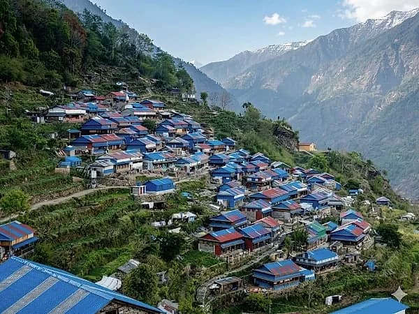
Ruby Valley Trek 2027: The Complete Guide to the 9-Day Route from Syabrubesi to Dhading Besi
The 9-day Ruby Valley trek from Syabrubesi over the Pangsang La to Tipling, Borang and Dhading Besi: day-by-day route, permits, best months and 2027 prices from USD 560.
Read More
Best Time for the Rara Lake Trek: Month by Month for 2027
Rara Lake month by month: measured rain and temperature, where sources disagree on freezing, rhododendron months, October crowds and 2027 prices.
Read More Chat with Shreejan