
Is the Langtang Trek Affected by the Rasuwa Flood? The Honest Answer

Update, 15 October 2026: As of 15 October 2026 the road to Dhunche and Syabrubesi is open again. There are no hotels running in Syabrubesi at the moment, so on day 1 we walk on from the road head to the first open lodge on the trail. We check road and trail conditions 48 hours before every departure.
Earlier update, 29 September 2026: a month on from the 26 August flood, the honest position had not improved for this corridor. The sole road into Langtang, up the Rasuwa and Trishuli valley through Dhunche and Syabrubesi, was still closed and no reopening had been reported, so as of 29 September I was treating Langtang, Gosaikunda, the Tamang Heritage Trail and Ruby Valley as not currently accessible. Late-September monsoon rain has since hit roads across the country as well. At that point I held off on this corridor, and I said I would update the moment access was genuinely restored. For the country-wide picture this week, see our late-September floods travel update. The account below is my 26 August snapshot, kept for the record and superseded by the notes above where they differ.
Since Wednesday morning I have had the same question from four different directions: is the Langtang trek still on this autumn?
The honest answer today is that nobody knows yet, including the district authorities, and I would be careful with anyone who tells you otherwise this week. What I can do is explain the geography properly, because once you understand which river did what, you can follow this yourself instead of waiting for somebody to tell you how worried to be.
On the morning of 26 August a large flood came out of Tibet and down the Bhote Koshi, hitting Timure and Syabrubesi. I have written the full account of what happened and what it does to the Kailash routes in a separate piece here. This one is only about trekking.
If you are weighing up a Langtang Valley trek this autumn, message me on WhatsApp with your dates and I will tell you the honest position for that week, not a sales line.
Two rivers meet at Syabrubesi, and only one of them flooded
This is the part that matters and it is the part nobody is explaining.
Syabrubesi sits in a deep valley at the point where two rivers join. The Bhote Koshi comes down from the north, out of Tibet. That is the river that flooded. The Langtang Khola comes down from the east, out of the Langtang valley, and that is the river the trek follows.
They are different drainages fed by different catchments. The water that destroyed the market at Timure came from a glacier on the other side of an international border, and it travelled south down the Bhote Koshi. It did not come down the Langtang valley, because the Langtang valley is not connected to it.
So the trekking route itself, from the first forest above Syabrubesi all the way to Kyanjin Gompa, sits up a side valley that the flood never entered. The Lama Hotel, Ghodatabela, Langtang village, Kyanjin Gompa: none of those are on the river that flooded.
That is genuinely good news and I want to say it plainly. But there is a catch, and it is a specific one.
The catch is the bridge
To start the Langtang trek you walk out of Syabrubesi and cross a bridge over the Bhote Koshi, then check in at the national park post and begin climbing on the true left bank of the Langtang Khola. It is the first twenty minutes of the walk.
That bridge is on the river that flooded. So is the road that brings you to it.
This is why I am not telling you today that Langtang is fine. The trail is very probably fine. The access to the trail is the open question, and access is on the flooded river, not the trekking one. Related: Syabrubesi Village: The Peaceful Gateway to the Langtang Himalayas.
The three things that actually decide October
If you want to follow this without reading every Nepali news report, these are the only three questions that matter. I am watching all three.
One. Is the road to Syabrubesi open? That is the Pasang Lhamu Highway, which runs up from Kathmandu through Dhunche. If a vehicle can reach Syabrubesi, most of the problem goes away. When this river flooded in July 2025 the road took thirteen days to carry one-way traffic. Thirteen days from now is well inside September.
Two. How much of Syabrubesi itself is standing, and are the lodges usable? Every Langtang group spends its first night there. The town is at the confluence, which is the exposed spot, so this is the honest worry rather than the trail.
Three. Is the bridge across the Bhote Koshi intact? Without it there is no walking entry to the valley from the town.
Notice that none of those three questions is about the Langtang valley. That is the point. Related: Rasuwa Flood 2026: How to Trace Someone Missing, and What Happened.
Not every trek in the region is equally exposed
People talk about Langtang as if it were one trip. It is at least three, and this flood does not touch them equally.
The Langtang valley trek
Syabrubesi in, up the Langtang Khola to Kyanjin Gompa, back the same way. Only the first and last hour are anywhere near the flooded river. Of all the routes in the region this is the one I would expect to be running normally once access is restored.
The Tamang Heritage Trail
This is the more exposed one, and I would rather say so. The heritage route swings north from Syabrubesi through Gatlang, Tatopani, Thuman and Briddim, and those last two sit in the Bhote Koshi country closer to Timure, which is where the damage is. If any part of the region needs rerouting this autumn, it is this part.
The good news is that the fix is not a worse trip. The Tamang Heritage itinerary already joins the Langtang valley in its second half, so a group can simply spend longer in the valley, which is where the mountains are anyway.
Gosaikunda
The short Gosaikunda trek does not go through Syabrubesi at all. It goes in from Dhunche, which is higher up the road and on the other side of the ridge, and climbs to the sacred lakes from there. If Syabrubesi turns out to be the problem, this is a completely different way into the same region.
I want to be careful not to oversell it. It still depends on the Dhunche road, which is the same highway. But it removes the town and the bridge from the equation entirely, and Gosaikunda at 4,380 metres is a fine trek in its own right rather than a substitute.
Please do not confuse this with 2015
Langtang village was destroyed in the 2015 earthquake by a landslide off the mountain above it, and a great many people died. That was a catastrophe and the valley has spent ten years rebuilding from it, which it has now done. I wrote about that rebuild here.
What happened on Wednesday is a different event in a different place caused by a different mechanism. It is a river flood on the valley floor at the Tibetan border, not a landslide onto a village at 3,430 metres.
I mention it because I have already seen the two mixed up online this week, and the people who live in Langtang do not deserve to have their village written off a second time for something that did not happen to them.
What I am telling my own October trekkers
I have a group going into this exact region on 3 October, and they are hearing from me directly rather than being left to notice it themselves. What they are being told is what I would tell you.
Do not cancel anything. Do not change your flights. Do not spend the next month reading Nepali news, because early reports on this kind of event are unreliable in both directions and you will only frighten yourself.
Assume the route may change and that the change will probably be an improvement rather than a loss. Nepal repairs this kind of road faster than people expect, and where it cannot, the alternatives in this region are good ones.
And wait for somebody who has actually walked it. My guide will be on that ground before the group arrives. That is worth more than any amount of reading from Kathmandu, let alone from abroad.
If you have a Langtang trek booked with anybody
Two questions are worth asking your operator, and the answers will tell you a lot about them.
Ask which river your trek follows. If they cannot tell you that the Langtang Khola and the Bhote Koshi are different rivers, they are reading the same news you are.
Ask what their alternative is if Syabrubesi is not usable. An operator who knows the region will answer in one sentence, and the sentence will probably involve Dhunche. An operator who does not will reassure you instead of answering.
I would also gently suggest that you do not accept a confident yes this week. Anyone telling you today that October is definitely fine is guessing, and if they will guess about this they will guess about other things while you are at altitude.
Where this leaves the season
My honest expectation, and I will mark it clearly as an expectation rather than a fact, is that the Langtang valley trek runs this autumn and that the northern heritage villages are the part that may need working around. That is based on the geography above and on how quickly this road was reopened last time, not on optimism.
What I am not going to do is confirm that to anybody until the road, the town and the bridge have actually been assessed by people standing in front of them. I will update this page when they have been, including if the answer is worse than what I have written here.
If you have a trip booked in this region, with us or with anyone else, message me on WhatsApp at +977 9810351300 and I will tell you what I actually know that day. No charge and no sales pitch. There are families in Syabrubesi and Timure with far larger problems than a rearranged holiday this week, and the least the rest of us can do is not add noise to it.
For the full picture across every region, see our trail-by-trail status page: which treks in Nepal are open after the Rasuwa flood. It covers what is damaged, what is untouched, and how we verify each route before departure.
Written by Shreejan Simkhada, CEO of The Everest Holiday and third-generation Himalayan guide. TAAN Member #1586. Last updated 29 September 2026. This describes a developing situation and will be corrected as better information arrives.
Planning a trip to Nepal?
Drop us your details and tell us what you have in mind. We will put together a personalised plan and get back to you.
Not sure which Nepal trek is right for you?
Take our free 2-minute quiz and get personalised recommendations based on your fitness, experience, and travel style.
Find Your Perfect Trek →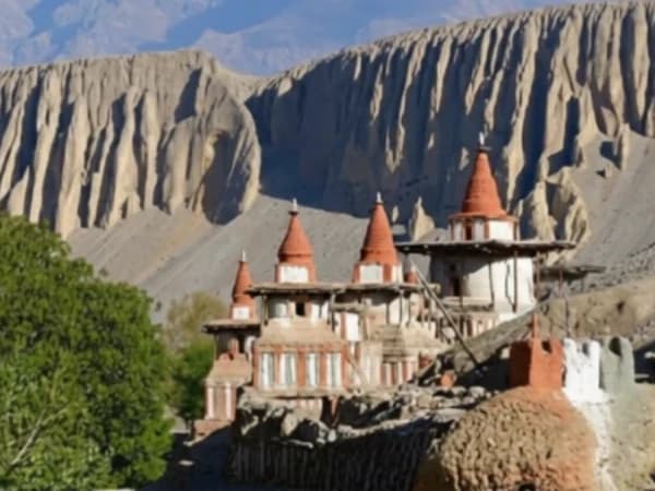
Upper Mustang Itinerary: 10, 12 or 14 Days? What Each Extra Day Adds for 2027
Our live 10-day Upper Mustang itinerary day by day, plus suggested 12 and 14 day outlines, with the USD 50 a day permit worked out for each length.
Read More
Nepal Weather Month by Month for 2027: Kathmandu, Pokhara and Namche
Average highs, lows and rainfall for Kathmandu, Pokhara and Namche Bazaar, the normal monsoon dates, and which of our treks suit each month in 2027.
Read More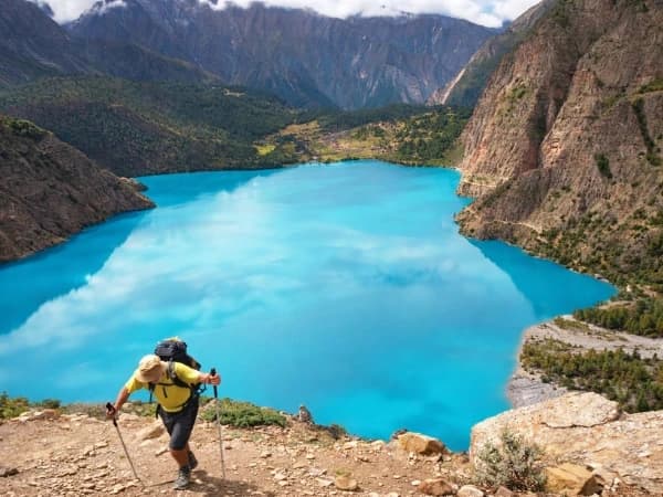
Dunai Village Guide: Height, What Is There and the Trail North for 2027
Dunai is the district town of Dolpa where the Lower Dolpo walk starts. Its height, what is there, the 7 km walk from Juphal, the trail north, best months and 2027 prices.
Read More Chat with Shreejan