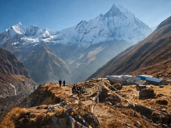
Every great journey culminates in the disappearance of the world, leaving only the road. Thorong La Pass is where many hikers on the Annapurna Circuit experience that moment.
Imagine being 5,416 meters above sea level and looking out over a view of snow-covered peaks that goes on forever. The wind pulls at your clothes and snaps prayer flags against a sky so blue that it hurts to look at it. The steep climb from the Marsyangdi Valley is behind you. You'll be going for days through pine forests and stone towns, past mani walls and flying prayers. In front of you is the way down into the Kali Gandaki Gorge, which is the deepest gorge on Earth. You are on the edge of two worlds, and for a short time, you are the tallest person around.
This is Thorong La Pass, the highest mountain pass in the world that people try to cross on foot. At 5,416 meters (17,769 feet), it is the hardest part of the famous Annapurna Circuit, which has been drawing explorers to Nepal for decades. But Thorong La is more than just a place to hike. It is one of the best things to do in the Himalayas, testing your endurance and teaching humility.
The pass lies in the Annapurna region of central Nepal. It is a high-altitude bridge that connects the Mustang district to the west with the Manang district to the east. For hundreds of years, local traders and pilgrims, equipped with yaks and determination, traversed this path to move from one valley to another. Today, modern hikers continue their journey, drawn by the allure of summiting the world.
It's not straightforward to cross Thorong La. You start the lengthy climb up in the dark, cold morning with flashlights piercing through the blackness. The path meanders through towering hills, with each stride becoming increasingly strenuous as the altitude depletes your breath. The wind howls across open ridges, and the temperature stays far below freezing. But then the sun rises over the eastern peaks and paints the mountains gold and pink. Suddenly, every difficult step is worth it.
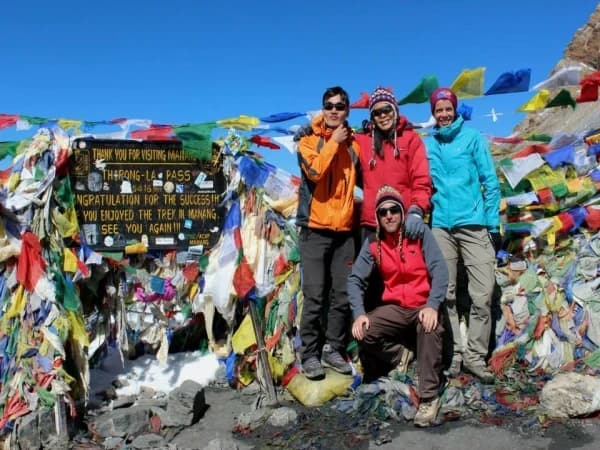
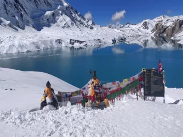
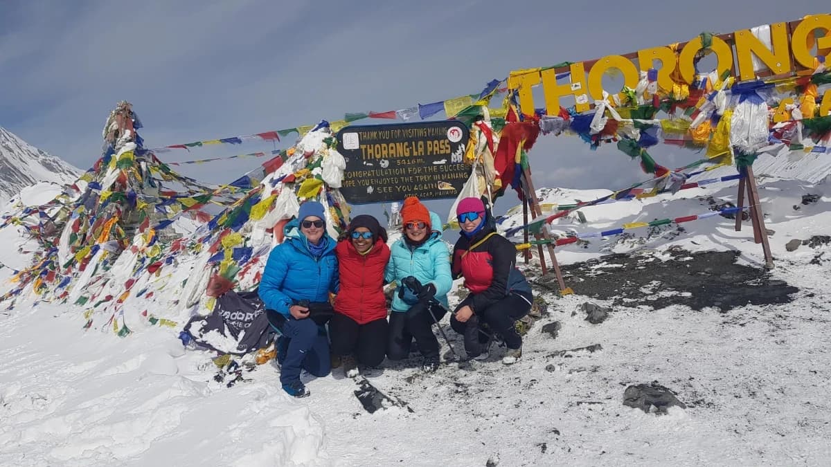
A group of prayer flags marks the top of the mountain. People who go trekking hug, take pictures of, and just stand in wonder at where they are. The Tibetan plateau continues to the north. The Annapurna massif is the most important thing in the sky to the south. And there are mountains everywhere—endless waves of rock and ice that make you feel little and remind you of how big the earth is.
The way down to Muktinath has its benefits. The trail goes down steeply through dry, barren areas that look nearly like the moon. The scenery is very different from the verdant slopes on the opposite side. You decrease thousands of meters of altitude in just a few hours, and the air gets heavier with each step. By nightfall, you're sitting in a teahouse with other trekkers, telling stories about the crossing. You can already tell that this hike will be one of the best adventures of your life.
This handbook is here to help you get ready for that trip. If you're going on your first Himalayan trek or adding Thorong La to your list of high-altitude accomplishments, the next few pages will tell you everything you need to know. This includes the best times to try the crossing, the physical challenges you'll face, the permits you'll need, and the itineraries that will give you the best chance of success. Thorong La is waiting for you at 5,416 meters. It is quiet and ready to test and reward anyone who climbs it.
The Thorong La Pass Altitude
Altitude affects every part of traversing Thorong La. Knowing exactly where you stand helps both your mind and body get ready.
Place Altitude
| Manang | 3,540 Meter / 11,614 Ft |
| Yak Kharka | 4,050 Meter / 13,287 Ft |
| Thorong Phedi | 4,450 Meter / 14,600 Ft |
| High Camp | 4,800 Meter / 15,748 Ft |
| Thorong La Pass | 5,416 Meter / 17,769 Ft |
| Muktinath | 3800 Meter / 12,467 Ft |
The pass is almost 1,000 meters higher than Thorong Phedi on the east side. More importantly, the crossing asks you to climb over 5,000 meters and then drop approximately 1,600 meters in one day. This quick change in altitude puts a lot of stress on the body, so it's really important to become used to it.
At an altitude of 5,416 meters, the oxygen content of the air is approximately half that of sea level. Performing any kind of physical activity requires extra energy. A deliberate effort is made to inhale more deeply. No more peaceful slumber. You can feel nauseous or acquire a headache out of nowhere. Still, many hikers manage to cross the pass each year by paying close attention to their bodies and the high altitude.
What Makes Thorong La Pass Famous
There are several good reasons why Thorong La is famous among trekkers.
The Highest Pass
It makes sense that people who want the most difficult journey would want to go to the highest trekking pass in the world. At 5,416 meters, you're in the clouds, above everything but the tallest peaks in the Himalayas.
The Annapurna Circuit's Main Attraction
The Annapurna Circuit was one of the best treks in the world for decades, with Thorong La being the most thrilling part. Even though roads have made the route shorter, crossing the pass is still the best part for most trekkers.
Big Difference
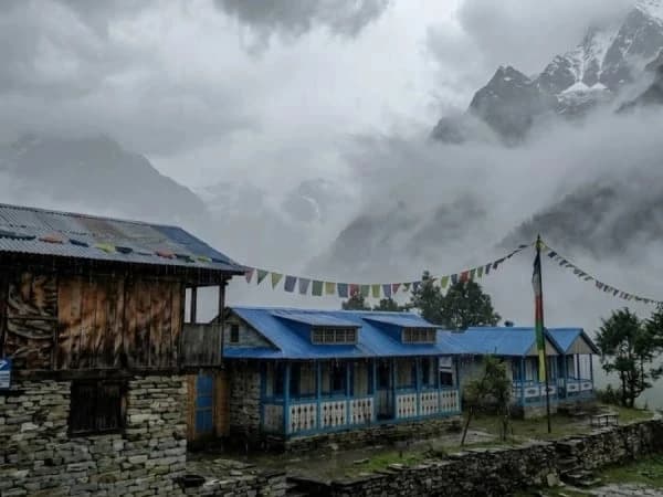
The pass separates two quite distinct worlds. The eastern side has lush valleys, pine trees, and the Buddhist culture of Manang. The western side descends into the arid Mustang region, influenced by Tibet and adorned with ancient monasteries and austere vistas. Standing at the pass implies being in the middle of these two worlds.
Personal Success
It takes a real task to cross Thorong La. The early morning start, frigid weather, breathless climb, and long descent all combine to give hikers a lasting sense of accomplishment.
The Best Time to Cross Thorong La Pass
When you cross the trail, everything from safety to whether you see views or clouds depends on when you do it.
From September to November, it's fall.
Everyone agrees that autumn is the greatest time to cross Thorong La Pass. The weather is calm, the skies are clear, and the temperatures are acceptable. The air after the monsoon rains clears away dust and shows off the mountains in all their grandeur. The days are still warm enough for enjoyable hiking, and the nights are chilly enough to make the pass safe for snow. There is a clear reason why this is peak season.
March–May is spring.
Spring is another excellent time to cross. Rhododendron blooms fill the lower elevations with colour as the weather warms up. There is still snow on the pass, but usually not much. Longer days of light make the long crossing day easier. However, clouds in the afternoon can sometimes block vistas.
Winter lasts from December to February.
Only experienced trekkers with the right clothing and local help can cross in the winter. Heavy snow can keep the pass closed for days or even weeks. The temperature drops well below freezing, which makes avalanches more likely. That being said, clear winter days have amazing views and vacant paths for anyone who is ready for the weather.
From June to August, the monsoon season
The monsoon sends a lot of rain to the southern side of the Himalayas, although Thorong La is in the rain shadow and gets less rain. But clouds typically block views, leeches live on lower routes, and landslides can make it hard to get to places. Most people who hike don't do it this time of year.
How Challenging is the Thorong La Pass Trek?
Let's answer the question that every trekker has: how difficult is this crossing?
The Thorong La Pass trek is challenging, but mostly because of the high altitude, not because of the technical terrain. Several things add to it:
Altitude
The main problem. To go to 5,416 meters in one morning's effort from Thorong Phedi or High Camp, you need to be very well acclimatized. Acute Mountain Sickness is still a serious risk, and hikers need to know the signs early on.
The Long Day
Crossing day usually lasts between 8 and 10 hours. You start between 3 and 4 AM, ascend for 4 to 5 hours to the pass, spend a little time at the summit, and then descend for 3 to 4 hours to Muktinath. This test of endurance is hard on both the body and the psyche.
Wind and Cold
The pass's temperatures often drop well below freezing, and the wind chill makes it feel significantly colder. You can't live without the right clothes.
Terrail
The path has steep switchbacks over loose stone and sometimes snow. Even if it's not hard to do, the combination of high altitude and steepness makes every step hard.
That being said, thousands of fit and well-prepared hikers make it across every season. The most important thing is to respect the mountain and take acclimatisation seriously.
The Crossing Day on the Thorong La Pass Itinerary
Most people who go to Thorong La come from the east and spend a few days getting higher before crossing. This is what a normal schedule looks like in the days leading up to the big day.
Days Before the Pass
-
Manang: 3,540 meters (you need to acclimatize for a day)
-
4,050 meters for Yak Kharka
-
4,450 meters to Thorong Phedi
Some people who are trekking to High Camp at 4,800 meters the day before crossing sleep higher, which makes the summit day shorter.
From Thorong Phedi to Muktinath on Crossing Day
-
3:30 AM: Get up to find your boots frozen and the sky full of stars. A simple meal of porridge and tea gives you energy.
-
At 4:00 AM, start ascending with a headlamp. From the start, the trail goes steeply back and forth. The pace is still gradual and steady.
-
6:00 AM: Get to High Camp as the sun rises. The hardest part of the climb is still to come, but the light of day shows you how big the mountains are around you.
-
Get to Thorong La Pass between 8:00 and 9:00 AM. The wind blows through the prayer flags. Trekkers take pictures, rejoice, and just enjoy the experience. Cold and high altitude make time at the top short.
-
Start going down at 9:30 AM. The trail drops abruptly into the Mustang scenery, which is very different from the eastern side.
-
1:00 PM to 2:00 PM: Get to Muktinath, tired yet happy. It was so lovely to have a hot supper and a comfortable bed.
How to Prepare for the Thorong La Pass
Getting ready properly greatly raises your chances of making it across.
Cardiovascular Health
Focus on improving your aerobic endurance for months before your hike. Running, biking, swimming, and climbing stairs all help. You should do cardio for at least 30 to 60 minutes four to five times a week.
Strength in the legs
Strong legs can take you up and down thousands of meters. Squats, lunges, step-ups, and hill repeats are all beneficial ways to improve strength.
Trekking Practice
If you can, Trek with a heavy pack on steep ground. Moving uphill for hours is good for both your body and psyche.
Getting Ready Mentally
The day of the crossing demands both your mental and physical strength. Get ready for pain, cold, and tiredness. Keep in mind that many people have already succeeded.
Important Permits for the Thorong La Pass
To cross Thorong La, you need the right papers. You need two permits:
Permit for the Annapurna Conservation Area (ACAP)
This permission costs about 3,000 NPR and helps protect the area's natural resources. You may get it in Kathmandu or Pokhara.
Card for the Trekkers' Information Management System (TIMS)
For safety reasons, the TIMS card keeps track of trekkers. Prices change depending on whether you hike alone or with a guide.
Bring your passport and a few passport images with you when you apply.
Getting used to things is the key to success.
The difference between a successful crossing and a dangerous failure is proper acclimation.
The Rules of Gold
Take your time walking. "Walk high, sleep low" is a good way to help you get used to the new place.
-
Every day, drink three to four liters of water.
-
Don't drink or smoke at all.
-
Above 3,000 meters, you shouldn't go up more than 400 to 500 meters a day.
-
Take breaks, especially in Manang.
How to Tell If You Have Altitude Sickness
Be aware of the signs:
-
Headache that won't go away
-
Throwing up or feeling sick
-
Dizzy
-
Not wanting to eat
-
More tired than expected
Do not go up any higher if you have symptoms. If things get worse, go down right away. The mountains will wait for you to try again.
Places to stay on the Thorong La Route
Along the route to Thorong La, you'll come across teahouses that offer simple but comfortable lodgings to stay.
What to Expert
-
Rooms made of wood with thin mattresses
-
Blankets are shared, so bring your sleeping bag
-
Dining rooms with kerosene heaters for everyone
-
Dal Bhat, noodles, soups, and bread are some simple but filling foods
-
Charging stations are available for an additional fee
-
Wi-Fi is limited or not available
The amenities at Thorong Phedi and High Camp are still very rudimentary. Get ready for frigid rooms and basic meals.
Thorong La's Weather and Safety
At high altitudes, the weather changes quickly. Get ready for anything.
The weather on Crossing Day is usually
In the morning, temperatures often dip to -10°C or below, and the wind chill makes it feel even colder. The afternoon will be warmer, but there may be clouds. Even during the busiest times, it can snow.
Rules for Safety
-
If you can, never cross alone. travelling in a group is safer.
-
Get going early to prevent changes in the weather in the afternoon.
-
If things get worse, turn back. The pass will have to wait.
-
Talk to teahouse proprietors and guides about the weather.
-
Bring a basic first aid kit with you and learn how to use it.
-
Thorong La Pass Compared to Other High Passes
What makes Thorong La different from other well-known Himalayan passes?
Pass Height Area Level
| Pass | Height | Area | Level |
| Thorong La | 5,416m | Annapurna | Challenging |
| Renjo La | 5,360m | Everest | Challenging |
| Cho La | 5,420m | Everest | Technical |
| Kongma La | 5,535m | Everest | Very Challenging |
Thorong La is one of the highest passes; the terrain is usually less challenging than that of some other passes in the Everest region. But the fact that it only goes up one day makes it just as hard.
Why Every Trekker Should Go to Thorong La
Thorong La Pass has everything that makes Himalayan trekking outstanding. It pushes your body to its limits, tests your willpower, and gives you sights that are hard to put into words. The crossing links two different cultures and environments, giving you a chance to see a lot of different things in a small region.
For centuries of trekkers, standing at 5,416 meters with prayer flags snapping in the wind has been a sign of a monumental accomplishment. The memory will last forever: the chilly start in the morning, the friendship of other trekkers, the moment the pass appears, and the joyful descent to warm tea and celebration.
Last Thoughts
You need to be humble, prepared, and respectful when you cross Thorong La Pass. The height doesn't care about your plans or your schedule. But for those who are ready and pay attention to their body, the prize is one of the best in the world of trekking.
The pass is waiting for you at 5,416 meters, silent and grand, ready to greet everyone who makes the trip. The path goes up through some of the most beautiful places on Earth. The prayer flags wave in the wind, sending blessings and wishes throughout the Himalayas. And if you're lucky, you'll find yourself at the top of the globe, staring out at mountains that go on forever, knowing that you earned every step along the way.