Trek Highlights
- 19-day private trek to Kanchenjunga Base Camp (5,143m), the foot of the world’s third-highest mountain (8,586m). One of the most remote trekking areas in Nepal.
- Far-east Nepal biodiversity hotspot: tropical lowland forest, rhododendron mid-hills, alpine pasture, and glacial moraine in a single trek. Red panda, snow leopard tracks, and Himalayan tahr habitat throughout.
- Restricted area permit required. Licensed guide required by the Nepal government, with no minimum group size since 22 March 2026. We handle all paperwork.
- Private guide and porter ratio that does not change based on group size. No shared-group surcharge gimmicks.
- 10% deposit to lock dates, balance paid in person in Kathmandu. No full prepayment required to a foreign trekker you have never met.
- Every booking helps fund our Nagarjun Learning Center work at Saldum, where 70 children are taught by one dedicated teacher.
Why I built this trek the way I did
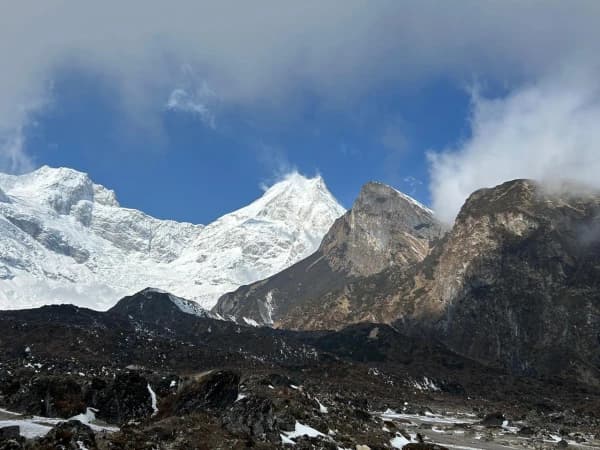
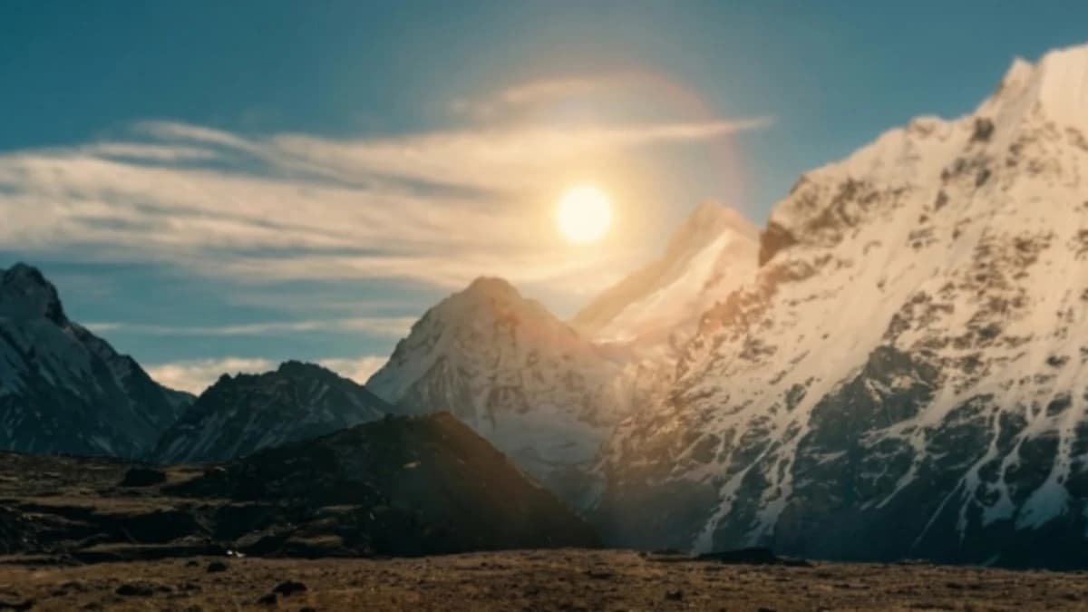
I am Shreejan, the founder of The Everest Holiday. The Kanchenjunga Base Camp trek is the longest standard trek we run. The reason it is 19 days is that the trail starts in subtropical forest at 200m above sea level in the lowland east, climbs slowly through rhododendron and oak mid-hill forests, then alpine pasture, and finally glacial moraine to reach the base camp at 5,143m. You climb almost 5 vertical kilometres on foot over two weeks. That gradual ascent is also the safest acclimatisation profile of any high-altitude trek in Nepal.
The far-east region is also where the biodiversity story of Nepal is most alive. The lower trail passes through villages where Limbu and Rai farmers still grow cardamom in shaded forests. The mid-hill rhododendron forests are red panda habitat. Above the treeline, you walk through Himalayan tahr country. The Kanchenjunga Conservation Area Project funds anti-poaching patrols and the wildlife has noticeably recovered in the last 15 years.
This is a serious trek. You walk 5 to 8 hours daily for 17 of the 19 days. The trail has no road access for the entire trek; everything you eat comes in by porter from Taplejung, the road head. We do not recommend this trek for first-time altitude trekkers or for anyone with less than 2 weeks of consecutive vacation. The reward is one of the wildest landscapes left in Nepal.
We run this as a private trek only. The Kanchenjunga Conservation Area Project enforces a 2-trekker minimum with licensed guide. If you are travelling alone we will hold dates until we can pair you with one other client.
Every booking on this trip helps us pay the teacher’s salary at our Nagarjun Learning Center in Saldum, where 70 children get free education. The salary is currently funded out of my own pocket. Your trek is what makes that sustainable.
“I have trekked in Nepal three times before but Kanchenjunga was on another level. The biodiversity is incredible, from tropical forest to glaciers in one trek. We saw red pandas. The team carried everything we needed and the cook made amazing food in the most basic kitchens. This trek is not for beginners but it rewards those who make the effort.”
— Ingrid Svensson · Verified Google Review, November 2025 · ★★★★★
The 19-day Kanchenjunga Base Camp Trek takes you to the foot of the world’s third-highest peak. This trek through Eastern Nepal leads you off the usual paths, where you’ll discover untouched landscapes, centuries-old monasteries, and genuine local culture far from the busy trekking routes.
What Makes This Trek Worth Every Step
- Standing at the foot of Mount Kanchenjunga, the world’s third-highest peak.
- Trekking through remote trails that few travellers ever explore.
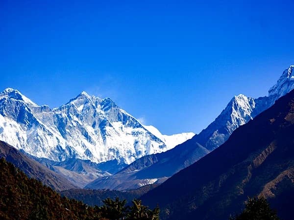
- Sweeping views of Everest, Lhotse, Makalu, and Kanchenjunga in one sweep.
- Walking across diverse landscapes,from subtropical valleys to high alpine terrain.
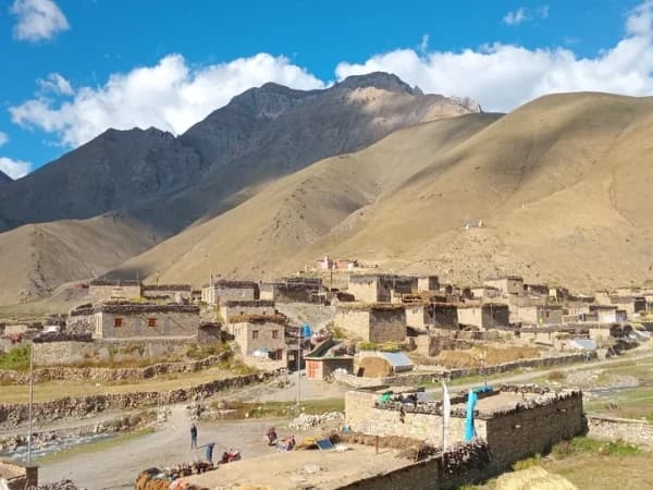
- Deep exploration of Rai and Limbu culture in the lower regions and Tibetan Buddhist influences in the higher villages like Ghunsa and Phale
- Visiting ancient monasteries and prayer walls that reflect deep Buddhist heritage.
- Crossing the Kanchenjunga Conservation Area, home to the Red Panda and Snow Leopard.
- Staying in traditional villages and enjoying genuine mountain hospitality.
19-Day Kanchenjunga Base Camp Trek Overview
Before You Arrive
For a smooth and stress-free start, we highly recommend arriving in Kathmandu by 4 PM the day before we leave. This gives you enough time for a final gear check, a trip briefing with your guide, and to make sure you have everything you need before heading to the trek.
Online Briefing
This is like our first coffee before the trip, but online! This online meeting is our chance to show you everything that will happen on the trip. We'll talk about everything from what gear to bring to what each day on the route will be like and how it will feel, and we'll answer any questions you have. After you book, we'll send you an email with a couple of times when we can talk. We'll set up the meeting after the booking process is completed. Furthermore, our trek itinerary does not include your hotel stay in Kathmandu. During the online meeting, please share your preferences, budget, and the standard of the hotel you would like to stay at in Kathmandu. We will arrange it for you accordingly.
Your Trek, Your Way
Experience the Himalayas on your terms. We create personal, intimate treks for groups of two or more. Whether you select our Budget, Standard, or Luxury package, your adventure will be exclusively for you and your companions, ensuring a comfortable and personal journey from start to finish.
Kathmandu Accommodation
Your hotel in Kathmandu is not included in the trek package. During the online briefing before your trek, we will ask about your preferences and budget, whether you want a simple guesthouse or a five-star hotel, and help you arrange it. Your trek package begins when you leave Kathmandu for the mountains.
Compare Our Three Packages
| Budget | Standard | Luxury | |
|---|---|---|---|
| Price from | USD 999 | USD 2,199 | USD 3,200 |
| Meals | Choose your own (approx. USD 15-25/day) | 3 meals + tea + fruits + 2L water daily | All meals + all drinks anytime (except alcohol) |
| Room | Shared teahouse | Private twin w/ bathroom | Private deluxe w/ bed heater |
| Porter | Not included | 1 per 2 trekkers | 1 per trekker (carry nothing) |
| Guide | 1 guide, assistant at 8+ | 1 guide per 6, assistant at 6+ | 1 guide per 2 trekkers |
| Transport | Local vehicle | Shared tourist vehicle | Luxury private vehicle |
| SIM data | SIM only | Limited data | Unlimited data |
| Best for | Backpackers and independent travellers | Comfort trekkers, couples, families | Premium experience seekers |
Himalayas for Every Budget, same expert guides, same safety, three comfort levels.
Your Trek, Our Family
Shreejan Simkhada doesn’t just run a trekking company, he comes from three generations of Himalayan expertise. His grandfather arranged expeditions in the 1960s. His father served at the Nepal Tourism Board. Shreejan personally designs every itinerary and hand-picks the guide for your group.
Your guide will be one of our Nepal government well-trained professionals, qualified mountaineering experts, all with years of Himalayan experience. Shreejan briefs every guide personally before your trek begins.
Need anything? WhatsApp Shreejan directly: +977 9810351300.
Why Trekkers Trust Us
- 197+ TripAdvisor Reviews, 4.9 out of 5 stars, TripAdvisor Travellers Choice 2024
- 108+ Google Reviews, 4.9 out of 5 stars
- TAAN Certified, Member #1586, Government Reg: 147653/072/073
- Secure 10% Deposit, pay just a 10% deposit to reserve, via Himalayan Bank
- Himalayas for Every Budget, from USD 999 for one of Nepal's most remote base camp treks
- Three Generations, three generations of family guides in the Himalayas
Solo Trekkers and the Restricted-Area Rule
Kanchenjunga is a restricted-area permit zone, which means you must walk with a licensed guide and book through a registered agency. Until March 2026 the rules also required a minimum of two trekkers on every departure. The Department of Immigration scrapped that on 22 March 2026, so a solo trekker can now walk this route legally. We are not allowed to file the permit for one person.
If you are coming on your own, write to us anyway. We will either pair you with another solo trekker on the same window, or post your dates on our website as an open group so others can join. Most of our Kanchenjunga departures are two to four trekkers, which is the right size for this kind of remote, demanding route.
Difficulty: Strenuous (4/5)
The Kanchenjunga Base Camp Trek is one of Nepal's most demanding treks. Over 19 days you will walk 5-8 hours daily through remote eastern Nepal, reaching a maximum altitude of 5,143m (16,873ft) at North Base Camp. The trail crosses glacier moraine, high passes, and uninhabited valleys with limited teahouse options. Previous trekking experience at altitude is strongly recommended. This trek is rated Strenuous (4 out of 5).
Trek With a Purpose, Changing the World, One Step at a Time
A portion of every booking supports the Nagarjun Learning Center, founded by our family in 2019. Today, 70 children receive free education and hot meals daily at our flagship centre in Saldum Village, Dhading District. We have also provided free medical care to 600+ people and reached 275+ women through empowerment programmes. The centre is verified and listed on the UN Partner Portal.
When you trek with us, you are not just climbing mountains, you are building futures. Trek With a Purpose.