Most trekkers who visit the Kanchenjunga region go north. The north base camp, Pangpema, at 5,143 metres, is the more popular destination, offering a direct view of Kanchenjunga's massive north face from a glacial moraine that feels like the edge of the inhabitable world. The south base camp, Oktang, at 4,730 metres, receives perhaps half the visitors that Pangpema does, and the trekkers who choose the south discover something that the north cannot provide: a different mountain.
Not literally a different mountain, Kanchenjunga is Kanchenjunga from every angle, 8,586 metres of ice and rock that is the third highest point on earth. But the south face and the north face are so different in character, different steepness, different glaciation, different light, different mood, that seeing one does not prepare you for the other. The north face is a wall. Vertical. Intimidating. The kind of mountain face that makes you understand why climbers die. The south face is a sweep. Broad. Glaciated. The kind of mountain face that makes you understand why climbers try.
Oktang sits at the foot of the south face, in the Yalung Glacier valley, a valley that branches west from the main Ghunsa Khola route at a point south of Ghunsa village. The approach from Ghunsa takes two to three days through terrain that transitions from alpine scrub to barren moraine, with the south face growing above you with each day's walking until it fills the sky at Oktang with a width and height that the photographs, taken from too far away, through too much atmosphere, can never reproduce.
How Do You Get to Kanchenjunga South Base Camp?
The south base camp is accessed from Ghunsa (3,595 metres) via the Simbua Khola valley, which branches west from the Ghunsa Khola. The trail diverges from the north base camp route at a point below Ghunsa, though most itineraries visit Ghunsa first and then backtrack to the south route.
The walk from the trail junction to Oktang takes two to three days through progressively more remote terrain. The first day follows the Simbua Khola upstream through forest and alpine meadow to Tseram (3,870 metres), a small settlement with one or two teahouses that is the last permanent habitation on the south route. The second day climbs from Tseram to the Oktang viewpoint at 4,730 metres, either directly or via a high camp at Ramche (4,360 metres).
The trail is less maintained than the north route. Fewer trekkers mean less trail traffic, less teahouse investment, and less of the social infrastructure that makes the north route feel, by Kanchenjunga standards, almost busy. On the south route, you may walk for an entire day without seeing another trekking group. The teahouses are simpler. The trail is rougher. And the solitude is deeper.
Tseram
Tseram is the south route's equivalent of Kambachen on the north route, the last village before the high camp, the last warm room, the last meal cooked in a kitchen rather than on a portable stove. The village sits at 3,870 metres in the Simbua Khola valley, surrounded by rhododendron forest that blooms spectacularly in spring (April-May) and that provides the last significant vegetation before the alpine barrenness above.
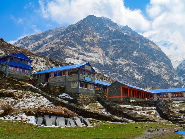
The teahouses at Tseram are basic, one or two lodges with rooms, a common room, and a menu that depends on what the operator carried from Ghunsa. The accommodation may be teahouse or tent, depending on your company's logistics. The setting is beautiful, the valley narrows above Tseram, and the first views of Kanchenjunga's south face appear above the ridgeline to the northeast, massive and white and startlingly close.
The night at Tseram is the last comfortable night on the south route. Above Tseram, the altitude and the exposure increase, the accommodation becomes more basic, and the trek transitions from walking through a landscape to walking toward a mountain.
Oktang
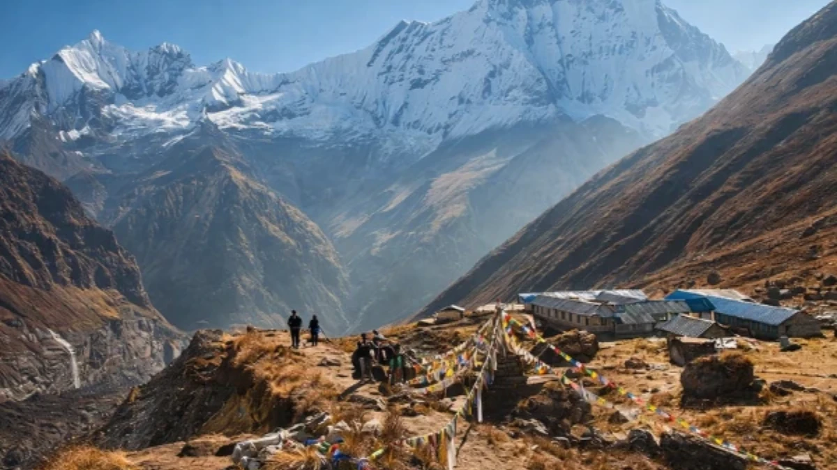
Oktang is not a village. It is a viewpoint, a flat area on the moraine of the Yalung Glacier at 4,730 metres, from which Kanchenjunga's south face is visible in its full scale. The "base camp" designation is historical, climbing expeditions to Kanchenjunga's south and southwest ridges have used this area as their staging ground, and the flat moraine provides space for tents, cooking, and the logistics that high-altitude mountaineering requires.
For trekkers, Oktang is a destination rather than a camp. You arrive, you look at the mountain, you take photographs, you absorb the scale, and you descend. The time at Oktang is typically one to three hours, long enough to understand what you are seeing, short enough that the altitude (4,730 metres) does not become dangerous for trekkers who have acclimatised through the approach.
The view from Oktang is different from Pangpema. The south face of Kanchenjunga is broader than the north, a wide sweep of glaciated terrain that stretches across the horizon rather than rising in a single wall. The Yalung Glacier flows from the base of the face toward you, its surface covered in the grey rubble of moraine. And the peaks that flank Kanchenjunga on the south side, Kabru (7,338 metres), Rathong (6,678 metres), and the lesser peaks of the Yalung ridge, create a mountain amphitheatre that is wider and more open than the north base camp's enclosed cirque.
The light at Oktang is different too. The south face catches afternoon light that the north face misses, and the evening illumination, when the sun angles across the face from the west, painting the ice in oranges and pinks, is the premium visual experience that the few hundred trekkers who reach Oktang each year carry home.
North vs South: Which Kanchenjunga Base Camp Should You Choose?
The choice between Kanchenjunga North Base Camp (Pangpema) and South Base Camp (Oktang) is a choice between different mountain adventures.
Pangpema (north): Higher (5,143m vs 4,730m). More dramatic, the north face is steeper and more imposing. More popular, receives roughly twice the visitors. Better infrastructure, more teahouses on the approach. The classic Kanchenjunga experience.
Oktang (south): Lower but still demanding. Different perspective, the south face is broader and more glaciated. Quieter, half the visitors of the north. More remote, fewer teahouses, rougher trail. The connoisseur's Kanchenjunga experience.
The full circuit: For trekkers with three weeks, visiting both base camps, north first, return to Ghunsa, then south, provides the complete Kanchenjunga experience. The full circuit takes eighteen to twenty-one days and delivers both faces of the mountain, both glacial systems, and the specific satisfaction of having seen the world's third highest mountain from every accessible angle.
What Do You Need to Know About Kanchenjunga South?
Duration: three to four days from Ghunsa to Oktang and return. Total trek including approach from Taplejung: sixteen to twenty-one days depending on whether combined with north base camp.
Maximum altitude: 4,730 metres (Oktang). Lower than the north base camp, making altitude sickness less of a concern for well-acclimatised trekkers.
Permits: Kanchenjunga Conservation Area restricted permit (approximately ten dollars per week) plus national park entry. Same permits as the north route.
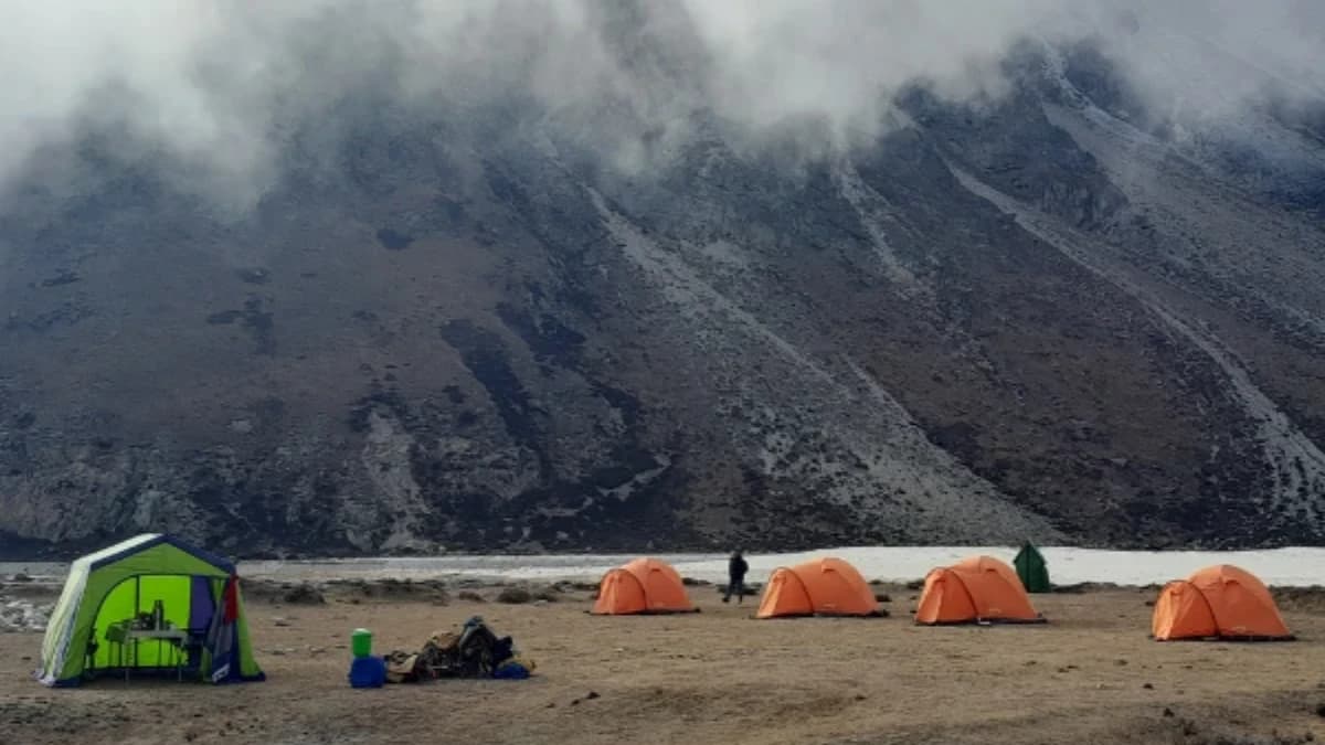
Accommodation: teahouses at Tseram. Camping may be required above Tseram depending on season and availability. Your trekking company arranges logistics.
Best season: October-November (clear, cold). March-May (warmer, rhododendron bloom at Tseram in April). Spring on the south route is particularly beautiful, the rhododendron forest between Ghunsa and Tseram blooms in crimson and pink against the white backdrop of Kanchenjunga's south face.
Why the South
The south base camp of Kanchenjunga is the trek within the trek. The hidden face within the hidden mountain. The experience that even the trekkers who visit Kanchenjunga, already a tiny fraction of Nepal's trekking visitors, mostly miss because the north route is more established, more documented, and more frequently recommended.
The south delivers what the north cannot: a different mountain. The same peak, the same summit, the same 8,586 metres, but seen from an angle that changes everything. The wall becomes a sweep. The cirque becomes an amphitheatre. The grey moraine becomes, in the afternoon light, a canvas for the orange and pink illumination that only the south face receives.
The trekkers who visit both, who see Kanchenjunga from north and south, from Pangpema and Oktang, from wall and sweep, understand something about mountains that a single viewpoint cannot teach: that a mountain is not a thing but a relationship, and the relationship changes with every angle, every light, every step you take around its base. Kanchenjunga from the north is formidable. Kanchenjunga from the south is beautiful. And the mountain itself, indifferent to both descriptions, holding both truths simultaneously at 8,586 metres, is simply Kanchenjunga. The Five Treasures of the Great Snow. Seen from every side, understood from none. And worth every step of the walk to its feet.
Oktang (Kanchenjunga South Base Camp) is the southern highlight of the Kanchenjunga Base Camp Trek. The full 19-day route visits both the north and south base camps.
Oktang is the Kanchenjunga south base camp viewpoint, and the glacier hanging above it is one of the most dramatic things you will see in Nepal. The ice towers, the crevasses, and the sheer mass of the world's third-highest mountain filling the sky — it is humbling in a way that photographs cannot convey. Getting here takes days of walking through forest that feels prehistoric. That is the price of admission, and it is fair.
Oktang is the turnaround point on our Kanchenjunga Base Camp Trek.
The trail to Oktang passes through Tortong, the forest gateway village to Kanchenjunga's south side.
WhatsApp:+977 9810351300
Email:[email protected]
Written by Shreejan Simkhada, CEO of The Everest Holiday and third-generation Himalayan guide. TAAN Member #1586.
Oktang is the southern Kanchenjunga viewpoint. Our Kanchenjunga Base Camp Trek (19 Days) is private (your group only, no strangers), 2026 dates open, From USD $2499. WhatsApp us for tailored 2026 dates and current departures.
Continue planning your trek
This is one stop on the Kanchenjunga Base Camp trail. For the full route, read our Kanchenjunga gateway guide. When you are ready for dates and prices, see the Kanchenjunga Base Camp Trek (19 days) or WhatsApp us directly. We reply personally.