

Kalopani is one of those places you would ride straight past if nobody told you to stop. On our Mustang motorbike tours we stop the night here on purpose, and this guide is my honest answer to why: where Kalopani is, what you see from it, what you eat, when to come, and how the road gets you there.
Where is Kalopani?
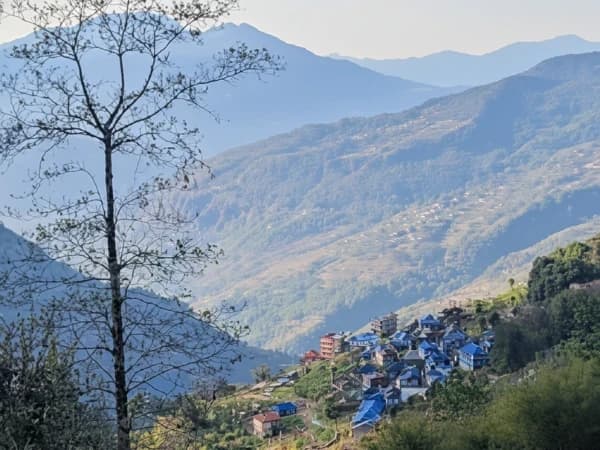
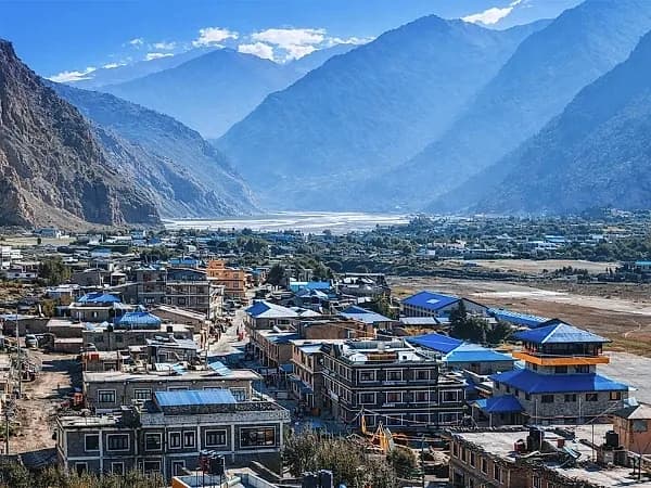
Kalopani is a village in the Kali Gandaki valley, in Thasang Rural Municipality, Mustang District, Gandaki Province. The name is plain Nepali: kalo means black and pani means water. Ask anyone on the trail and they will translate it for you with a smile.
Riding up the valley from Pokhara, you meet the villages in this order: Ghasa, then Lete, then Kalopani, and further north Tukuche, Marpha and Jomsom. Kalopani sits on the valley floor at roughly 2,400 to 2,500 metres. I give you a range rather than one exact figure because published sources disagree, and I would rather be honest than precise and wrong.
It is also the start of Thakali country. The Thak Khola, or Thak-sat-se, region of the Kali Gandaki valley is the home of the Thakali people, who numbered 11,743 in Nepal's 2021 census. The census puts them at about 68 percent Buddhist and 30 percent Hindu, and you see both in the prayer flags and the small shrines along the road.
Why do we stop the night in Kalopani?
On our Lower Mustang Motorbike Tour, day 3 is Pokhara to Kalopani, and day 4 carries on to Muktinath. On our Upper Mustang Motorbike Tour, day 3 is the same ride, and day 4 goes on to Samar past the apple orchards of Marpha.
There are three reasons we put the first valley night here.
The first is the road. The ride up from Pokhara is long, and the Beni to Jomsom road is rough, with river crossings and landslide sections, worst after the monsoon. Kalopani is far enough to feel you have arrived in Mustang, and close enough to reach in good light without rushing.
The second is the wind. The Kali Gandaki valley is known for strong winds that blow up the valley every afternoon. Riding into them tired, in dust, is no fun and not safe. We aim to be parked in Kalopani before they build, and we leave early the next morning while the valley is still calm.
The third is the height. At roughly 2,400 to 2,500 metres you are in the mountains, but low enough to sleep well before the road climbs towards Muktinath and Samar. A quiet first night makes the rest of the trip better.
Cyclists meet Kalopani from the other direction. On our Annapurna Circuit Mountain Bike Tour, day 10 runs from Marpha down to Tatopani through Tukuche, Larjung, Kalopani, Ghasa and Dana.
What will you see from Kalopani?
This is the reason to wake up early. The Kali Gandaki runs here between two 8,000-metre peaks: Dhaulagiri at 8,167 metres to the west, and Annapurna I at 8,091 metres to the east. Between them the river sits at about 2,520 metres, some 5,571 metres below the summit of Annapurna I. The valley is often called one of the deepest gorges in the world. Writers measure it in different ways, so I will not argue the record, but standing on the valley floor with those two walls above you, you do not need a number.
Morning is the time. The air is still, the peaks are clean against the sky, and the light is soft for photographs. By afternoon the wind and the dust take over.
Look around the village too. To the north the valley opens out and turns dry towards Jomsom. To the south, towards Lete and Ghasa, it narrows and turns green. Kalopani sits right where you can see that change. For what comes next, my Marpha village guide and Jomsom gateway guide cover the villages a few hours up the road.
What do you eat in Kalopani?
Dal bhat, and a good one. The dal bhat served in Thakali kitchens is famous right across Nepal: rice, lentils, greens, pickle and whatever vegetables are in season, with refills until you stop them. After a day on that road, a hot plate and a warm drink matter more than any menu.
If you have food needs, tell us before the trip so we can pass them on in good time. This is a mountain village, not a city, so simple requests are the easiest to meet.
When is the best time to ride through?
October and November, then March to May. Autumn gives the clearest views and the driest road. Spring is warmer, with long days and good light.
The monsoon, from June to mid-September, is when landslides close the road and the river runs high. If your dates fall near the edge of the monsoon, message me first and I will tell you honestly what the road is doing that week.
How do you get to Kalopani?
By the Beni to Jomsom road, up the Kali Gandaki from Pokhara. It is a full riding day on our tours, with stops for fuel and tea, timed to reach Kalopani before the afternoon wind. The road needs respect: keep space between bikes in the dust, cross rivers slowly, and stop if a slide looks fresh. Your guide rides with the group the whole way.
If you are thinking about Mustang on two wheels, my complete guide to motorcycle touring in Nepal covers the bikes, permits and planning.
And if Kalopani sounds like your kind of stop, message me on WhatsApp at +977 9810351300. Tell me when you want to ride and if you are thinking of Lower or Upper Mustang, and I will tell you honestly what fits.
Written by Shreejan Simkhada, CEO of The Everest Holiday and third-generation Himalayan guide. TAAN Member #1586.

 Chat with Shreejan