
Juphal (Jhupal) Village Guide: Height, Flights and the Walk to Dunai for 2027

Updated 25 October 2026.
Short answer: Juphal (also spelled Jhupal) is the small village with the airstrip that opens Lower Dolpo. It sits at about 2,500 m, in Dolpa district in Karnali Province. You reach it on a flight of about 40 minutes from Nepalgunj, and from the airstrip it is a 7 km walk of about 3 hours down to Dunai (about 2,100 m), where the trek really starts. Our 15-day Lower Dolpo Circuit costs USD 3,470 Budget, USD 4,765 Standard and USD 6,735 Luxury per person for two to four people.
I am Shreejan. Most people only see Juphal from the window of a small plane and then from the back as they walk away from it. I want to tell you what is actually there, what happens on the day you land, and the day you come back, because that is the day people forget to plan for.
Where is Juphal and how high is it?
Juphal is a village in Thuli Bheri, in Dolpa district. The airport is here, and it is the main way in and out for the whole district. Nepal Traveller describes a small farming village of stone houses with slate roofs, growing barley, buckwheat, potatoes, maize and millet, with a mostly Chhetri and Thakuri population.
Now the height. You will see 2,320 m quoted in some places. I do not use it. Wikipedia gives the airport at 2,500 m (8,200 ft), with 2,499 m in the body text. Our own itinerary says about 2,500 m. Nepal Traveller says about 2,475 m for the village, and a Logistics Cluster airport page lists 2,480 m. So the range is 2,475 to 2,500 m depending on where on the slope you stand. I plan with 2,500 m.
| Fact | Figure | Source |
|---|---|---|
| Height of Juphal airport | About 2,500 m (8,200 ft) | Wikipedia, our itinerary |
| Runway | 663 m by 30 m, asphalt since 2017 | Wikipedia |
| Airlines listed, all to Nepalgunj | Nepal Airlines, Sita Air, Summit Air, Tara Air | Wikipedia |
| Flight Nepalgunj to Juphal | About 40 minutes | Our Lower Dolpo package |
| Walk Juphal to Dunai | 7 km, about 3 hours, down about 400 m | Our itinerary |
| Dunai | About 2,100 m on our itinerary, 2,000 m on Wikipedia | Both |
| Walk Shyanta to Juphal (the way out) | 7 km, usually 3 to 4 hours | Our itinerary |
2,500 m is high enough that you should take the first day easy. The good news is that the walk from the airstrip is downhill, so you are not climbing while your body gets used to the height.
What is the Nepalgunj to Juphal flight like?
You do not fly to Juphal from Kathmandu on our plan. You fly Kathmandu to Nepalgunj on day 1, sleep there, and take the mountain flight on the morning of day 2. The Kathmandu to Nepalgunj leg is about an hour, according to our Nepalgunj guide.
The Juphal flight is short and the weather decides everything. Nepal Traveller says flights are often hit by weather, and our package page says flights to Juphal depend on the weather, so keep a spare day or two at the end of the trip. Do not book your international flight home for the evening after you are due back.
Fares are not something I can give you as one number. Our 15-day version with flights on every tier says the flights cost about USD 780 per person in air fares alone, before the guide's own tickets. That is the reason the flying version is priced higher than the road version for Budget and Standard.
For more on how domestic flights work in general, my domestic flights guide covers baggage and delays.
Is there a road to Juphal and Dunai?
Yes, and no. A 118 km road reached the district in 2018, as I wrote in the Dho Tarap village guide. On our Lower Dolpo Circuit, Budget and Standard guests travel by road to Dunai (public bus to Nepalgunj, then a shared local jeep via Jajarkot, about two days each way) and Luxury flies. That adds two to three days to the trip.
The road is not reliable. Floods closed the Jajarkot to Dunai stretch in August and September 2026, and our package says we check it before every departure and tell you before you travel if it is closed. I cannot give you a dated source saying it is open for 2027, so I will not say it is. We will confirm closer to your date.
If you want the plane on every tier, the Lower Dolpo Trek with Flights, 15 days is built for that.
Where do you sleep and eat in Juphal?
I do not have a published list of lodges in Juphal, and I will not invent one. Here is what I can tell you from our plan. On the way in you do not sleep in Juphal at all. You land, meet your team and walk to Dunai the same day. On the way out, day 14 ends with the walk from Shyanta (2,520 m) to Juphal, and the flight is on the morning of day 15, so that is your last night near the airstrip.
Along the trail, our package says you will sleep in tents at camps, in homestays, and in local teahouses and lodges. What each tier includes is on the package page. Expect simple rooms and simple food. Dolpo is not Everest, and the teahouse system there is not the same.
Kathmandu hotels are not in any trek price, so they are quoted separately.
What permits do you need to start from Juphal?
Lower Dolpo is a restricted area. These figures come from the Department of Immigration and the Nepal Tourism Board, not from the trail talk you may hear.
| Permit | Cost for a foreign trekker | Source |
|---|---|---|
| Lower Dolpo restricted-area permit | USD 20 per week, then USD 5 per day | immigration.gov.np/trekking-route-and-permit-fee |
| Shey Phoksundo National Park entry | NPR 3,000 | ntb.gov.np/plan-your-trip/before-you-come/park-entry-fees |
| TIMS card (issued through the agency) | NPR 2,000 | ntb.gov.np/plan-your-trip/before-you-come/tims-card |
A licensed guide is required, and solo restricted-area permits have been possible since 22 March 2026 through an agency with a licensed guide. We arrange all three permits and they are in the trek price. My restricted-area permits guide compares the other regions.
When is the best time to go through Juphal?
Dolpo sits in the rain shadow, so it is drier than most of Nepal, but the flights and the high passes still follow the seasons. This is what our package page says, month by month. The plane is the weak point, so I have added what it means for flying.
| Months | What it is like |
|---|---|
| December to February | Very cold. The high passes (Numa La about 5,190 m, Baga La about 5,070 m) are snowed shut |
| March to May | Clear and dry in the rain shadow. A good second season |
| June to September | Monsoon. Rain, cloud and leeches on the approach, and a high chance of flight cancellations to the trailhead |
| September to October | Our page names this the best window |
| October to November | Clear and dry. The main season |
My advice for 2027 is October, or late April to May. June to September is monsoon, so I would avoid it. I have not walked Dolpo in January and I will not pretend to tell you how Juphal feels then.
How much does it cost to start a Lower Dolpo trek here?
These are prices from our live pages, per person, for two to four people, Budget, Standard and Luxury.
| Trip | Budget | Standard | Luxury |
|---|---|---|---|
| Lower Dolpo Circuit Trek, 15 days (Luxury flies, Budget and Standard go by road) | USD 3,470 | USD 4,765 | USD 6,735 |
| Lower Dolpo Trek with Flights, 15 days (flights on every tier) | USD 4,680 | USD 5,710 | USD 6,735 |
Standard has one porter for every two guests, each carrying 10 kg of guest bags, and Luxury has your own porter for a bag of up to 20 kg. Budget has no porter. Deposit is 10%, the balance is paid in Kathmandu, and foreign guests pay in USD or EUR. Card on the balance carries 3.5%. Cash in Kathmandu does not.
Insure to at least 5,500 m. The highest point is Numa La at about 5,190 m, rounded up to the next 500 m.
Frequently asked questions
How high is Juphal?
About 2,500 m. Wikipedia gives the airport as 8,200 ft (2,500 m), and our itinerary says the same. Other sources give 2,475 to 2,480 m for the village, so I treat 2,500 m as the working figure. I do not use 2,320 m.
Is Juphal the same as Jhupal?
Yes. Both spellings are used. Our itinerary and permit portal write Juphal and Jhupal respectively. The airport is also listed as Dolpa Airport, with the code DOP.
How do you get from Kathmandu to Juphal?
Fly Kathmandu to Nepalgunj, which is about an hour, stay the night, then take the Nepalgunj to Juphal flight of about 40 minutes. Four airlines are listed on Wikipedia for the route: Nepal Airlines, Sita Air, Summit Air and Tara Air. The alternative is the road to Dunai, about two days each way.
How far is it from Juphal to Dunai?
7 km, and about 3 hours on foot. It is a drop of about 400 m, from about 2,500 m to about 2,100 m.
Do I need a permit to land at Juphal?
You need the Lower Dolpo restricted-area permit for the trek, USD 20 per week and USD 5 per day after that, plus the park entry (NPR 3,000) and TIMS (NPR 2,000). A licensed guide is required. We arrange them.
Can I trek Lower Dolpo alone?
Solo restricted-area permits have been possible since 22 March 2026, but only through an agency with a licensed guide. Group size on our trips is from 1 to 20 people.
What if my flight to Juphal is cancelled?
Flights to the trailhead are weather-dependent, and our package page warns of a high chance of cancellations in the monsoon. Keep a spare day or two at the end of the trip, and do not tie your onward international flight to the same evening. Your guide will tell you the plan at dinner the night before.
Is Juphal a good place to stay for a night?
It is a working village, not a trekking resort. I do not have a published lodge list for it. On our plan the only night near the airstrip is the last one before the flight home.
If you want to plan Lower Dolpo for 2027, message me on WhatsApp at +977 9810351300 and tell me your dates.
Planning a trip to Nepal?
Drop us your details and tell us what you have in mind. We will put together a personalised plan and get back to you.
Not sure which Nepal trek is right for you?
Take our free 2-minute quiz and get personalised recommendations based on your fitness, experience, and travel style.
Find Your Perfect Trek →
Best Time to Climb Mera Peak in 2027: Month by Month, Weather and Summit-Day Windows
When to climb Mera Peak in 2027: autumn versus spring, rain at Lukla month by month, the NMA royalty by season, flights via Manthali, insurance height and 2027 prices.
Read More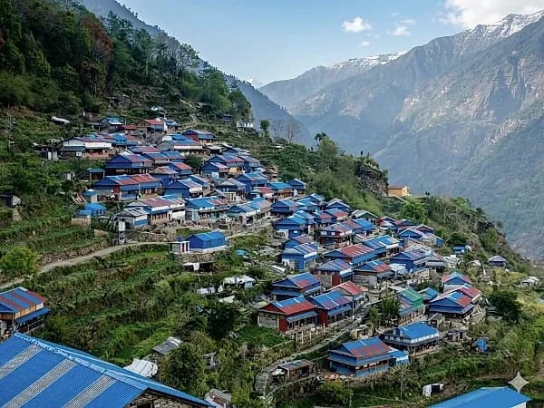
Ruby Valley Trek 2027: The Complete Guide to the 9-Day Route from Syabrubesi to Dhading Besi
The 9-day Ruby Valley trek from Syabrubesi over the Pangsang La to Tipling, Borang and Dhading Besi: day-by-day route, permits, best months and 2027 prices from USD 560.
Read More
Best Time for the Rara Lake Trek: Month by Month for 2027
Rara Lake month by month: measured rain and temperature, where sources disagree on freezing, rhododendron months, October crowds and 2027 prices.
Read More Chat with Shreejan