
Thaknak: The Hinku Valley Night Below Khare on the Mera Peak Route

Short answer: Thaknak (also Thangnak) sits at about 4,350 m in the Hinku valley, the night below Khare on the way to Mera Peak and the first night above 4,000 m on the route. On our itinerary day 6 runs from Kothe to Thaknak, about 8 km and 4 to 5 hours with a gain of about 750 m. Do not confuse it with the Thangnak near the Cho La. See our Mera Peak climb.
Most people who climb Mera Peak remember the summit and the view. What they tend to forget is the night before the last big push, when the trees have gone, the river is grey with glacier water and the whole valley suddenly feels much bigger than you are. On our route that night is Thaknak. It is a stop between two better-known places, and it deserves more than a line in an itinerary.
Where is Thaknak, and why is it spelled so many ways?
Thaknak sits in the upper Hinku valley in Solukhumbu District, on the trail between Kothe below and Khare above. The Hinku is a separate valley from the busy Everest Base Camp corridor, and this part of it falls inside Makalu Barun National Park, which was established in 1992 and covers 1,500 square kilometres.
The spelling is a mess, and I should say so plainly. You will see Thaknak, Thangnak, Thagnak, Tangnag and Tagnag on maps, in guidebooks and on lodge signs, and they all mean the same place in this valley. Our itinerary uses Thaknak. One warning for anyone searching online: there is a completely different Thangnak on the Cho La pass route in the Khumbu, at about 4,700 metres. That one is not on the way to Mera.
How high is Thaknak?
Our itinerary gives Thaknak as 4,350 metres (14,272 feet), and that is the figure we use with guests. But I would not treat it as exact, because published sources do not agree. One 1998 account of the village gives 4,356 metres, a trekking guidebook site gives 4,358 metres, and one operator lists both 4,350 and 4,300 metres on different days of the same trip. So the honest answer is somewhere between about 4,300 and 4,360 metres. The differences are small, but they show how loosely village heights are measured in the Hinku. The real point is that this is the first night above 4,000 metres on the route, and your body will notice.
What is Thaknak like to sleep in?
It is a summer grazing area with simple lodges for trekkers and climbers. Expect basic rooms and a short menu, and treat it as a place to eat, rest and go to bed early. The trees stop around here. Our itinerary describes the trail from Kothe as one where the forest thins, the pastures open out, and you pass yak herding areas and prayer flags before arriving. The cold at night is real, so keep your warm layers within reach.
It is not a village in the way Namche or Khumjung is. Nobody comes here for the shops. You come because the trail goes through it, and because it happens to be a good place to be.
What can you see from Thaknak?
The valley opens out here, and the mountains close in. Our itinerary notes the views of the Mera Glacier and the Charpate Himal. Kusum Kanguru, a 6,367 metre peak in the same range, whose ridge separates the Dudh Koshi valley from the Hinku, is the mountain other operators single out from this stretch. On a clear evening you can simply stand outside the lodge and look up, and the snow and ice above you do most of the talking.
Where does Thaknak fit in our Mera Peak itinerary?
On our Mera Peak climbing trip, Day 5 takes you from Chetrakhola to Kothe at 3,600 metres. Day 6 is Kothe to Thaknak, about 8 kilometres and 4 to 5 hours of walking, with a gain of about 750 metres. You sleep at Thaknak that night. Day 7 goes on to Khare at 5,045 metres, about 6 kilometres and 4 to 5 hours, gaining a further 695 metres. Day 8 is the acclimatisation day, and it is at Khare, not at Thaknak. Day 9 climbs to Mera High Camp at 5,780 metres.
On the way back, our itinerary runs Khare to Kothe in a single long day on Day 11, so Thaknak is not a night stop on the descent. The one night you spend here is on the way up.
What is the walk in from Kothe like?
It is a short day by the standards of this trek, but a steady one, and it is the day the landscape changes. The trail follows the Hinku River valley with unbroken views of snow peaks and rocky hillsides. As you climb, the trees become fewer and the surroundings open into wide pastures and glacial streams. You pass yak herding areas, and colourful prayer flags flutter in the cool mountain breeze. The distant sound of the river stays with you below the trail, and the scale of the place starts to sink in.
What is the walk on to Khare like?
The next morning the trail climbs gently along the side of the Hinku valley. It then becomes steeper and more uneven, crossing glacial streams and rocky stretches, and the air feels cooler and thinner with every step. Mera Peak appears closer and clearer as you go. It is a short day on paper, but you are now well above 4,000 metres, so we walk it slowly and stop when your guide says stop. You arrive at Khare in time to rest, eat and let your body settle before the acclimatisation day.
Is the climb to Thaknak too fast for your body?
I want to be honest here, because this is the part of the route I think about most. The CDC Yellow Book advises that once you are above 3,000 metres you should raise your sleeping altitude by no more than 500 metres a day, and add an extra day for every additional 1,000 metres. Our itinerary has you sleeping about 750 metres higher at Thaknak than at Kothe, and then about 695 metres higher again at Khare. That is more than the guideline on both days. The rest day at Khare is there because of that, and it is a real rest day, not a formality.
I would rather you read this now than find out on the trail. Our guides carry a pulse oximeter and check your oxygen up high, and the plan bends to how you are actually doing rather than to a fixed timetable. Our guides do not carry bottled oxygen as a matter of course, and on a well-paced trek you should not need it. If the profile worries you, talk to us before you book. Our guide to acclimatisation on Nepal treks explains the reasoning in more detail. And if you are still deciding whether Mera is right for you, our comparison of Mera Peak and Island Peak is a good place to start.
What happened at Sabai Tsho in 1998?
This is the piece of Thaknak's story that I find most sobering, and it is well documented. Near the village sits Sabai Tsho, a glacial lake also known as Tam Pokhari. On 3 September 1998 its moraine dam collapsed. A study by Rabindra Osti, Tara Bhattarai and Katsuhito Miyake, published in the journal Natural Hazards in 2011, traces the failure to a landslide on the dam and estimates that about 18 million cubic metres of water was released.
A separate account written in the weeks afterwards by a visitor to the valley describes what happened in the village itself. The flood swept away two houses at Thaknak and killed three yaks, with no other casualties reported there. Further downstream, along the Hinku Drangkha and the Dudh Koshi, bridges and houses were washed away. That account was a personal web page, not a peer-reviewed paper, so I treat the detail of it with care, but the date and the dam failure are confirmed by the published study.
Sabai Tsho is not on our day plan and I will not pretend it is. I mention it because it is part of the valley's history, and because researchers have since surveyed the glacial lakes of the Hinku and Hongu valleys. It is one more reason to walk with a guide who knows the current state of the trail.
When does the trek go through Thaknak?
Mera is a climbing trip as well as a trek, so it runs in the two clear-weather windows: October and November in the autumn, and roughly March to May in the spring. Those are the months when the lodges up the valley are open and the weather on summit day gives you the best chance of the view. Outside them the valley is quiet, and not every lodge stays open, so ask us before planning a winter or monsoon trip.
What permits does the Mera route need?
For the Mera Peak climb you need a Nepal Mountaineering Association climbing permit, a Makalu Barun National Park entry permit, the Khumbu Pasang Lhamu Rural Municipality fee of NPR 3,000, and a TIMS card at NPR 2,000. We buy the TIMS card for you in Kathmandu, and your guide buys the local permit on the trail. You do not need to arrange any of it yourself. For a full breakdown of what a Mera trip costs, including gear, see our Mera Peak cost guide.
The short version
Thaknak is a small grazing settlement in the upper Hinku valley at about 4,350 metres, give or take what your source says. It is the first night above 4,000 metres on our Mera Peak itinerary, the place where the forest gives way to open ground, and the last stop before Khare. It also has a real history, from the 1998 flood at Sabai Tsho. Come prepared for the cold, take the altitude seriously, and drink more water than you think you need. If you want to talk it through, message me on WhatsApp on +977 9810351300.
Written by Shreejan Simkhada, CEO of The Everest Holiday and third-generation Himalayan guide. TAAN Member #1586.
Planning a trip to Nepal?
Drop us your details and tell us what you have in mind. We will put together a personalised plan and get back to you.
Not sure which Nepal trek is right for you?
Take our free 2-minute quiz and get personalised recommendations based on your fitness, experience, and travel style.
Find Your Perfect Trek →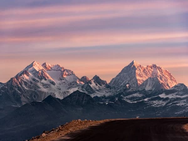
Christmas and New Year Treks from Pokhara 2026/27: 3 to 5 Days
<p>Short treks from Pokhara for Christmas and New Year 2026/27: Panchase 3 days, Poon Hill 4 days and Mardi Himal 5 days. Weather, snow, what is open, and prices by group size.</p>
Read More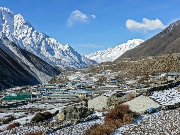
Thamdanda and Surke: The Road Head for Everest Base Camp by Road
Thamdanda is the road head where our Everest Base Camp trek by road starts and ends on foot. How to get there from Phaplu and what the first walk to Paiya is like.
Read MorePoon Hill Trek Permits 2027: ACAP, TIMS, Cost and What You Need
Poon Hill needs two permits: ACAP at NPR 3,000 and a TIMS card at NPR 2,000. Who arranges them, where they are checked, SAARC rates and the 2027 trek prices.
Read More Chat with Shreejan