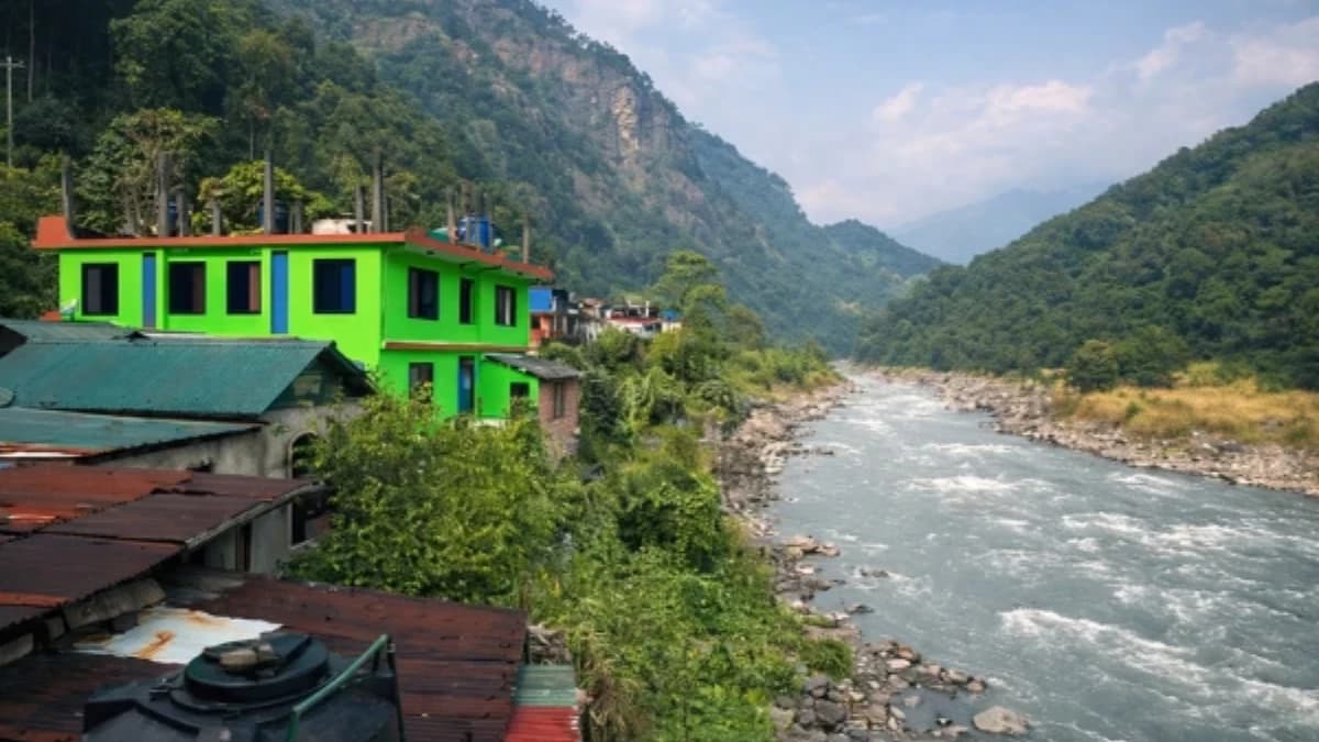
The bus from Kathmandu stops. Not at a bus station, there is no bus station. Not at a town centre, there is barely a town. It stops where the road runs out of ambition, at a cluster of buildings beside a river in a gorge so steep and so green that the sky is a strip of blue between walls of jungle. This is Soti Khola. Seven hundred metres above sea level. The starting point of the Manaslu Circuit. And the last place on the trek where anything with wheels will carry you.
The name means "where the river flows", soti from the Nepali for current, khola for river. The Budhi Gandaki, the Old Gandaki, the river you will follow upstream for the next ten days, crashes through the gorge below the settlement with a force that vibrates through the ground. The sound is constant: not background noise but foreground presence, a bass rumble that fills the valley and that you will hear, diminishing with altitude, for the first week of the trek until the river shrinks to a glacial stream above Samagaon.
Soti Khola is not where most trekkers expect a Himalayan trek to begin. At 700 metres, the altitude is subtropical. The air is warm and humid. Banana trees grow beside the teahouses. Rice paddies terrace the hillsides. And the mountains, the reason you came, the eight-thousander that the circuit circumnavigates, are invisible, hidden behind layer upon layer of forested ridges that rise from the river to the sky. The mountains are twelve days away. The walking starts here.
How Do You Get to Soti Khola From Kathmandu?
The journey from Kathmandu to Soti Khola takes seven to nine hours by local bus or private vehicle. The road follows the Prithvi Highway west to Dhading Besi, then turns north on a road that deteriorates progressively, paved to gravel to dirt to the specific Nepali road condition that is best described as "geological suggestion." The final section, from Arughat to Soti Khola, is the roughest, a narrow track carved into the cliff above the Budhi Gandaki that handles one vehicle at a time and that introduces you, before the trek begins, to the gorge landscape that will define the first five days of walking.
Some itineraries start from Arughat (520 metres) rather than Soti Khola, adding a day of walking through agricultural lowlands. Some start from Machha Khola (870 metres), one day above Soti Khola, if the road has been extended (road construction in the Budhi Gandaki valley is ongoing, and each year the road pushes a little further north). Your trekking company will advise on the current roadhead, the starting point depends on road conditions, which depend on season, weather, and the specific ambitions of the road-building crews.
What Is Soti Khola Like?
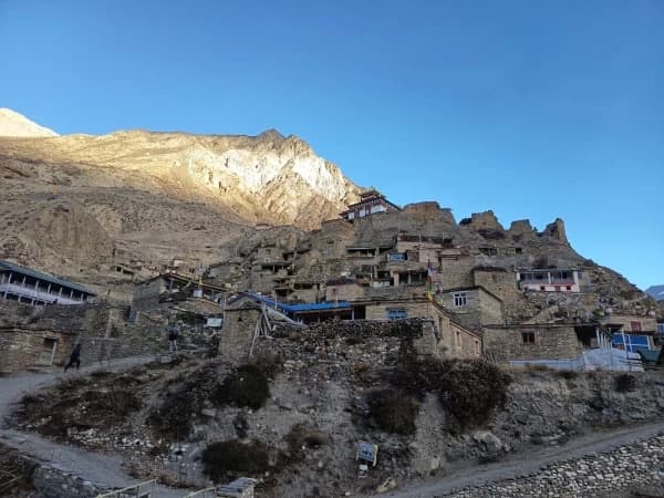
Soti Khola is a small settlement, a handful of houses and three or four teahouses strung along the road above the river. The teahouses are basic by any standard: rooms with two beds, a shared bathroom, and a common room where the stove burns wood rather than the dried yak dung you will encounter at altitude. The menu is standard Nepali: dal bhat, noodle soup, fried rice, and tea. The food is fresh, at 700 metres, vegetables grow year-round, and the dal bhat at Soti Khola may be the freshest you eat on the entire circuit.
The community is mixed, Gurung, Tamang, and Chhetri families who farm the terraced fields around the settlement. The economy is agricultural, supplemented by the trekking traffic that passes through during peak season (October-November and March-April). The trekking economy has brought modest prosperity, better-built houses, a small shop selling basic goods, and the particular social infrastructure of a trailhead: guides meeting their groups, porters organising loads, and the first nervous energy of trekkers beginning a fourteen-to-eighteen-day walk into the mountains.
What is the first day from Soti Khola to Machha Khola like?
The walk from Soti Khola on Day 1 typically ends at Machha Khola (870 metres), a gain of only 170 metres over four to five hours. The altitude gain is trivial. The effort is not. The trail follows the Budhi Gandaki upstream through the gorge, crossing suspension bridges, climbing over rocky outcrops, descending to river level and climbing again. The terrain is uneven, the trail is narrow, and the subtropical heat at 700-900 metres makes the walking harder than the altitude suggests.
The gorge between Soti Khola and Machha Khola is beautiful in a way that the high-altitude landscape above cannot match. Waterfalls drop from cliffs hundreds of metres above. The river below is blue-white with glacial sediment, churning through boulders in rapids that produce a continuous roar. The forest is dense, bamboo, sal, rhododendron at higher points, and the wildlife includes langur monkeys, birds that flash through the canopy, and the occasional glimpse of a Himalayan tahr on the cliffs above.
The suspension bridges on this section are among the most dramatic on the circuit, long, narrow, swaying spans across the gorge with the river fifty to a hundred metres below. They are engineered and maintained, but the first crossing, especially if you carry a fear of heights, is a moment that every Manaslu trekker remembers. Your guide walks across first. You follow. The bridge sways. The river roars below. And you arrive on the other side with the specific satisfaction of having done something your body did not want to do and your mind now celebrates.
How many days is the Manaslu Circuit trek from Soti Khola?
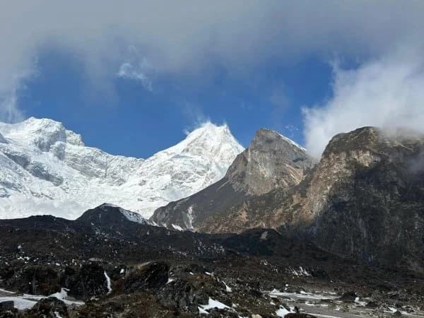
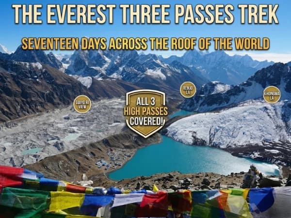
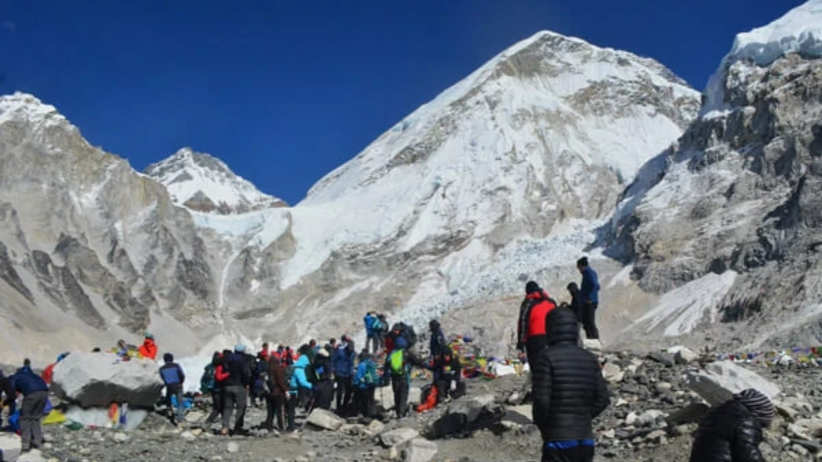
The full Manaslu Circuit from Soti Khola takes fourteen to eighteen days and gains approximately 4,460 metres of altitude, from 700 metres at the start to 5,160 metres at the Larkya La pass. The circuit is one of the great multi-week treks in the Himalaya: a complete circumnavigation of Manaslu (8,163 metres, the world's eighth highest mountain), through terrain that transitions from subtropical gorge to alpine meadow to glacial moraine to high desert and back to forest.
The circuit's character changes dramatically with altitude:
Days 1-3 (700-1,500m): Subtropical gorge. Hot, humid, green. Suspension bridges, waterfalls, rice paddies. Leeches in monsoon season. Cultural transition from lowland Nepali to Gurung communities.
Days 4-6 (1,500-3,000m): Temperate forest. Cooler, drier. Rhododendron and pine. The gorge narrows to its tightest point between Jagat and Deng. Cultural transition to Tibetan-influenced communities.
Days 7-9 (3,000-3,800m): Alpine transition. Forest gives way to scrub. The valley broadens at Samagaon. Manaslu visible for the first time. Acclimatisation day. Tibetan Buddhist culture dominant.
Days 10-12 (3,800-5,160m): High altitude. Glacial moraine. Larkya La crossing. The crux of the circuit, pre-dawn start, glacier, prayer flags, descent to Bhimtang.
Days 13-15 (3,500-1,500m): Descent through forest to Dharapani, where the circuit meets the Annapurna Circuit route. Temperature rises, oxygen returns, appetite explodes.
Do you need a permit and guide for the Manaslu Circuit?
The Manaslu Circuit is a restricted area trek. A restricted area permit is required, one hundred US dollars per person per week in peak season (September-November), seventy-five dollars in other months. A minimum of two trekkers with a licensed guide is mandatory. The permit is obtained through your trekking company as part of the booking process.
The restriction is deliberate. It limits visitor numbers to six to eight thousand per year, a fraction of the Annapurna Circuit's thirty thousand or the EBC trail's fifty thousand. The result is a trail that feels genuinely remote: fewer trekkers per day, simpler teahouses, quieter villages, and a relationship with the landscape that the popular routes, for all their grandeur, have surrendered to popularity.
The Soti Khola trailhead is where the restricted area begins. Your guide presents the permit and the group's documentation at the first checkpoint (at Jagat, approximately two days above Soti Khola). From that checkpoint onward, you are in the Manaslu Conservation Area, a protected zone where the permit revenue funds trail maintenance, community development, and the conservation of one of Nepal's most biodiverse mountain regions.
Why is Soti Khola the starting point for the Manaslu Circuit?
Soti Khola is not a destination. Nobody comes here for Soti Khola itself. It is a beginning, the point where the road stops and the walking starts, where the bus engine falls silent and the river takes over as the dominant sound, where the journey from Kathmandu's traffic and noise transitions to the Budhi Gandaki's gorge and birdsong.
Every great trek needs a beginning that teaches you what the trek will be. Lukla teaches EBC trekkers about altitude (you land at 2,840 metres and feel it immediately). Nayapul teaches ABC trekkers about stone steps (two thousand of them to Ghandruk). Soti Khola teaches Manaslu trekkers about the gorge, the narrow valley, the suspension bridges, the river that you will follow upstream for ten days, and the specific, humid, subtropical beginning that makes the high-altitude middle and the glacial climax feel earned in a way that a helicopter transfer to three thousand metres never could.
The mountains are not visible from Soti Khola. They are twelve days away. But the river that flows past the teahouse, the Budhi Gandaki, carrying meltwater from Manaslu's glaciers, has been to the mountain and back. It carries the mountain's water, the mountain's ground rock, and the mountain's specific, mineral cold. Follow it upstream. The mountain is waiting.
Soti Khola is the roadhead where the Manaslu Circuit Trek begins. The jeep drive from Kathmandu to Soti Khola takes about 7-8 hours.
Soti Khola is the start of the Manaslu Circuit — a riverside village where the bus drops you and the walking begins. The Budhi Gandaki River roars through the gorge below, the trail clings to the hillside above, and the next two weeks of your life will be defined by this river and the mountains it carved through.
Soti Khola is day one of our Manaslu Circuit Trek.
WhatsApp:+977 9810351300
Email:[email protected]
Written by Shreejan Simkhada, CEO of The Everest Holiday and third-generation Himalayan guide. TAAN Member #1586.
Soti Khola is the road head for Manaslu. Our Manaslu Circuit Trek (12 Days) is private (your group only, no strangers), 2026 dates open, From USD $799. WhatsApp us for tailored 2026 dates and current departures.