
Most trekkers pass through Pangboche in an hour. They stop at a teahouse, drink tea, glance at the monastery on the hill above, and continue toward Dingboche or Pheriche, eyes fixed on the higher ground ahead. They do not know that the village they are leaving is the oldest permanent settlement in the Khumbu. They do not know that the monastery on the hill is where Tenzing Norgay and Edmund Hillary received their blessing before the 1953 expedition that put humans on the summit of Everest for the first time. And they do not know that the fields below the village, terraced into the hillside at 3,930 metres, are the highest cultivated land in the Khumbu, growing potatoes and buckwheat in soil that freezes for four months of the year.
Pangboche deserves more than an hour. It deserves a morning, an afternoon, or, if your itinerary allows, a night. The village sits at the junction of the main EBC trail and the trail to Ama Dablam Base Camp, in a location that offers views of both Ama Dablam's perfect pyramid to the south and the massive bulk of Lhotse and Nuptse to the north. The lodges are quieter than Dingboche's. The monastery is more authentic than Tengboche's (which was rebuilt after a fire in 1989). And the village itself, stone houses, mani walls, prayer flags, and the specific quality of mountain light that altitude and latitude create at 3,930 metres, is the Khumbu as it existed before trekking tourism arrived.
How Old Is Pangboche and Why Does It Matter?
Pangboche's claim to be the oldest village in the Khumbu is supported by both oral tradition and the physical evidence of the monastery. The Sherpa people migrated from eastern Tibet approximately five hundred years ago, crossing the high passes into the Khumbu and establishing settlements in the valleys below Everest. Pangboche, protected by its south-facing position and its access to water from the Imja Khola, was among the first permanent settlements.
The village is divided into Upper Pangboche and Lower Pangboche. Upper Pangboche, clustered around the monastery, is the original settlement, the houses are older, the paths are narrower, and the atmosphere is more traditional. Lower Pangboche, along the main trail, is newer and more developed for trekking, with lodges, a small shop, and the trail junction that sends trekkers toward either Dingboche (for EBC) or Ama Dablam Base Camp.
The agricultural terraces below the village are remarkable at this altitude. Potatoes, the staple crop of the high Khumbu, grow in small fields enclosed by stone walls. Buckwheat and barley supplement the potatoes. The growing season is short, June through September, and the harvest must be completed before the October frosts. The same families that run trekking lodges during the season farm these fields in the summer, maintaining a dual economy that has sustained the village for generations.
What Is Special About Pangboche Monastery?
The monastery sits on a ridge above Upper Pangboche, surrounded by ancient juniper trees that are among the oldest living trees in the Khumbu. The trees are considered sacred, they predate the monastery and are protected by both religious tradition and community law. Cutting a juniper in Pangboche is a transgression that carries social consequences more severe than any legal penalty.
The monastery was founded approximately three hundred and fifty years ago and is the oldest gompa in the Khumbu, older than Tengboche (founded 1916), older than Thame, and older than any other monastery in the Everest region. The building is modest, whitewashed stone walls, a wooden door, a dark interior lit by butter lamps, but its significance is outsized. This is where the lama of Pangboche performed the puja (blessing ceremony) for the 1953 British Everest expedition. Tenzing Norgay, who was Sherpa and understood the importance of the blessing, brought the expedition team to Pangboche specifically for this purpose. The blessing is credited by many Sherpas with the expedition's success.

The monastery housed, until its theft in the 1990s, what was claimed to be a yeti scalp and a yeti hand. The scalp was examined by Western scientists in the 1950s and 1960s (Edmund Hillary himself participated in one examination) and was identified as likely made from the hide of a serow (a Himalayan goat-antelope). The hand was stolen from the monastery in 1991 and has never been recovered. The theft is still discussed in Pangboche with a mixture of anger and sadness, not because the villagers necessarily believed the relics were from a yeti, but because they were sacred objects that had been in the monastery for centuries.
Visitors are welcome at the monastery. The door is usually open during daylight hours. A small donation (two hundred to five hundred rupees) is customary. The interior contains wall paintings, Buddhist statues, and butter lamps that have been burning continuously for longer than anyone can remember. The lama, if present, may offer a blessing. The experience is intimate and authentic in a way that the larger, more touristic monasteries along the trail cannot replicate.
What Can You See from Pangboche?
Pangboche's position, on a south-facing slope at 3,930 metres, at the point where the Imja Khola valley opens toward the high peaks, creates a panorama that is among the best on the EBC trail.
Ama Dablam dominates the southern skyline. From Pangboche, the mountain's famous shape, a steep pyramid with hanging glaciers that resemble a mother's charm box (the literal meaning of "Ama Dablam", mother's necklace), is seen from an angle that emphasises its symmetry and its intimidating steepness. Climbers approaching Ama Dablam Base Camp pass through Pangboche, and from the village you can sometimes see the ant-like figures of climbers on the mountain's lower ridges.
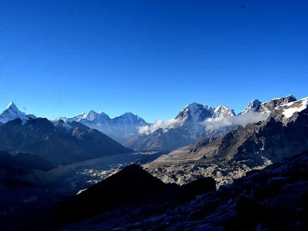
To the north, the Lhotse-Nuptse wall fills the horizon, a continuous rampart of ice and rock that separates the Imja valley from the Everest massif behind it. Everest itself is not visible from Pangboche (it is hidden behind Nuptse and Lhotse), but the wall that conceals it is itself one of the most impressive mountain views on the trail.
Early morning, before eight AM, is the best time for views. The mountains catch the first light while the valley is still in shadow. The air is clear, cold, and still. And the village, with smoke rising from kitchen chimneys and prayer flags catching the first breeze, is a composition that photographers find irresistible and that memory preserves with an accuracy that even the best photographs cannot match.
Where Should You Stay in Pangboche?
Pangboche has several lodges in both Upper and Lower Pangboche. The lodges are quieter and less crowded than those in Dingboche or Namche, which makes Pangboche an attractive overnight option for trekkers who want a more peaceful experience.
Recommended lodges include:
Sonam Lodge (Lower Pangboche), well-maintained, good food, friendly family. Popular with trekkers heading to Ama Dablam BC.
Himalayan Lodge (Upper Pangboche), close to the monastery, traditional setting, excellent views of Ama Dablam.
Ama Dablam Garden Lodge (Lower Pangboche), garden setting with mountain views, clean rooms.
Expect to pay the standard teahouse rates: free to five hundred rupees for a room (with the expectation that you eat dinner and breakfast at the lodge), and two hundred to five hundred rupees per meal.
What Do You Need to Know About Pangboche?
Altitude: 3,930 metres. Located between Tengboche (3,860m) and Dingboche (4,410m) on the standard EBC trail.
Walking times: approximately two hours from Tengboche, approximately two and a half hours to Dingboche. Most trekkers pass through Pangboche as a tea stop on the Tengboche-to-Dingboche day. Staying overnight adds the monastery visit and the morning views without adding a day to the itinerary, you simply split the Tengboche-Dingboche walk into two shorter days.
The trail through Pangboche is well-maintained and clearly marked. The junction for Ama Dablam Base Camp is in Lower Pangboche, a sign marks the trail that branches south toward the mountain.
Water is available at the lodges. Do not drink from the streams without purification. The village has a small shop selling basic supplies, chocolate, biscuits, batteries, at altitude-appropriate prices (two to three times Kathmandu prices).
Why Should You Spend Time in Pangboche?
The EBC trail is a walk through altitude and landscape, but it is also a walk through time. Lukla is modern, an airstrip built in the 1960s. Namche is commercial, a trading town that has adapted to tourism. Tengboche is monumental, a monastery rebuilt after fire, designed to impress. Dingboche is functional, a staging point for the high camps above.
Pangboche is none of these. It is old. Genuinely, deeply old. The monastery predates every other structure on the trail. The juniper trees predate the monastery. The terraced fields predate the trees. And the village, stone houses on a hillside at 3,930 metres, growing potatoes in soil that freezes for a third of the year, represents the Khumbu as it was before trekking, before tourism, before the rest of the world knew that Everest existed.
When you walk through Pangboche, you walk through the history of the Khumbu. When you visit the monastery, you sit in the room where the first Everest expedition was blessed. When you look at the mountains from the village, you see the same view that the original settlers saw five hundred years ago when they crossed the passes from Tibet and decided that this, this specific hillside, this specific angle on the peaks, was home.
The trekkers who stop for an hour miss this. The trekkers who stay for a night find it. And the finding, the slow, quiet recognition that you are in a place where history, religion, agriculture, and mountain beauty converge at 3,930 metres, is one of the gifts that the EBC trail offers to those who walk slowly enough to receive it.
Pangboche sits on the trail between Tengboche and Dingboche on the Everest Base Camp Trek. It is also the starting point for the Ama Dablam Base Camp Trek, an eight-day route that takes you to the foot of what many climbers call the most beautiful mountain in the Khumbu.
Pangboche has the oldest monastery in the Khumbu, and the monks there will bless your trek if you ask. I have seen trekkers who do not believe in blessings sit quietly while the monk chants, accept the red thread around their wrist, and walk out looking calmer than they have looked in days. Whether it works or not is beside the point. The monastery is beautiful, the monks are kind, and the pause in the trek is welcome.
Pangboche is on day five or six of our Everest Base Camp Trek.
WhatsApp:+977 9810351300
Email:[email protected]
Written by Shreejan Simkhada, CEO of The Everest Holiday and third-generation Himalayan guide. TAAN Member #1586.
Pangboche is days 4-5 on EBC. Our Everest Base Camp Trek (12 Days) is private (your group only, no strangers), 2026 dates open, From USD $1399. WhatsApp us for tailored 2026 dates and current departures.