The Annapurna Circuit trail splits at Bratang. The lower trail — the one that most trekkers follow, the one that the guides default to, the one that the road has reached and partially paved — continues along the Marsyangdi valley floor to Upper Pisang and onward to Manang. The upper trail climbs. Steeply. Away from the road, away from the valley, away from the other trekkers, and up to a ridge where a village sits at 3,660 metres with a view of the Annapurna range that makes every step of the climb worthwhile and that the lower trail, for all its convenience, cannot provide.
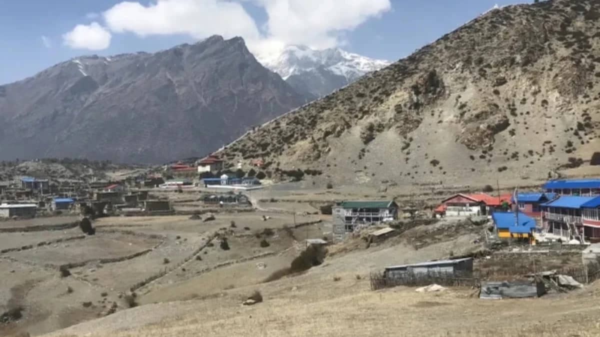
Ngawal is the village that the Annapurna Circuit forgot. Not literally — it appears on maps, it has teahouses, and some guides include it in their itineraries. But the majority of Circuit trekkers — particularly those on shorter itineraries or those whose guides favour the lower, faster, road-accessible trail — pass through Upper Pisang to Manang without ever climbing to the ridge where Ngawal sits, looking down on the valley they walked through and across at the peaks they came to see.
The trekkers who do climb to Ngawal, who take the upper trail at Bratang, who accept the extra effort, who trust their guide's recommendation or their own curiosity, discover something that the lower trail cannot deliver: a panoramic view of the Annapurna range from a height and angle that the valley floor does not provide, in a village so quiet that the loudest sound is the wind in the prayer flags and the second-loudest is your own breathing.
How hard is the upper trail to Ngawal village?
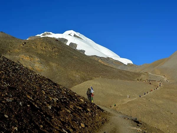
The upper trail from Bratang to Ngawal climbs approximately 500 metres through pine forest and across open hillside. The walking takes three to four hours, significantly more effort than the flat lower trail to Upper Pisang, which takes two hours along the road. This effort differential is why most trekkers take the lower trail: it is easier, it is faster, and it arrives at the same general area (Manang valley) without the climb.
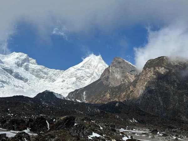
What the effort buys is height. From Ngawal at 3,660 metres, you are 400 metres above the valley floor. The Annapurna range, Annapurna II (7,937 metres), Annapurna III (7,555 metres), Annapurna IV (7,525 metres), and Gangapurna (7,454 metres), is visible in a continuous panorama that stretches across the northern horizon. The peaks are not distant, they are close, across the valley, their glaciated faces catching the light with a directness that the lower trail's oblique angle cannot match.
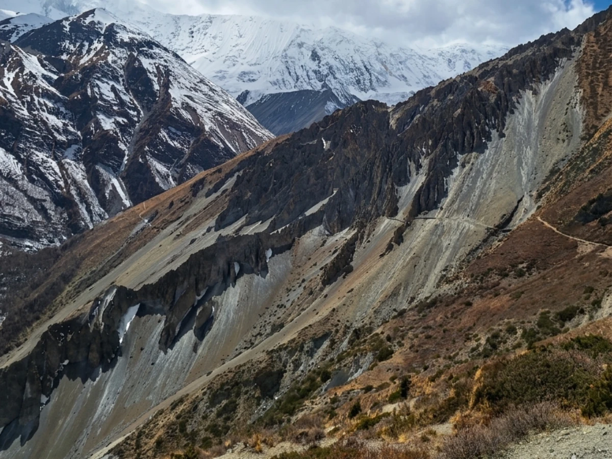
The trail itself is beautiful. Pine forest gives way to open hillside as you climb. The vegetation thins with altitude. Small chortens and mani walls mark the trail at intervals. And the view, which is behind you as you climb, requiring you to turn and look back, opens progressively, revealing more of the Annapurna range with each hundred metres gained. The final approach to Ngawal is along a ridge with views on both sides, the Marsyangdi valley below to the south, the Manang valley ahead to the north, and the peaks above in every direction.
What Is Ngawal Village Like?
Ngawal is a traditional Manangi village, stone houses with flat roofs, narrow paths between buildings, and a gompa on the hillside above. The Manangi people are ethnically Tibetan, related to the communities of Manang, Braga, and Khangsar, and their culture, language, and religious practices reflect centuries of connection to Tibet via the trade routes that cross the Annapurna range.
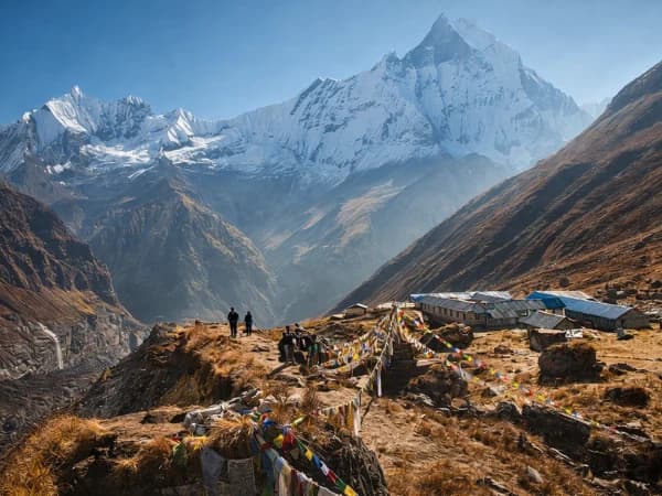
The village has approximately thirty houses and three or four teahouses. The teahouses are simpler than those in Manang (which is two to three hours further along the trail) but comfortable by Circuit standards, clean rooms, a common room with a stove, and a menu that includes dal bhat, noodle soup, and Tibetan bread. The prices are slightly lower than Manang, reflecting the lower volume of trekkers.
The gompa above Ngawal is small but worth the fifteen-minute climb. The monastery belongs to the Kagyu tradition and contains wall paintings that are considered among the finest on the Circuit, detailed, well-preserved, and depicting scenes from Buddhist teaching with a sophistication that reflects the Manangi community's historic wealth from trans-Himalayan trade. The monastery is usually open; a small donation is customary.
A cave monastery, known locally as the "guru's cave", sits above the village on the cliff face. The cave, accessible by a steep trail, was reportedly used by Buddhist practitioners for meditation retreats. The views from the cave entrance, across the Manang valley to the Annapurna peaks, suggest why a meditator would choose this particular location: the landscape itself is a meditation, vast and silent and composed of nothing but mountain, sky, and the space between.
What Can You See from Ngawal?
The view from Ngawal is the reason to come. The specific combination of height (400 metres above the valley floor), aspect (facing directly north toward the Annapurna range), and clarity (the high-altitude air at 3,660 metres is dry and transparent) creates a panorama that the lower trail cannot approach.
Annapurna II dominates the view, 7,937 metres of rock and ice, its south face catching the morning light in a cascade of gold and white that lasts twenty minutes and that photographers return to Ngawal specifically to capture. Annapurna III and IV rise to the east. Gangapurna, with its hanging glaciers and its lake visible at the base, sits to the northeast. And the Chulu peaks, the trekking peaks that ambitious Circuit trekkers climb as a side expedition, are visible to the north, their summit ridges sharp against the deep blue sky.
Sunrise from Ngawal, if you stay overnight, is the premium experience. The peaks catch the light while the valley below is still in shadow. The contrast between the illuminated mountains and the dark valley is extreme, and the effect, mountains floating above darkness, disconnected from the earth, is one of the most photographed phenomena in the Annapurna region.
Sunset is equally rewarding. The western light hits the east-facing slopes of Annapurna II and III, painting them in oranges and pinks that deepen through purple to black over twenty minutes. The village, prayer flags silhouetted against the sky, smoke rising from kitchen chimneys, provides a foreground that grounds the celestial scale of the sunset in human domesticity.
How do you fit Ngawal into the Annapurna Circuit itinerary?
The standard Annapurna Circuit itinerary places the Ngawal section between Bratang/Upper Pisang and Manang. The most common way to include Ngawal is:
Option 1: Take the upper trail from Bratang to Ngawal (3-4 hours). Stay overnight at Ngawal. Continue to Manang the next morning (2-3 hours). This adds one night to the itinerary but provides the overnight experience, sunset, sunrise, and the evening atmosphere of a quiet mountain village.
Option 2: Take the upper trail from Bratang to Ngawal (3-4 hours). Continue to Manang the same day (2-3 hours more, total 5-7 hours). This fits Ngawal into the standard itinerary without adding a night, but the day is long and you miss the sunrise.
Option 3: Walk the lower trail to Upper Pisang, then climb to Ngawal as a side trip (1.5 hours up, 1 hour down). This is a compromise, you get the view without the full upper trail, but the approach from Upper Pisang is steeper and less scenic than the full upper trail from Bratang.
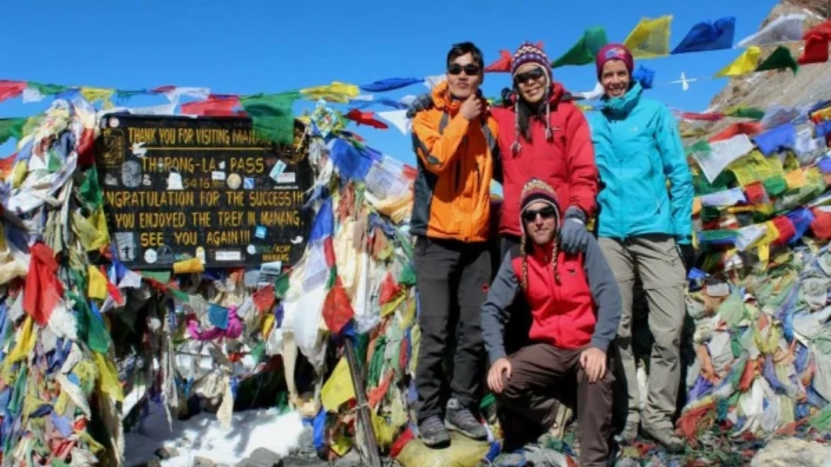
Discuss the options with your guide before reaching Bratang. A guide who knows the Circuit well will recommend the upper trail, the effort is worth the reward, and the acclimatisation benefit of walking at 3,660 metres (400 metres above the lower trail) is a bonus that supports the push to Thorong La three days later.
Is Ngawal good for acclimatisation before Thorong La?
Ngawal at 3,660 metres provides excellent altitude exposure for trekkers heading to Thorong La (5,416 metres). Walking the upper trail, which reaches 3,660 metres compared to the lower trail's 3,300 metres at Upper Pisang, exposes your body to higher altitude earlier in the Circuit, triggering acclimatisation responses that benefit you at Manang (3,540 metres) and above.
If you stay overnight at Ngawal, you sleep at 3,660 metres, the highest sleep so far on the Circuit for most trekkers. This "climb high, sleep high" approach (a variation of the usual "climb high, sleep low") works here because the altitude gain from the previous night (typically Chame at 2,670 metres or Bratang at 2,850 metres) is within safe limits, and the extra night at 3,660 metres gives your body additional time to adapt before the acclimatisation days at Manang.
Is Ngawal village worth visiting on the Annapurna Circuit?
The Annapurna Circuit is a trek of contrasts, subtropical lowlands to alpine desert, Hindu villages to Buddhist monasteries, river gorge to mountain pass. Ngawal represents a contrast within the contrast: the choice between the easy path and the rewarding one. The lower trail is flat, fast, and road-adjacent. The upper trail is steep, slow, and spectacular. Both reach Manang. Only one reaches Ngawal.
The trekkers who choose the lower trail save three hours and two hundred metres of climbing. The trekkers who choose the upper trail gain a view that the lower trail cannot provide, a village that the lower trail does not visit, and the specific, climb-earned satisfaction of standing at 3,660 metres on a ridge above the Marsyangdi valley, looking at the Annapurna range from an angle that turns the mountains from a backdrop into a wall, close, bright, enormous, and seen from a height that makes you feel not small but elevated. Not diminished by the peaks but lifted toward them. Standing where most Circuit trekkers do not stand, seeing what most Circuit trekkers do not see, in a village where the loudest sound is the wind carrying prayers from flags that have been flying on this ridge since before the Circuit was a trail and the mountains were a destination.
Ngawal is on the Annapurna Circuit Trek, an alternative high route above Manang with views of the Annapurna range.
Ngawal is the Annapurna Circuit's best-kept secret. Most trekkers take the main trail through Pisang and miss it entirely. The village sits on a ridge above the valley with views of Annapurna II, III, and IV that are better than anything on the main route. The caves above town are ancient, the monastery is peaceful, and the teahouse owner serves the best apple pie on the circuit. Go to Ngawal.
Our Annapurna Circuit Trek takes the upper trail through Ngawal. We never skip it.
WhatsApp:+977 9810351300
Email:[email protected]
Written by Shreejan Simkhada, CEO of The Everest Holiday and third-generation Himalayan guide. TAAN Member #1586.
Ngawal is the acclimatisation village on AC. Our Annapurna Circuit Trek (12 Days) is private (your group only, no strangers), 2026 dates open, From USD $720. WhatsApp us for tailored 2026 dates and current departures.
Continue planning your trek
This is one stop on the Annapurna Circuit trail. For the full route, read our Annapurna Circuit cost and planning guide. When you are ready for dates and prices, see the Annapurna Circuit Trek (12 days) or WhatsApp us directly. We reply personally.