
Nayapul: The Trailhead for Poon Hill, Annapurna Base Camp and Khopra Danda

Short answer: Nayapul is the road head where our Poon Hill, Annapurna Base Camp and Khopra Danda treks start or finish, a drive from Pokhara (820 m). From there you walk through Birethanti into the Annapurna Conservation Area, which needs the NPR 3,000 entry fee and a TIMS card (NPR 2,000). On our Poon Hill trek the first night is Ulleri at 1,960 m. Start at Nayapul on our Poon Hill trek.
Nobody books a trip to Nayapul. It is the place where the car stops and the trek begins, and most people spend ten minutes here, tying boots and counting bags, before they walk on towards Birethanti. I think it deserves a page anyway, because on several of our Annapurna-region treks it is the first step on the trail, the last, or both, and a surprising number of the questions we get are really about it: how far is it from Pokhara, what happens at the checkpoint, and is the road open?
Where is Nayapul?
Nayapul is the roadhead for the Modi Khola valley. Our Poon Hill yoga itinerary puts the drive from Pokhara at 42 kilometres and usually around an hour and a half, and our Annapurna Base Camp itinerary also says about ninety minutes. From here the trail goes up the Modi Khola river, through Birethanti, and on towards the Annapurna Conservation Area.
The name is easy to explain and I should be careful with it. In Nepali and Hindi, naya means new and pul means bridge, so you will often see it translated as New Bridge. I don't know which bridge it refers to, so I won't guess. Be aware, too, that a different Nayapul is a well-known neighbourhood of Hyderabad in India, so if you search online for the name alone you will get the wrong place. Search for Nayapul with Birethanti or Pokhara instead.
How high is Nayapul?
I don't give a figure, because none of our itineraries states one. What we can say from our own pages is that Pokhara is at 820 metres, Tikhedhunga, the first night stop on our yoga trek, is at 1,540 metres, and Ulleri, the first night on our Poon Hill trek, is at 1,960 metres. Nayapul sits well below both, in warm, subtropical country, which matches what our yoga itinerary describes: terraced rice paddies and banana groves. The Annapurna Conservation Area itself, starts at about 790 metres at its lowest point and rises to the summit of Annapurna I at 8,091 metres, so you are walking into a protected area that covers 7,629 square kilometres.
What happens when you arrive?
Very little, and that is the point. You step out of the vehicle and onto the trail. Our Annapurna Base Camp itinerary describes the change as instant: one moment you are in a dusty market town, the next you are on a stone path through terraced fields with the Modi Khola echoing from below. Our guide and porters meet you here, loads are sorted, and you start walking. If you are on Budget you carry your own bag. On Standard a porter is shared between two trekkers, and on Luxury you have your own, as set out on each package page.
Our Annapurna Base Camp itinerary calls it a dusty market town, not a village in the way Ghandruk is, so do your last shopping in Pokhara before you drive, not here.
What is the checkpoint at Birethanti?
Birethanti is the first village on the trail, a short walk from Nayapul, and it is where your permit is checked. Our Poon Hill itinerary says exactly that: the trail follows the Modi Khola through Birethanti, a riverside village where your ACAP permit is checked. Our yoga itinerary adds that the village sits at the confluence of the Modi and Bhurungdi rivers.
The official fees for the conservation area, from the Nepal Tourism Board's park entry fee page, are NPR 3,000 per foreign visitor for the Annapurna Conservation Area, and a TIMS card is NPR 2,000. TIMS is issued through the Nepal Tourism Board and the Trekking Agencies' Association of Nepal, and the card records who is on the trail so that rescuers know where to look in an emergency. Ask us which of these your price includes before you book, and carry your passport on the first day. Our permits guide covers the paperwork for each region, and the Annapurna Conservation Area guide explains the area itself.
Which of our treks start here?
Five of our itineraries touch Nayapul, and each uses it differently.
| Trek | What happens at Nayapul | Source |
|---|---|---|
| Ghorepani Poon Hill Trek, 6 days | Day 2: drive to Nayapul, walk through Birethanti to Ulleri at 1,960 m, about 8 km and 3 to 4 hours, climbing about 501 m. The famous stone staircase of roughly 3,000 steps is on this day | Our itinerary, day 2 |
| Ghorepani Poon Hill Yoga Trek, 9 days | Day 3: drive to Nayapul, walk past Birethanti to Tikhedhunga at 1,540 m, about 3 to 4 hours. Day 7: walk from Ghandruk to Nayapul, about 8 km and 4 to 5 hours, then drive to Pokhara | Our itinerary, days 3 and 7 |
| Annapurna Base Camp, 9 days | Day 2: drive to Nayapul, then a short jeep to Kimche, which saves roughly ninety minutes of road walking, and on to Ghandruk at 1,940 m. Day 8: walk out to Nayapul and drive to Pokhara | Our itinerary, days 2 and 8 |
| Khopra Danda Trek, 9 days | Day 2: jeep through Nayapul and Kimche to Ghandruk, about three hours, then walk to Tadapani. Day 8: Poon Hill sunrise, then the long descent by Ulleri and Tikhedhunga to Nayapul | Our itinerary, days 2 and 8 |
| Annapurna Circuit with Tilicho Lake, 16 days | Day 15: Poon Hill sunrise, then the descent through Gurung villages to Nayapul and a drive to Pokhara | Our itinerary, day 15 |
There is one honest inconsistency in our own pages, and I would rather tell you than hide it. The long final descent from Poon Hill to Nayapul is given as 4 to 5 hours on one itinerary and about six hours on another. The difference is real. It depends on how early you leave Ghorepani, whether you stop for breakfast on the way, and how your knees feel after three thousand stone steps downhill. Plan for six hours and be pleased if it takes less.
Is the road to Nayapul open right now?
I do not know today, and nobody should tell you they do without checking that morning. Here is what we know. On 9 September 2026 a landslide-dam scare on the Kimrong Khola in Kaski led to an evacuation advisory for Nayapul and Birethanti and put treks to Annapurna Base Camp, Poon Hill and Khopra on hold. OnlineKhabar reported on 9 and 10 September that the block reopened naturally within about six hours and the immediate risk subsided. Our blog on the Kimrong Khola landslide has the full account.
The Pokhara to Baglung road was newly washed out by 150 metres at Sahasradhara in Parbat District in late September, with repairs targeted for Dashain. It is not confirmed whether that washout affects the road to Nayapul, and there is no report of damage on the Nayapul road itself, so ask us for the current position before you travel.
What is the trail like in the first hour?
The first hours are gentle and warm. Our yoga itinerary describes following the Modi River upstream through terraced rice paddies, banana groves and stone staircases worn smooth by centuries of footsteps, past waterfalls that tumble down the hillside, and our Annapurna Base Camp itinerary mentions well-kept stone steps wide enough for two people to walk side by side, with mule trains passing and their bells jangling. In spring, rhododendrons bloom along the upper stretches, although our yoga itinerary notes they are not yet in flower at this altitude. Do not let the warmth fool you. The trail climbs steadily from here, and it is the first day on which many people discover how much their pack weighs.
Which months suit this trailhead?
The same two windows as the rest of Nepal: October and November in the autumn, and March to May in the spring, when our Annapurna Base Camp itinerary says the rhododendrons turn hillsides crimson and pink. This is lower country than Everest, but I would still avoid the monsoon months of June to September, when the landslide risk described above is at its highest. Our month-by-month guide goes deeper.
Why does the trailhead matter if you only spend ten minutes here?
Because three things are decided here. The first is your pace. Nayapul to Ulleri on the Poon Hill route climbs about 501 metres in 3 to 4 hours, and on the yoga route Nayapul to Tikhedhunga takes about the same, so the people who start slowly are the ones who still enjoy the third day. The second is your bag. The porters take your duffel from here, so do your final check before the drive, not after it. The third is your paperwork. The checkpoint at Birethanti is where your permit is looked at, so have your passport to hand on the first morning.
The short version
Nayapul is the roadhead for the Modi Khola valley, about 42 kilometres and an hour and a half from Pokhara, and the start or finish of our Poon Hill, Poon Hill yoga, Annapurna Base Camp and Khopra Danda treks and the last day of the Annapurna Circuit with Tilicho Lake. Birethanti, a short walk beyond it, is where your ACAP permit is checked. We have no reliable altitude and can't promise the road, but I can tell you which day of which trek begins here. If you want to talk it through, message me on WhatsApp on +977 9810351300. For the sunrise at the end of the Poon Hill route, read our Poon Hill and Ghorepani guide, and for the village at the top of the first big climb, Ghandruk.
Written by Shreejan Simkhada, CEO of The Everest Holiday, from a family of three generations of family guides. TAAN Member #1586.
Planning a trip to Nepal?
Drop us your details and tell us what you have in mind. We will put together a personalised plan and get back to you.
Not sure which Nepal trek is right for you?
Take our free 2-minute quiz and get personalised recommendations based on your fitness, experience, and travel style.
Find Your Perfect Trek →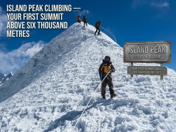
Island Peak Itinerary and Summit Day 2027: 14 Days, Base Camp to the Top
The 14-day Island Peak itinerary day by day, what summit day is like from base camp, where sources disagree on heights, best months and 2027 prices.
Read More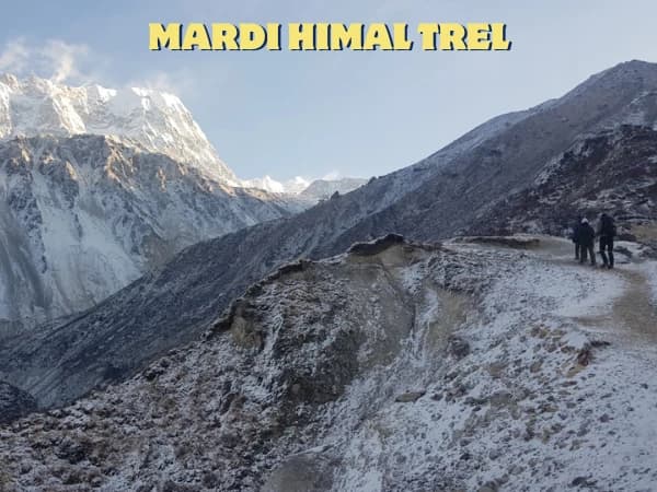
How Difficult Is the Mardi Himal Trek? An Honest Day-by-Day Rating for 2027
An honest day-by-day rating of the Mardi Himal trek: the steep climb to High Camp, the 4,500 m push to Base Camp, altitude risk, who finds it hard and 2027 prices.
Read More
Manaslu Circuit Reopened: What Changed After the 2026 Floods and How to Plan 2027
The Manaslu Circuit over the Larke Pass is open again with extreme caution. What changed in the lower valley after the two 2026 floods, 2027 prices and permits, and how I would plan.
Read More Chat with Shreejan