
The trail from Deng climbs through a forest so thick that the mountains above are invisible. For two hours you walk through bamboo and rhododendron, crossing the Budhi Gandaki on a suspension bridge that sways above white water, climbing stone steps through a gorge that narrows to the width of the river and then opens — suddenly, dramatically — into a valley that makes you stop walking and stand still. Namrung sits on a shelf above the river at 2,630 metres, and the view from its upper terrace is the first real mountain view of the Manaslu Circuit. Not a glimpse through gorge walls. Not a peak above a ridge. A full, unobstructed view of the Himalchuli range to the south and the first hint of Manaslu's bulk to the north — a preview of what the next eight days of walking will deliver in increasing scale and proximity.
Namrung is the village where the Manaslu Circuit begins to feel like a mountain trek rather than a gorge walk. For three days you have been climbing through subtropical and temperate forest, following a river upstream through a valley that was more gorge than valley — narrow, steep-walled, hot at the bottom and lush with vegetation that belonged to a world below the mountains. At Namrung, the world above arrives. The air cools. The valley broadens. The mountains appear. And the culture shifts — the Gurung villages of the lower gorge give way to the Nubri villages of the upper valley, where the architecture is Tibetan, the religion is Buddhist, and the prayer flags that will accompany you for the next ten days begin in earnest.
The Nubri Transition
The Nubri people, the ethnic group that inhabits the upper Budhi Gandaki valley from Namrung northward, are culturally Tibetan. Their language is a Tibetan dialect. Their religion is Nyingma Buddhism. Their houses have flat roofs, thick stone walls, and the carved wooden details that Tibetan-heritage architecture throughout the Himalaya shares. And their relationship with the landscape, the mountains are not just scenery but sacred geography, the rivers are not just water but carriers of spiritual meaning, is a relationship that the trekker begins to understand at Namrung, where the first mani walls appear along the trail.
The mani walls at Namrung are modest, short stretches of carved prayer stones lining the trail through and around the village. But they are the beginning of what becomes, above Samagaon, one of the most extensive mani wall systems in Nepal, kilometres of continuously carved stones that line the trail walking up through the village to the monastery, then higher to the pass, and finally the descent. Walking along these walls, always keeping them to your right, becomes the rhythm of the upper Manaslu Circuit, and the rhythm begins at Namrung.
The monastery at Namrung is small but active, a single-room prayer hall with wall paintings, a central Buddha statue, and butter lamps that are tended by a caretaker or rotating village members. The monastery is not as old or as significant as the gompas at Samagaon or Samdo further north, but it marks the beginning of the Buddhist cultural zone that will define the rest of the circuit. Visiting is informal, remove shoes, walk clockwise, leave a small donation.
What Is Namrung Village Like?
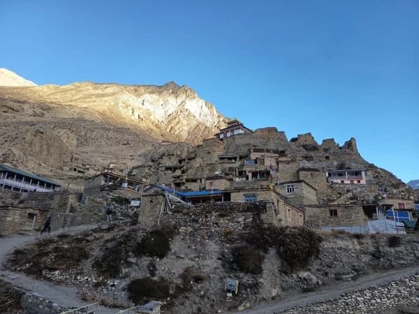
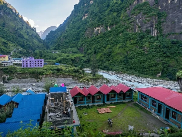
Namrung has approximately two dozen houses and three or four teahouses that serve the Manaslu Circuit trekkers. The teahouses are a step up from the lower gorge stops, larger rooms, warmer common areas, and a menu that begins to include Tibetan dishes: thukpa, Tibetan bread, and the first yak butter tea of the trek. The improvement reflects the altitude, at 2,630 metres, the air is cooler, the growing season is shorter, and the supplies that arrive on porter-back from the roadhead below are supplemented by local products: potatoes, buckwheat, and the dairy products that yak herding provides.
The village sits on a south-facing terrace, the standard Himalayan village orientation that maximises winter sunlight and provides natural drainage. The houses are stone-walled with slate or tin roofs, and the courtyards between them serve as drying areas for grain, gathering places for community events, and the specific social spaces where village life happens in full view of the mountains above.
The agricultural cycle at Namrung follows the altitude-determined calendar of the upper Budhi Gandaki: planting in May-June after the winter snow melts, growing through the monsoon months, and harvesting in September-October just as the trekking season begins. The trekkers who arrive in October walk past fields of golden buckwheat and stacked potato sacks, the harvest that will sustain the village through the winter months when the trail is snow-covered and the trekkers are gone.
What mountains can you see from Namrung on the Manaslu Circuit?
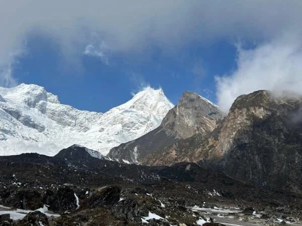
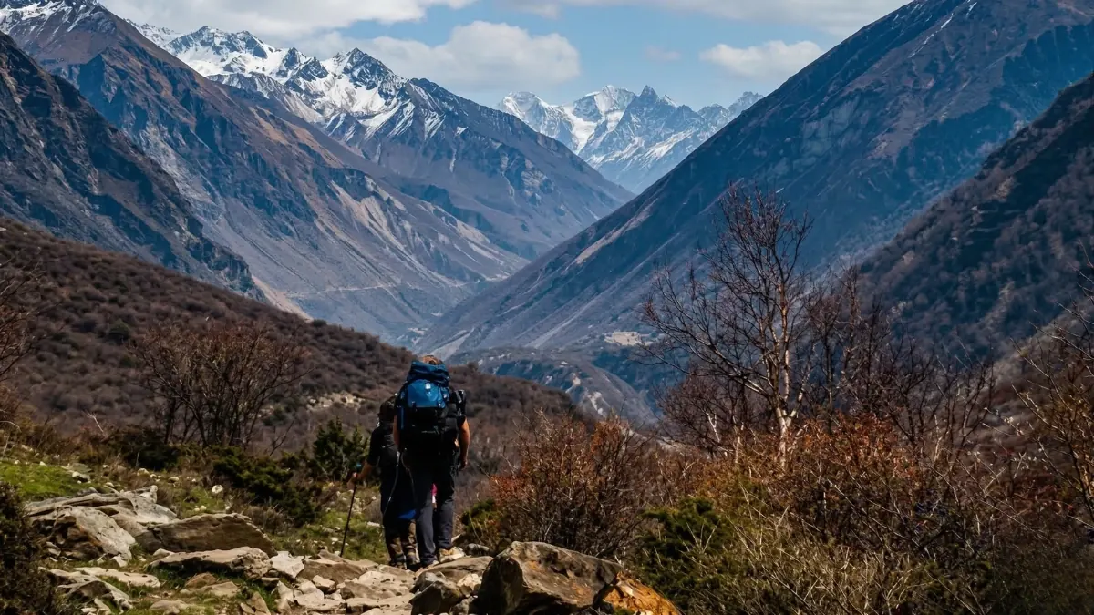
The view from Namrung's upper terrace, or from the trail above the village, is the first panoramic mountain view on the Manaslu Circuit. The Himalchuli range (7,893 metres at its highest) fills the southern horizon, its glaciated peaks visible above the forested ridges of the lower valley. To the north, the upper Budhi Gandaki valley stretches toward Samagaon and the Manaslu range, still hidden behind intervening ridges but announced by the glacial streams and the cold wind that flow down from the ice above.
The view is a promise. After three days in a gorge where the sky was a strip and the mountains were invisible, the panorama at Namrung promises what the next eight days will deliver: Manaslu itself, visible from Samagaon onward. The Larkya La pass, visible from Dharamsala. And the specific, escalating grandeur of a mountain circuit where each day's walking reveals more of the mountain that the circuit circumnavigates.
Sunrise at Namrung, if you wake early, which the altitude may enforce regardless of your intentions, illuminates the Himalchuli range in gold and pink while the valley below is still in shadow. The light at 2,630 metres is warmer and softer than at higher altitudes (the thicker air scatters more colour), and the combination of golden peaks, green valley, and the gentle domesticity of the village, smoke from kitchen chimneys, children walking to school, yaks moving through the lanes, creates a scene that is beautiful in a way that the austere grandeur of the high passes is not. Not lesser. Different. Warmer. More human.
How do you acclimatize safely on the Manaslu Circuit?
Namrung at 2,630 metres is below the altitude threshold (3,000 metres) where most trekkers experience AMS symptoms. But the approach from the lower gorge, which starts at 700 metres (Soti Khola) or 1,340 metres (Jagat) and gains altitude over three to four days, means that your body has been climbing steadily, and the acclimatisation process has already begun.
The walk from Namrung continues to Lho (3,180 metres) and then to Samagaon (3,530 metres) over the next two days. This rate of ascent, approximately 500 metres per day, is within the recommended limits but requires attention. Drink three to four litres of water per day. Eat well (the calories fuel the adaptation process). Walk at a steady pace rather than rushing. And tell your guide if you experience headache, nausea, or unusual fatigue, these are normal at this stage but need monitoring.
Which day of the Manaslu Circuit do you reach Namrung?
Namrung is typically Day 4 or Day 5 of the Manaslu Circuit, the day when the gorge walking ends and the mountain walking begins. Most itineraries place the overnight at Namrung or at nearby Lihi (2,920 metres, slightly higher), with the next day's walk continuing to Lho or Shyala.
The section of trail between Namrung and Lho is one of the most beautiful on the circuit, the trail climbs through mixed forest, crosses streams on wooden bridges, passes mani walls and chortens at every village, and delivers progressively more expansive mountain views as altitude is gained. The walking is moderate, four to five hours, and the terrain is gentler than the gorge sections below. The body, which has been working hard for three days on steep, rough trail, begins to find a rhythm that the gorge did not allow.
This rhythm, the steady, altitude-aware, mani-wall-guided walking of the upper Manaslu Circuit, is established at Namrung. The gorge is behind you. The mountains are ahead. And the village where the transition happened, small, warm, south-facing, with prayer flags on the rooftops and buckwheat drying in the courtyards, is the village that made you a mountain trekker instead of a gorge walker.
Namrung is on the Manaslu Circuit Trek, the point where the valley narrows and the Tibetan influence in architecture and culture becomes visible.
Namrung is where the Manaslu Circuit starts to feel different. Below here, it is Nepal. Above here, it is Tibet. The flat-roofed stone houses, the prayer flags, the mani walls along the trail — this is the transition point, and it catches people off guard. One hour you are in a Hindu village; the next you are in a Buddhist one.
Our guides know this trail well. The Manaslu Circuit Trek passes through Namrung on day four or five, depending on pace.
WhatsApp:+977 9810351300
Email:[email protected]
Written by Shreejan Simkhada, CEO of The Everest Holiday and third-generation Himalayan guide. TAAN Member #1586.
Trekking through Namrung on the Manaslu Circuit? Our Manaslu Circuit Trek 12 Days includes Namrung as day 5, Larkya La (5,106m), restricted area permits. From USD 799. Message us on WhatsApp with questions.
Continue planning your trek
This is one stop on the Manaslu Circuit trail. For the full route, read our complete Manaslu region guide. When you are ready for dates and prices, see the Manaslu Circuit Trek (12 days) or WhatsApp us directly. We reply personally.