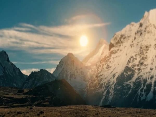
Above Kambachen, the world empties. The forest that accompanied you for five days from Taplejung ended two valleys ago. The scrub juniper that clung to the hillsides above Ghunsa disappeared an hour below. What remains is rock, ice, and the specific grey-brown barrenness of a glacial valley at 4,780 metres — a landscape stripped of everything that is not essential, reduced to its geological elements, and dominated by a mountain so massive that it creates its own horizon.
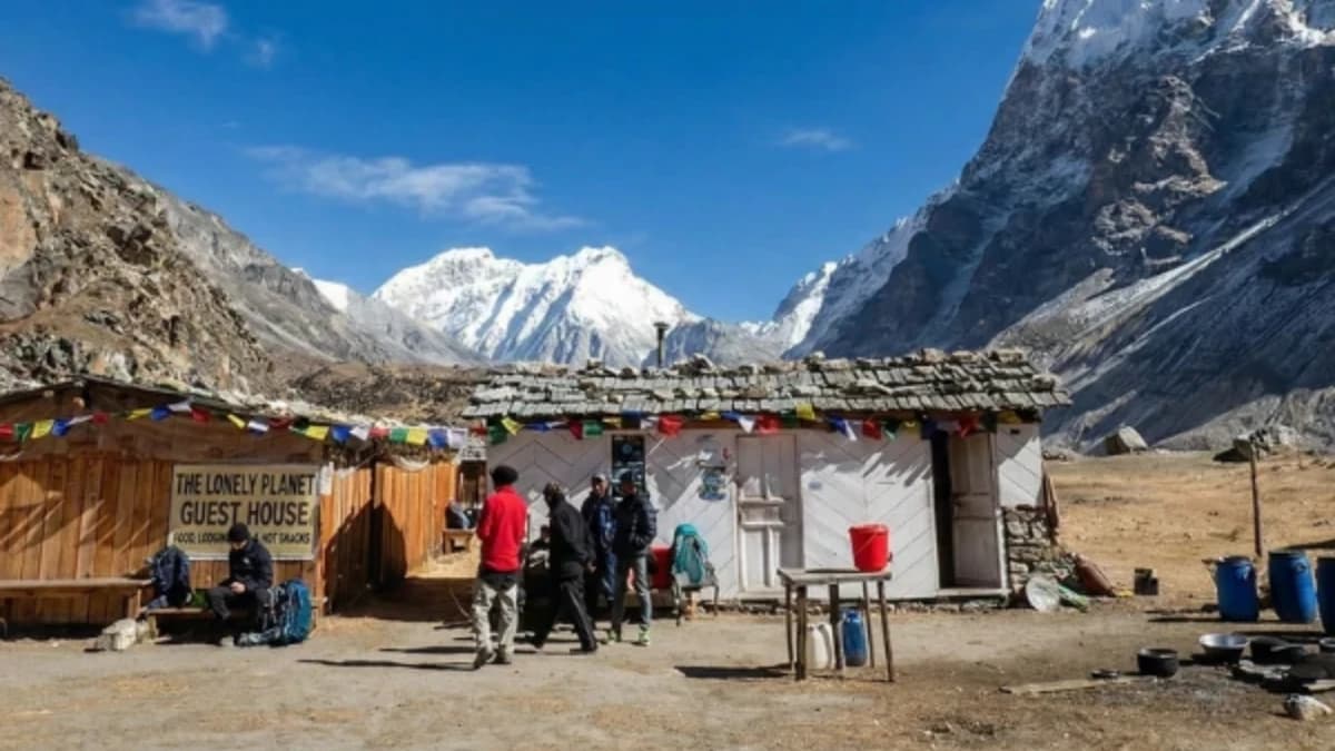
Lhonak sits at the head of the Kanchenjunga Glacier's northern moraine — a flat of rubble and frozen ground where three or four stone shelters provide the only accommodation between Kambachen (4,050 metres) and Pangpema (5,143 metres), the north base camp of the world's third highest mountain. The shelters are not teahouses in any meaningful sense. They are survival infrastructure — walls and a roof against wind that at this altitude carries the cold of the glacier above with an efficiency that makes exposed skin painful within minutes.
Lhonak is where the Kanchenjunga trek stops being a walk and becomes an expedition. Below Lhonak, the trail passes through villages. People live in those villages. Teahouses serve food that was grown somewhere nearby. Above Lhonak, there are no villages. No permanent habitation. No food that was not carried from days below. There is only the glacier, the moraine, and the mountain — Kanchenjunga's north face, rising three and a half thousand metres from base camp to summit in a wall of ice and rock that is one of the most imposing mountain faces on earth.
How Long Is the Walk from Kambachen to Lhonak?
The trail from Kambachen to Lhonak takes five to six hours and gains 730 metres. The walking is not technically difficult — no scrambling, no glacier crossing, no exposure, but the altitude makes every step deliberate. At 4,500 metres, you are breathing air that provides roughly fifty-five percent of sea-level oxygen. Your pace drops. Your heart rate rises. And the trail, which at lower altitudes you would walk without thinking, requires the specific, conscious, one-step-at-a-time attention that extreme altitude demands.
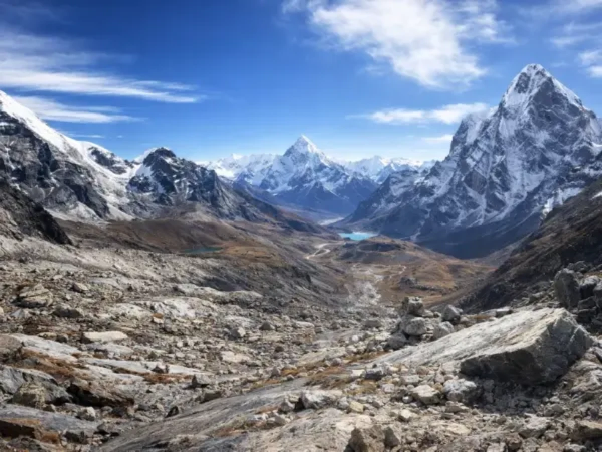
The landscape between Kambachen and Lhonak is glacial moraine, the debris deposited by the Kanchenjunga Glacier as it has retreated over centuries. The terrain is loose rock, boulders, and frozen ground that thaws in the midday sun and refreezes at night. The trail picks a route through this debris, following cairns that your guide knows and that a solo trekker (not that solo trekking is permitted) would struggle to follow. The river, the Ghunsa Khola, now reduced to a glacial stream, runs somewhere below the moraine, audible but often invisible beneath the rubble.
The peaks that surround the valley are unnamed, six and seven-thousanders that would be famous in any other mountain range but that here, in the shadow of Kanchenjunga, are footnotes. The walls of the valley are steep, glaciated, and active, the occasional distant rumble of rockfall or ice calving is the soundtrack of a landscape that is geologically alive, slowly but continuously reshaping itself under the forces of gravity, ice, and time.
Where Do You Sleep at Lhonak?
Lhonak has three or four stone shelters, some sources say two, some say five, depending on the year and the condition of the structures. The shelters are built from the same moraine rock that covers the valley floor, with tin or stone-slab roofs. Inside: a raised sleeping platform, sometimes a stove (fuel must be carried from below), and the specific spartan minimalism of a building that exists at 4,780 metres for the sole purpose of keeping its occupants alive overnight.
The food at Lhonak is whatever the cooking team carried from Kambachen or Ghunsa. On a well-organised trek, this means dal bhat, noodle soup, tea, and biscuits. On a less well-organised trek, it means whatever the porter could carry after the weight of tents, sleeping bags, and stove fuel was accounted for. The Kanchenjunga trek's remoteness means that food quality above Ghunsa is directly proportional to the quality of the trekking company, a well-provisioned team eats adequately at Lhonak; a poorly provisioned team does not.
The night at Lhonak is cold. Minus fifteen to minus twenty in October. The wind, which blows down from the glacier above with a constancy that the lower valleys dampen, is stronger at Lhonak than at any previous camp. The shelters provide wall and roof but not insulation, the interior temperature approximates the exterior temperature within an hour of the stove going out. Your sleeping bag, which should be rated to minus twenty for the Kanchenjunga trek, is tested to its limits at Lhonak.
Sleep is fragmented. The altitude produces periodic breathing that wakes you repeatedly. The cold seeps through the sleeping bag in the small hours. And the wind, constant, rushing, pressing against the shelter walls, creates a sound environment that is too loud for silence and too monotonous for distraction. You lie in the dark, breathing the thin air, and wait for morning.
What Is Above Lhonak at Kanchenjunga North Base Camp?
The walk from Lhonak to Pangpema (Kanchenjunga North Base Camp, 5,143 metres) takes three to four hours and gains 363 metres. The trail follows the glacier moraine north, crossing several ridges of rubble and descending to stream crossings before the final climb to the base camp viewpoint.
Pangpema is not a camp in the sense that EBC is a camp. There are no teahouses. No prayer flags (though some trekkers leave them). No flat area where dozens of trekkers gather. Pangpema is a point on the moraine, marked by cairns and the accumulated offerings of the few hundred trekkers who reach it each year, from which Kanchenjunga's north face is visible in its full, devastating scale.
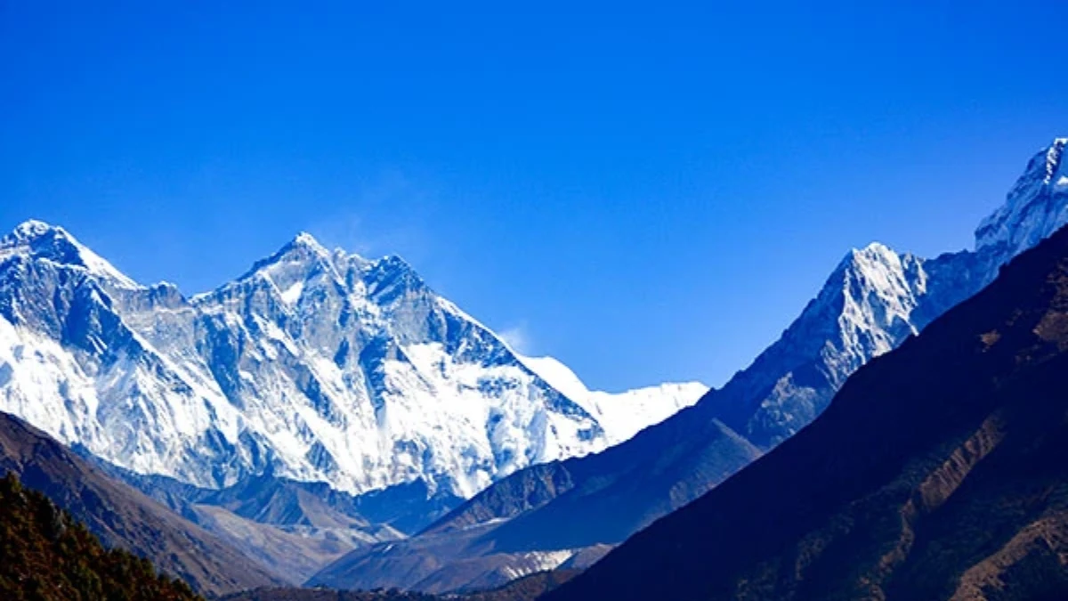
The north face. Three and a half thousand metres from base to summit. Ice walls, rock bands, hanging glaciers, and the summit pyramid of the world's third highest mountain, 8,586 metres, directly above you. The face has been climbed by a handful of expeditions, and from Pangpema the route is traceable: up the left side, across the upper snowfields, and along the summit ridge to the top that climbers, by tradition, leave untouched.
The experience of standing at Pangpema is different from standing at EBC or ABC. Those base camps receive thousands of visitors. Pangpema receives hundreds. The solitude is near-total, you may be the only trekking group there. The mountain is closer than Everest is from its base camp. And the scale, the vertical distance from where you stand to the summit, is greater than at any other base camp accessible by trekking in Nepal.
The Return
From Pangpema, you return to Lhonak (or directly to Kambachen, a long day). From Kambachen, the descent to Ghunsa, to the lower valley, and eventually to Taplejung takes four to five days. The descent is the Kanchenjunga trek's release, each day brings warmer air, thicker oxygen, denser vegetation, and the gradual return of the human world that the upper valley's barrenness erased.
Lhonak, in memory, becomes the pivot. The highest camp. The coldest night. The point where the trek reached its extreme, where the landscape was reduced to rock and ice and the body was reduced to breathing and walking and the mind was reduced to the single question that extreme altitude asks of everyone who enters it: can you continue?
At Lhonak, the answer was yes. And the descent, through the valleys, through the forest, through the villages, back to the road, carries that yes with it like a stone in the pocket, smooth and heavy and permanent. A yes earned at 4,780 metres in a wind-scoured shelter at the foot of the world's third highest mountain, in a valley that fewer than two thousand people visit each year, in a silence that the rest of the world does not know exists.
Lhonak is the final camp before Kanchenjunga North Base Camp on the Kanchenjunga Base Camp Trek.
Lhonak is the Kanchenjunga north base camp approach, and the glacier here is one of the most dramatic things on any trek in Nepal. The ice towers, the moraine, and the sheer wall of Kanchenjunga rising above — it is wild, remote, and humbling. Very few trekkers reach Lhonak. Those who do remember it for the rest of their lives.
Lhonak is on our Kanchenjunga Base Camp Trek.
WhatsApp:+977 9810351300
Email:[email protected]
Written by Shreejan Simkhada, CEO of The Everest Holiday and third-generation Himalayan guide. TAAN Member #1586.
Lhonak is the Kanchenjunga North acclimatisation village. Our Kanchenjunga Base Camp Trek (19 Days) is private (your group only, no strangers), 2026 dates open, From USD $2499. WhatsApp us for tailored 2026 dates and current departures.