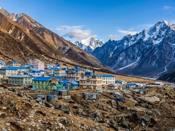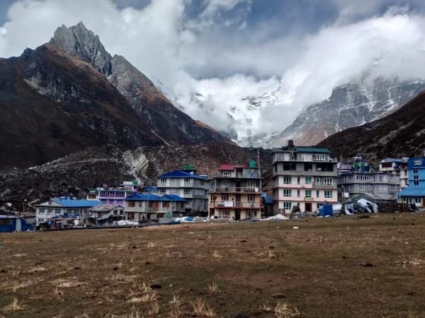
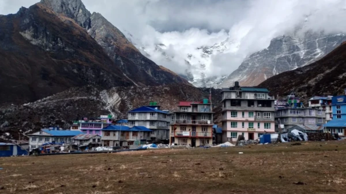
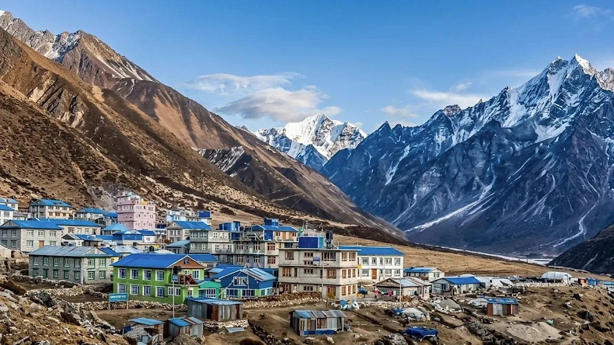
The climb starts at the edge of Kyanjin Gompa settlement, where a trail, more suggestion than path, angles up the hillside through juniper scrub and over frost-shattered rock. There is no signpost. No staircase. No handrail. Just a line of cairns ascending the ridge that rises directly south of the village, getting steeper with each hundred metres gained, until the trail becomes a scramble over loose rock at an altitude where scrambling requires twice the breath and three times the will that it demands at sea level.
You climb for two hours. The altitude gain is nine hundred metres, from 3,870 at Kyanjin Gompa to 4,773 at the summit. Nine hundred metres sounds modest. At this altitude, with sixty percent of sea-level oxygen and legs tired from three days of uphill walking, nine hundred metres feels like climbing Snowdon with a plastic bag over your head. Your guide walks ahead, steady, unhurried, turning back occasionally to check your pace and your colour, because the pace tells them about your fitness and the colour tells them about your oxygen.
And then you arrive. The ridge flattens to a rocky platform marked by prayer flags, and the world opens. Not gradually. All at once. Three hundred and sixty degrees of Himalayan panorama that trekkers who have seen Kala Patthar, Poon Hill, and Gokyo Ri consistently describe as the most underrated viewpoint in Nepal.
What Can You See from Kyanjin Ri?
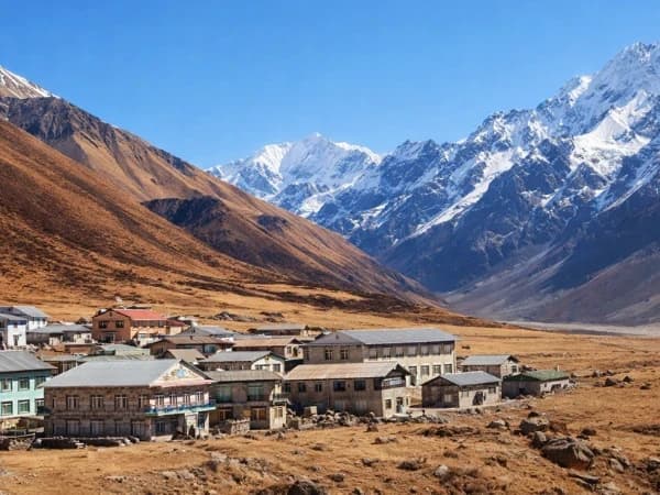
Langtang Lirung fills the north. Not as a distant peak but as a wall, seven thousand two hundred and twenty-seven metres of ice and rock, its face less than five kilometres away, close enough that individual seracs and crevasses are visible without binoculars. The mountain's north face has been attempted by some of the world's best alpinists, and from Kyanjin Ri you can see why, the face is steep, complex, and continuously active, with ice calving from hanging glaciers that sends sound across the valley like distant artillery.
The Langtang Glacier stretches east, a broad, debris-covered river of ice that flows from the base of the peaks toward the Tibetan border. The glacier's surface is grey rubble, the same moraine material every great Himalayan glacier grinds out, but from the elevation of Kyanjin Ri, the ice beneath is visible in the crevasses and at the glacier's edges, blue and ancient.
Gangchempo (6,387 metres) rises to the northeast, a sharp, triangular peak that catches the morning light earlier than the surrounding mountains and holds it with a luminosity that makes it appear self-lit. To the west, the Langtang Valley drops away in forested ridges toward Syabrubesi and the road to Kathmandu. And on clear days, October and November, primarily, the distant summits of the Annapurna and Manaslu ranges are visible on the western horizon, white points against the deep blue sky, eighty kilometres away but visible because the air at 4,773 metres holds almost no moisture or haze.
The panorama is not wider than Kala Patthar's (which spans more named peaks) or higher than Gokyo Ri's (which reaches 5,357 metres). What makes Kyanjin Ri special is proximity. Langtang Lirung is closer from Kyanjin Ri than Everest is from Kala Patthar. The glacier is directly below rather than kilometres away. And the sense of being inside the mountains, surrounded rather than overlooking, creates an intimacy that the wider panoramas of the Khumbu do not provide.
How long and hard is the Kyanjin Ri climb?
The trail from Kyanjin Gompa to Kyanjin Ri is not technically difficult. There is no scrambling that requires hands (though some trekkers use hands for balance on the steeper sections). There are no exposed ridges with drops on both sides. There is no rope, no harness, no equipment beyond trekking boots, trekking poles, and the determination to keep climbing when the altitude makes every step feel like the last one your body is willing to offer.
The first hour is the steepest, climbing through juniper scrub on a trail that switchbacks up the lower hillside. The gradient is consistent and demanding. At 4,200 metres, the scrub thins and the trail crosses bare rock and grass. The views begin to open, Langtang Lirung appearing over the ridge crest, the glacier becoming visible below. At 4,500 metres, the trail becomes less defined, following cairns across rocky terrain where the path is more intuited than seen. And at 4,773 metres, the summit ridge levels to a platform that holds prayer flags, a few cairns, and a view that makes the two hours of climbing disappear from memory.
The descent takes ninety minutes, faster because downhill is always faster, but requiring attention because the loose rock and steep gradient on tired legs and altitude-impaired balance create a fall risk that the ascent did not. Trekking poles are essential. Watch your footing. And resist the temptation to rush, the view will not change if you descend slowly, and a twisted ankle at 4,400 metres is a problem that the Langtang Valley's remote infrastructure makes more serious than it would be on the EBC trail.
When to Climb
Start early. Six or six-thirty in the morning. The reasons are practical: the morning air at altitude is stable and clear, the mountain views are unobstructed before afternoon cloud builds, and the temperature is tolerable (cold but manageable in layers) rather than the afternoon cold that descends when the sun drops behind the western ridge.
The summit light between seven and nine AM is the best, low angle, warm colour, the peaks catching light while the valleys remain in shadow. Photographers who climb Kyanjin Ri specifically for the light report that the golden hour at this altitude lasts longer than at sea level because the atmospheric scattering is different, the light is more direct, the colours more saturated, and the shadows more defined.
Allow four to five hours total, two up, thirty minutes at the summit, ninety minutes down. This fits comfortably into a rest day at Kyanjin Gompa, leaving the afternoon for the cheese factory, the monastery visit, and the specific post-climb contentment of sitting on a teahouse terrace with tea and yak cheese, looking at the mountain you just climbed above.
Should you climb Kyanjin Ri or Tserko Ri?
Kyanjin Gompa offers two summit options, and the comparison between them is the primary decision of the Langtang trek's rest day.
Kyanjin Ri (4,773m): Shorter (two hours up), closer views of Langtang Lirung, accessible to most fit trekkers, excellent as a half-day acclimatisation hike.
Tserko Ri (4,984m): Longer (three to four hours up), wider panorama including Shishapangma (8,027m, in Tibet), more demanding, reaching nearly 5,000 metres. Recommended for fit, well-acclimatised trekkers who want the altitude challenge.
If you have two nights at Kyanjin Gompa: do Kyanjin Ri on Day 1 and Tserko Ri on Day 2. The first climb provides acclimatisation for the second.
If you have one night: do Kyanjin Ri. It is the more accessible climb and provides ninety percent of the visual reward with sixty percent of the effort. Tserko Ri's additional two hundred metres of altitude and wider panorama are wonderful but not essential, Kyanjin Ri delivers the Langtang experience that the trek was designed to provide.
Is altitude sickness a risk when climbing Kyanjin Ri?
Kyanjin Ri at 4,773 metres is a serious altitude. Most trekkers reach it on Day 4 or Day 5 of the Langtang trek, having ascended from Syabrubesi (1,460 metres) over three to four days. The acclimatisation profile is adequate for the climb if you have followed a sensible itinerary, but "adequate" at altitude means "possible," not "easy."
Expect: headache (mild to moderate, responding to paracetamol). Breathlessness (significant on the steep sections, requiring frequent stops). Reduced coordination (the loose rock sections demand attention that altitude-impaired cognition makes harder to sustain). And fatigue (the summit feels disproportionately hard relative to the altitude gain because your body is operating at sixty percent oxygen).
If you experience severe headache, vomiting, confusion, or inability to walk in a straight line during the climb, descend immediately. Your guide will make this call if you do not, and the guide's call overrides your desire to continue. Kyanjin Ri will be there tomorrow. Your brain will not tolerate HACE today.
The Memory
The trekkers who climb Kyanjin Ri carry home a specific memory. Not of the widest panorama in Nepal (it is not). Not of the highest viewpoint (it is not). But of the most intimate, the view from 4,773 metres with Langtang Lirung so close you could throw a stone at it (you could not, it is five kilometres away, but the altitude and the scale conspire to make it feel closer). The glacier below. The peaks above. The prayer flags snapping in the wind that never stops at this altitude. And the specific, physical, altitude-earned knowledge that you climbed here, that your lungs and your legs and your determination carried you to a viewpoint that most people will never see, in a valley that most people will never visit, in a corner of the Himalaya that the guidebooks mention briefly and that the trekkers who find it remember forever.
Kyanjin Ri is not famous. It is not on any list. It is a rocky hill above a cheese factory in a valley that most trekkers have never heard of. And the view from its summit, Langtang Lirung filling the sky, the glacier spreading below, the prayer flags carrying mantras into air so thin it tastes like metal, is the view that proves, once and finally, that the best things in Nepal are not the most famous things. They are the things you find when you stop following the crowd and start following the trail.
Kyanjin Ri is a day hike from Kyanjin Gompa on the Langtang Trek. The sunrise view over the Langtang range from 4,773 metres is one of the best in the region.
Kyanjin Ri is the quick summit. Two to three hours up from Kyanjin Gompa, and you are standing at 4,773 metres looking at Langtang Lirung, Ganesh Himal, and the Tibetan plateau. If you only have one morning to climb something in Langtang, this is the one. Tserko Ri is higher and harder, but Kyanjin Ri gives you eighty percent of the view for half the effort.
We schedule the Kyanjin Ri climb on the rest day of our Langtang Valley Trek. Your guide goes with you.
WhatsApp:+977 9810351300
Email:[email protected]
Written by Shreejan Simkhada, CEO of The Everest Holiday and third-generation Himalayan guide. TAAN Member #1586.
Kyanjin Ri is the bonus viewpoint above Kyanjin Gompa. Our Langtang Trek (8 Days) is private (your group only, no strangers), 2026 dates open, From USD $619. WhatsApp us for tailored 2026 dates and current departures.