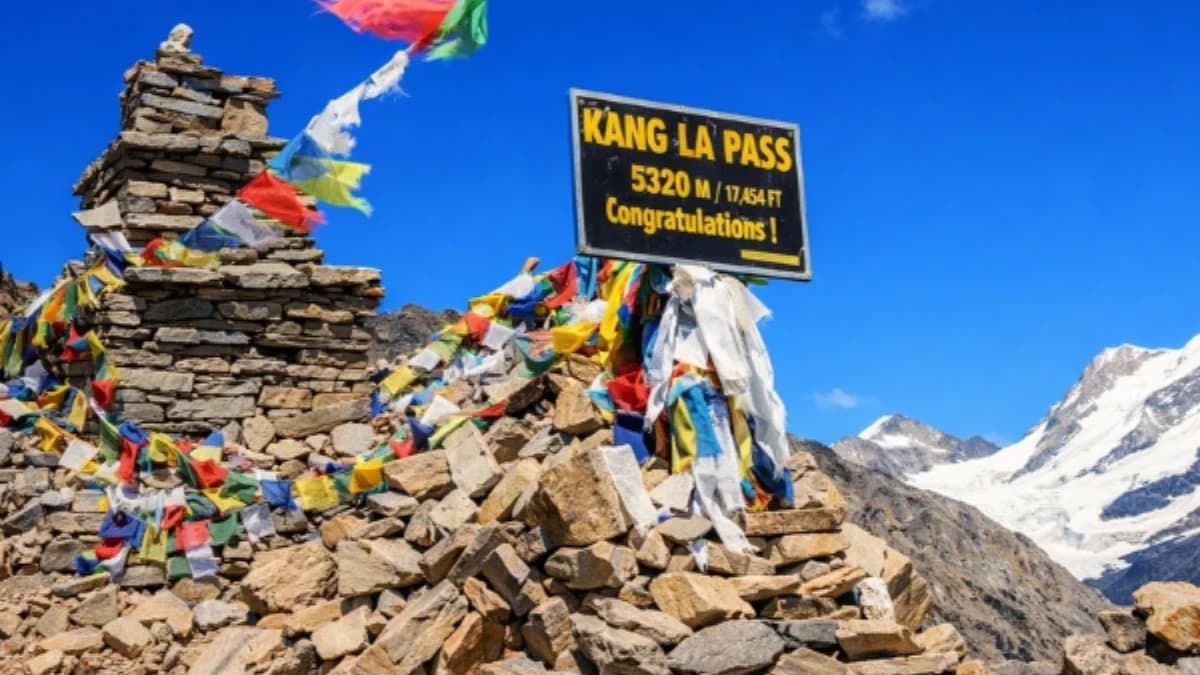
At 5,322 metres, the Kang La is not the highest pass in Nepal trekking. It is not the most famous. It is not the most photographed or the most written about. What the Kang La is, is the connection — the high ridge that links the restricted Nar Phu Valley to the Manaslu Circuit trail, creating a route that combines two of Nepal's most compelling restricted-area experiences in a single trek. And the crossing itself — a sustained day of effort at extreme altitude, over a pass that is narrower, steeper, and less forgiving than the better-known Thorong La or Larkya La — is a genuine mountaineering day disguised as a trekking day.
The Kang La sits between the Nar Phu Valley (a restricted valley accessible as a side trip from the Annapurna Circuit) and the Manaslu Conservation Area. Trekkers who cross it typically approach from the Nar Phu side — having spent three to four days exploring the hidden villages of Nar and Phu — and descend to the Manaslu Circuit trail at Koto or Dharapani. The crossing adds complexity, altitude, and the specific satisfaction of connecting two restricted areas via a pass that most Circuit trekkers never see.
The Approach from Nar Phu
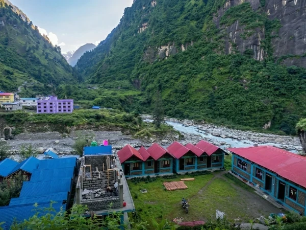
The Nar Phu Valley is itself a revelation. Accessed from the Annapurna Circuit trail at Koto (a short diversion from the main route), the valley runs north toward the Tibetan border through a landscape of desert canyons, Buddhist monasteries, and stone villages perched on cliff faces above the valley floor. The villages of Nar (4,110 metres) and Phu (4,080 metres) are among the most culturally intact Tibetan-heritage settlements in Nepal, places where the architecture, the religion, and the daily rhythms of life have changed less in five centuries than most villages change in five decades.
The restricted area permit for Nar Phu (approximately ninety dollars for the first week) and the minimum group requirement of two trekkers with a licensed guide keep visitor numbers low, perhaps a thousand trekkers per year. The result is villages that feel genuinely remote, trails that feel genuinely yours, and a cultural immersion that the busier sections of the Annapurna Circuit cannot provide.
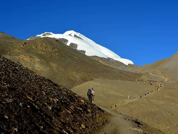
From Phu village, the trail to the Kang La climbs north and east, gaining altitude steadily through alpine meadow and moraine terrain. The high camp before the pass is typically at approximately 4,800-5,000 metres, a cold, exposed bivouac on rocky ground with the pass visible above as a notch in the ridge. The night before the crossing is cold (minus ten to minus fifteen), sleepless (altitude and anticipation conspire against rest), and dark (the stars at 5,000 metres, far from any light source, are a galaxy visible to the naked eye that lower altitudes only suggest).
What Is Crossing Kang La Pass Like?
The crossing day starts before dawn, three or four in the morning, headlamps, every layer, and the slow crunch of frozen scree underfoot. The climb from high camp to the pass gains approximately three hundred metres over two to three hours. The gradient is steep, steeper than Thorong La's approach, comparable to Larkya La's final section. The footing is loose rock and, in the upper section, snow or ice that may require microspikes or crampons depending on conditions and season.
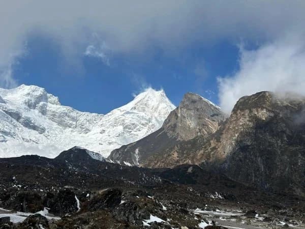
The pass at 5,322 metres is narrow. Not the broad, windswept saddle of Thorong La but a genuine col, a notch in the ridge with drops on both sides and prayer flags snapping in wind that funnels through the gap. The views from the pass, if the weather cooperates, are exceptional: the Annapurna range to the south, the peaks of the Manaslu region to the east, and the brown, Tibetan-influenced landscape of the Nar Phu Valley falling away behind you to the north.
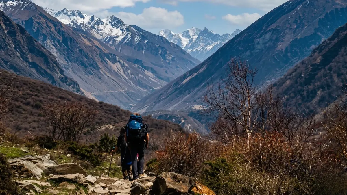
The descent on the eastern side is steep and technical, loose scree, boulder fields, and sections where the trail is more suggestion than path. The descent drops approximately 1,300 metres from the pass to the Manaslu Circuit trail at Koto, a long, demanding afternoon that tests knees, concentration, and the specific endurance that altitude depletes but descent demands.
Who Crosses the Kang La
The Kang La crossing is for experienced trekkers who want to connect the Nar Phu Valley with the Manaslu Circuit, creating a route that combines the Annapurna Circuit's eastern approach, the Nar Phu cultural immersion, the Kang La alpine crossing, and the Manaslu Circuit's upper section in a single three-to-four-week trek. This combined route is one of the most complete trekking experiences available in Nepal, it covers more cultural diversity, more altitude range, and more landscape variation than any single-circuit trek.
The crossing requires: fitness for a sustained day at 5,000+ metres, basic comfort with steep terrain (no ropes or technical climbing, but steep enough that a fall would be serious), proper gear (crampons or microspikes, trekking poles, full cold-weather kit), and a guide who has crossed the Kang La before and who can read the conditions, snow, ice, visibility, with the judgment that safe passage requires.
The Kang La is weather-dependent. Cloud, snow, or high wind on the pass make the crossing dangerous, the narrow col, the steep approaches, and the exposed ridge demand visibility and stable conditions. Your guide decides whether to cross, and if the decision is to wait, spending an extra day at high camp in the cold, the decision is the right one. The pass will be there tomorrow. Your safety is today's concern.
What Do You Need to Know About Kang La Pass?
Altitude: 5,322 metres. Duration of crossing day: eight to twelve hours. Approach from Phu: one to two days to high camp. Descent to Koto: four to six hours from the pass.
Permits: Nar Phu restricted area permit (approximately ninety dollars for the first week) plus ACAP permit (thirty-four dollars) for the Annapurna side. Manaslu Conservation Area permit (one hundred dollars per week peak season) if continuing on the Manaslu Circuit.
Season: October-November (best, least snow on the pass, clearest conditions). March-May (possible but more snow, longer days help). December-February (too much snow, pass likely closed). June-September (monsoon, not recommended).
Gear: trekking boots compatible with crampons, microspikes or light crampons, trekking poles, sleeping bag rated to minus twenty, all warm layers (down jacket, balaclava, insulated gloves), headlamp with fresh batteries, two litres of water in insulated bottles.
The Connection
The Kang La is a connection. Between valleys. Between restricted areas. Between the Annapurna and Manaslu regions. Between the cultural immersion of Nar Phu and the mountain adventure of the Manaslu Circuit. And between the trekker you were when you entered the Nar Phu Valley, excited, curious, eager for the hidden villages, and the trekker you are when you descend from the pass to the Manaslu trail, tired, altitude-tested, carrying the specific knowledge that you crossed a five-thousand-metre pass on your own feet and that the world on the other side is different from the world you left.
Every pass in the Himalaya is a connection. Thorong La connects east and west on the Annapurna Circuit. Larkya La connects east and west on the Manaslu Circuit. Cho La connects EBC and Gokyo. The Kang La connects two restricted areas, two valleys that most trekkers visit separately, if at all, through a ridge at 5,322 metres that only a few hundred trekkers cross each year.
The few hundred who cross carry home something that the many thousands who walk the standard circuits do not: the knowledge that the Himalaya contains connections that are not on the standard maps, that the restricted valleys have doors that open onto other restricted valleys, and that the trekker who is willing to climb higher and walk further than the itinerary requires discovers a Nepal that the itinerary, by definition, cannot contain.
Kang La Pass connects the Nar Phu Valley to the Manaslu Circuit. Trek it on the Manaslu with Nar Phu Valley Trek (21 days).
Kang La Pass at 5,322 metres connects the Nar Phu valley to the Manaslu Circuit. It is one of the most technical passes in Nepal — crampons, rope, and a guide who has crossed it before are all mandatory. The reward is a route that almost nobody takes, through terrain that feels genuinely unexplored.
Kang La is on our Nar Phu Valley Trek. We only send experienced guides on this crossing.
WhatsApp:+977 9810351300
Email:[email protected]
Written by Shreejan Simkhada, CEO of The Everest Holiday and third-generation Himalayan guide. TAAN Member #1586.
Kang La connects Nar Phu to Manaslu Circuit. Our Manaslu with Nar Phu Valley Trek (21 Days) is private (your group only, no strangers), 2026 dates open, From USD $1438. WhatsApp us for tailored 2026 dates and current departures.