

Last updated 2 October 2026. The distances below come from our live 12-day itinerary. The route itself is open but disrupted this autumn, as last reported on 28 September, and the status section is the one to read before you plan.
The short answer: on our 12-day Manaslu Circuit you walk about 124 km over nine walking days, plus a 160 km drive at the start and a drive out at the end. The whole route from Arughat to Besisahar is 177 km, and the gap is explained below. The defining day is day 10, when you climb about 680 m to the Larkya La at 5,160 m and then descend about 1,440 m to Bhimtang in a single day of 24.7 km.
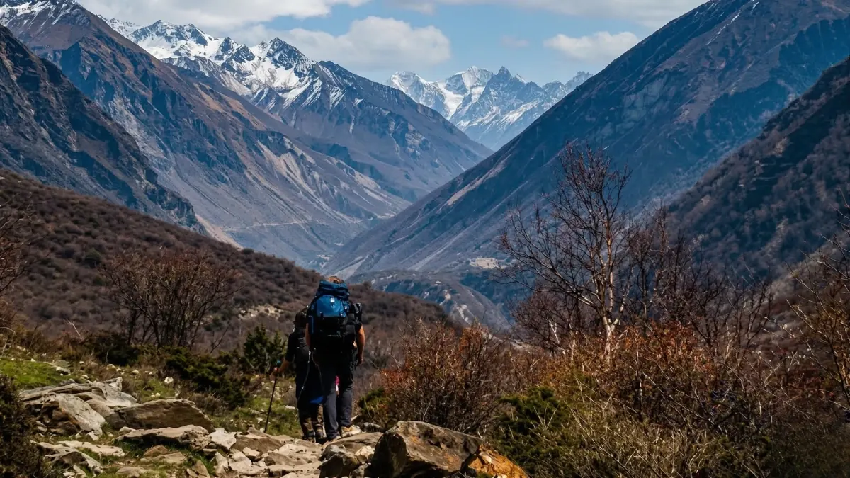
How far do you walk each day on the Manaslu Circuit?
This is the day-by-day plan from our live itinerary. Distances, altitudes and times are as printed on that itinerary, so treat them as approximate. Day 7 is a rest day in Samagaun, with no distance.
| Day | Route | Sleep | Distance | Time |
|---|---|---|---|---|
| 1 | Drive Kathmandu to Machha Khola | 890 m | 160 km by road | 8 to 10 hours |
| 2 | Machha Khola to Jagat | 1,400 m | 22 km | 5 to 6 hours |
| 3 | Jagat to Deng | 1,860 m | 6.5 km (as printed) | 6 to 7 hours |
| 4 | Deng to Namrung | 2,630 m | 6.5 km (as printed) | 6 to 7 hours |
| 5 | Namrung to Shyala | 3,500 m | 14 km | 7 hours |
| 6 | Shyala to Samagaun | 3,530 m | 10 km | 6 to 7 hours |
| 7 | Acclimatisation in Samagaun | 3,530 m | Rest day | |
| 8 | Samagaun to Samdo | 3,875 m | 8.2 km | 3 to 4 hours |
| 9 | Samdo to Dharamsala | 4,480 m | 11.7 km | 3 to 4 hours |
| 10 | Dharamsala over the Larkya La (5,160 m) to Bhimtang | 3,720 m | 24.7 km | 7 to 8 hours |
| 11 | Bhimtang to Dharapani | 1,910 m | 20 km | 7 to 8 hours |
| 12 | Drive Dharapani to Besisahar, then to Kathmandu | By road | The itinerary gives 4 to 5 hours for the first leg |
One honest note on the table. Days 3 and 4 both show 6.5 km in our itinerary, while both are given as 6 to 7 hours of walking. Two equal short distances for two full days looks like a printing error to me, and I have flagged it for our guides to measure. Until I have a measured figure, do not rely on either number. The total of about 124 km therefore carries a margin of error, most of it from those two days.
Why is the total 124 km here and 177 km elsewhere?
The Manaslu route is described as 177 km, and the circuit usually starts in Arughat Bazaar and ends in Besisahar. Our itinerary starts walking at Machha Khola, after a 160 km drive, and finishes the walk at Dharapani. Adding the walking days 2 to 11 gives 123.6 km, with the walking beginning later in the valley and ending before Besisahar. That is my reading of why the figures differ, and I have not surveyed the trail. Both are fair descriptions of "the Manaslu Circuit", which is why two operators can quote very different distances. Always ask where the walking starts and ends.
Our nine walking days average about 13.7 km, but the average hides the spread: the longest days are the 22 km on day 2, the 24.7 km on day 10 and the 20 km on day 11.
Which day is the hardest?
Day 10. You leave Dharamsala at 4,480 m in the dark, climb about 680 m to the Larkya La at 5,160 m, and then descend about 1,440 m to Bhimtang at 3,720 m, in 24.7 km and 7 to 8 hours on our itinerary. The Larkya La is one of the longest passes in the Himalaya. The altitude figure differs between sources: our itinerary uses 5,160 m, while some lists give 5,106 m. I use 5,160 m throughout. The difference is a matter of survey method and does not change the day.
The second hardest day is day 11. It is 20 km and about 1,810 m of descent to Dharapani, and it is a day that tires knees rather than lungs. Poles help.
How much do you climb each day?
| Day | Altitude change on our itinerary |
|---|---|
| 2 | About 530 m up |
| 3 | About 460 m up |
| 4 | About 770 m up |
| 5 | About 840 m up |
| 6 | About 30 m up |
| 8 | About 345 m up |
| 9 | About 605 m up |
| 10 | About 680 m up, about 1,440 m down |
| 11 | About 1,810 m down |
The itinerary also records these day by day as "total elevation change". The big climbing days come in the middle of the trek, on days 4 and 5, and the pace slows on purpose from Samagaun, where the rest day is the one that matters. Do not skip it.
How does the trek compare with our other long circuits?
These are our own itineraries, so the numbers are comparable with each other. They are not a ranking of difficulty.
| Trek | Walking distance | Walking days | Highest point |
|---|---|---|---|
| Manaslu Circuit (12 days) | About 124 km | 9 | Larkya La 5,160 m |
| Annapurna Circuit (12 days) | About 106 km | 8 | Thorong La 5,416 m |
The two circuits are close in length, and the Manaslu Circuit has the longer walk. For the Annapurna side see the teahouse guide and for the shorter alternatives see the ABC distance guide.
Is the Manaslu Circuit open this autumn?
It is passable, with disruption, as last reported on 28 September, with nothing newer as at 2 October. The Gorkha district administration closed the route on 6 September after a flash flood at Namrung and it reopened on 8 September on a locally built bypass, which uses temporary wooden bridges. On 26 September a landslide struck above Samagaun, and bad weather grounded rescue helicopters for about four days. My earlier posts, the closure and reopening and Trekking Nepal in November 2026, carry the detail. Namrung is our night 4, so the bypass matters to this itinerary.
We confirm the route 48 hours before departure, and I would want a route check a week before for a start in November. If it is not safe we find you an alternative route and tell you before you travel. In December I do not recommend the pass at all (see trekking in Nepal in December 2026).
What permits do you need, and what do they cost?
These are the figures from the Department of Immigration and the Nepal Tourism Board pages, as logged in our permit fee file. A restricted-area permit does not replace the TIMS card, so we arrange both.
- Manaslu restricted-area permit: USD 100 for the first week from September to November (USD 75 from December to August), plus USD 15 per day (USD 10 from December to August).
- Manaslu Conservation Area entry: NPR 3,000.
- TIMS card: NPR 2,000 for foreigners, issued through us.
You must trek with a licensed guide through a registered agency. Solo trekkers have been able to apply since the rule change on 22 March 2026, with an agency and a licensed guide, and we have filed solo permits since then. Permits need 48 hours of government working days, so send us your passport details early. The permits guide carries the full list, and fees change.
What does it cost, and who carries what?
The 12-day circuit is from US$799 Budget, US$1,599 Standard and US$2,099 Luxury for a group of one to four. On Budget you carry your own bag. On Standard you have all meals and one porter for every two trekkers, so a solo Standard trekker has no porter and the guide carries up to 10 kg. On Luxury you have a dedicated porter and all meals with fruit and nuts. Kathmandu hotels are not included on any trek tier. The 10 per cent deposit holds your dates and the balance goes in Kathmandu, with a 3.5 per cent charge if you pay the balance by card. If you must move your dates, you can reschedule free with at least 72 hours' notice, or seven days for restricted areas, to any date within one year. The deposit itself is not refunded if you cancel. If we cannot run the trip, we refund what you paid less taxes, bank and card charges and money already spent on permits or flights. Insurance must be bought at home, and it should cover helicopter evacuation.
Who should not do the Manaslu Circuit?
Anyone who has never slept above 3,500 m and cannot add a spare day. Anyone who dislikes long days: two of the nine walking days are over 20 km on our itinerary and a third is 20 km. Anyone who needs a fixed start date this autumn, given the road and bridge position above. For a gentler Himalayan trek, the Mardi Himal trek or Poon Hill start from Pokhara and sit far lower.
Tell me your dates on WhatsApp, +977 9810351300, or email [email protected].
Sources: Department of Immigration and Nepal Tourism Board (permit fees). Route status as at 2 October 2026, from Gorkha district administration notices. The 123.6 km total is the sum of the daily distances on days 2 to 11, and the day 10 climb and descent are worked out from the altitudes in our itinerary. The 177 km distance and the Larkya La 5,106 m figure are published figures for the wider route.
About The Everest Holiday
We are a family company in Kathmandu, three generations of Himalayan guides, registered in 2016 and a member of the Trekking Agencies' Association of Nepal, number 1586. When you book with us you deal with the family, not a call centre.
Every booking helps fund our Nagarjun Learning Center. We fully run the centre at Saldum, where 70 children learn with a teacher I pay for personally.
Written by Shreejan Simkhada, CEO of The Everest Holiday and third-generation Himalayan guide. TAAN Member #1586.
Manaslu needs a route check before you fly. Our Manaslu Circuit Trek (12 Days) is private (your group only, no strangers), from USD $799. WhatsApp us for dates and the current route position.

 Chat with Shreejan