There is a photograph from the nineteen-eighties—black and white, slightly blurred—of a trail through the lower Marsyangdi valley that is nothing but packed earth and stone between two walls of green. No vehicles. No power lines. No sound except river water and wind and the footsteps of trekkers who had come from every corner of the world to walk what many called the greatest trek on earth.
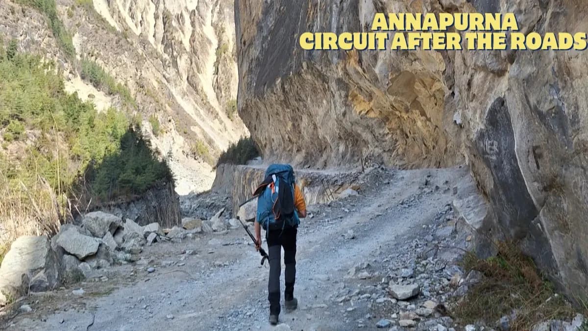
That trail is now a road. The 2026 Annapurna Circuit discussion differs from the one held 20 years ago, but not all aspects are the same. Road construction through the Marsyangdi valley on the eastern approach and the Kali Gandaki valley on the western descent has replaced several days of the original trail with gravel jeep tracks shared by motorbikes, supply trucks, and dust.
The internet is full of trekkers mourning the loss. Forums overflow with posts declaring the Circuit ruined, finished, and not worth doing anymore. And from a certain angle—the angle of nostalgia, the angle of those who walked it before the roads—the grief is understandable.
But from the angle of someone who guides this route every season and walks it with fresh eyes alongside people who are seeing it for the first time, the Annapurna Circuit in 2026 is still extraordinary. Not despite the changes. Alongside them.
How has road construction affected the Annapurna Circuit trek?
A road now runs from Besisahar to Manang on the eastern side of the Circuit. In the early years of the trek's fame, this section was five to six days of walking through subtropical forest, terraced hillside, and river-carved gorges. Trekkers today can—and many do, drive this section in a day, starting the walk at Chame or Dharapani instead of Besisahar.
On the western side, a road connects Jomsom to Muktinath and continues south to Beni and eventually Pokhara. The traditional three-day descent from Muktinath through Kagbeni, Tukuche, and Tatopani is now a jeep track. Most trekkers today fly from Jomsom to Pokhara, skipping the western descent entirely.
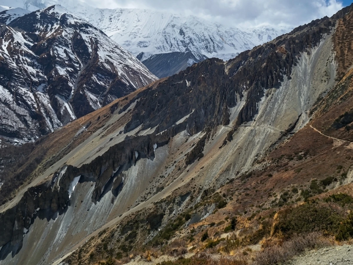
Between these two road sections sits the heart of the Circuit, Manang Valley, Thorong La Pass, and the high arid plateau above Muktinath, and this section is entirely unchanged. No road. No vehicles. No possibility of a road, because the terrain is too extreme and the altitude too high for anything but feet and yak hooves.
Which sections of the Annapurna Circuit have no roads?
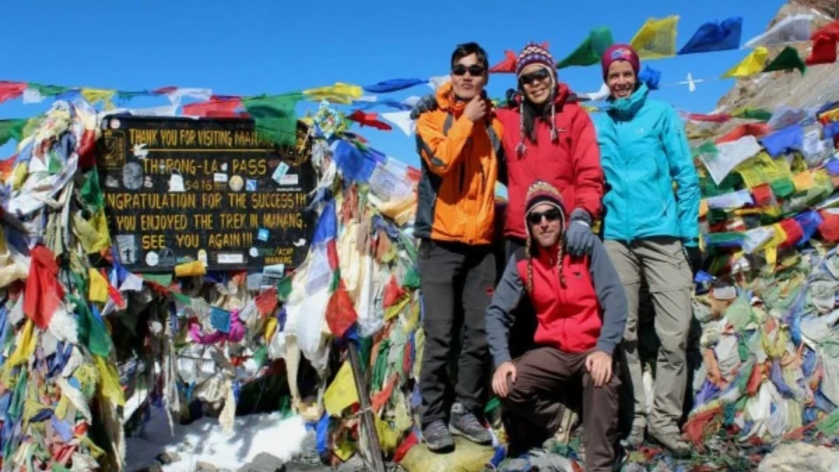
Thorong La Pass at 5,416 metres. The pre-dawn climb in darkness. The prayer flags at the summit snap in the wind that bites through every layer. The descent, a staggering sixteen hundred metres in a single day, culminates in the medieval village of Muktinath. This is the same experience as in 1980, and it will be the same in 2080. The mountain isn't concerned about roads in the valley below.
The Manang Valley above the road. Apple orchards are heavy with fruit in autumn. Tibetan Buddhist monasteries cling to cliffs above the river. The ice lake at Gangapurna reflects Annapurna III in water so still that it looks like mercury. Elderly monks who have never left the valley turn prayer wheels.
The high route between Pisang and Manang through Ngawal, a trail that takes you above the road through open alpine meadows with views of the entire Annapurna range. This route existed before the road and continues to thrive because of the road, trekkers who drive past the lower valley create space for those who choose the quieter, higher, more beautiful path.
Kagbeni, the medieval fortress town where the Annapurna Circuit meets the entrance to Upper Mustang. Narrow alleys, crumbling walls, and a monastery where monks debate in a courtyard surrounded by five-hundred-year-old architecture. The road passes below the town. You walk above it, through it, as trekkers always have.
How do trekking companies redesign the Annapurna Circuit itinerary to avoid roads?
The 2026 Annapurna Circuit is not the same as the 1996 one, but it can be just as enjoyable if the itinerary is designed with knowledge of what to skip and what to savor.
Drive from Kathmandu to Chame or Dharapani. By doing this, you completely bypass the road sections, four to five days of once-beautiful walking now shared with jeep traffic. Starting at Chame puts you at the edge of the Manang Valley, where the road ends and the real trekking begins.
Take the high route through Ngawal instead of the road through lower Pisang. This adds half a day, but the views from 3,657 metres, with Annapurna II and Annapurna IV dominating the skyline, make it one of the finest sections of the entire Circuit.
Add Tilicho Lake as a side trip. The world's highest lake, at 4,919 metres, is accessible via a full-day detour from Manang. This extension did not exist on the original Circuit itinerary but has become one of the Circuit's most spectacular additions, a high, cold, astonishing body of water surrounded by ice and rock that relatively few trekkers reach.
Cross Thorong La as always, there is no shortcut and no alternative to walking over the highest trekking pass in the world.
Fly from Jomsom to Pokhara instead of walking the western road descent. The flight is twenty-five minutes of spectacular aerial scenery over the Kali Gandaki gorge, the deepest gorge on earth, flanked by Annapurna and Dhaulagiri.
Is the Annapurna Circuit still worth it in 2026?
Is it still worth doing?
Yes. Without qualification, without nostalgia, without comparing it to a version of the trek that no longer exists. The Annapurna Circuit in 2026, properly designed, takes you from Kathmandu to 5,416 metres and back through a landscape that changes from jungle to desert in less than two weeks. No other trek on earth offers this range of geography, culture, and altitude in such a short distance.
The trekkers who are disappointed are the ones who expected 1985 and found 2026. The trekkers who are moved, challenged, and transformed are the ones who arrived without expectations and let the mountains show them what they have to offer today, which is still, by any honest measure, more than almost anywhere else on the planet.
Despite road construction, the Annapurna Circuit remains one of Nepal's great treks. See our Annapurna Circuit Trek for the current itinerary that avoids the worst road sections.
The road construction on the Annapurna Circuit is real, and it changes the trek every year. Some sections that were trails in 2020 are now jeep roads. But the trek is not ruined — the high sections from Manang to Muktinath via Thorong La are untouched and will stay that way because roads cannot be built at 5,000 metres. The circuit is evolving, not dying.
Our Annapurna Circuit Trek adapts the itinerary each season based on current road conditions.
WhatsApp:+977 9810351300
Email:[email protected]
Written by Shreejan Simkhada, CEO of The Everest Holiday and third-generation Himalayan guide. TAAN Member #1586.
AC road construction 2026 — we route around it. Our Annapurna Circuit Trek (12 Days) is private (your group only, no strangers), 2026 dates open, From USD $720. WhatsApp us for tailored 2026 dates and current departures.