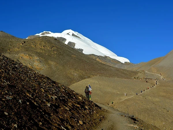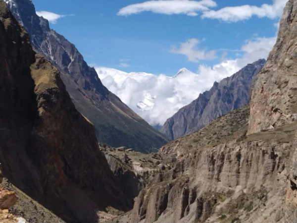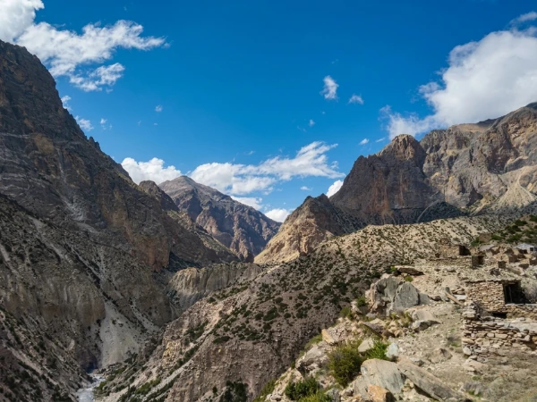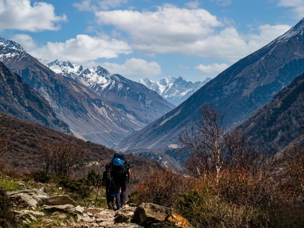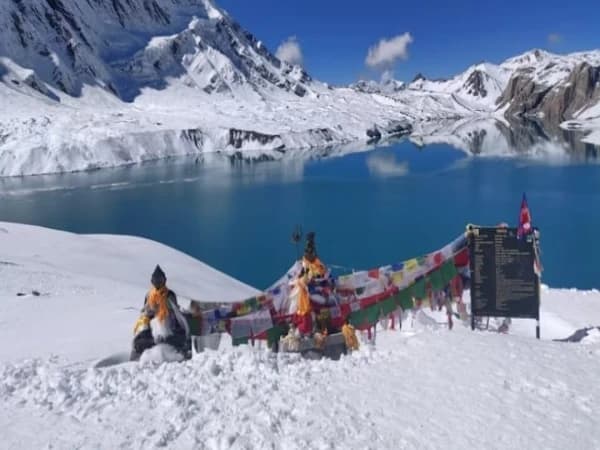
The second pass is harder than the first. You crossed Larkya La three days ago, 5,160 metres of frozen scree and glacier with Manaslu's south face so close you could count the crevasses. That felt like the summit of your trek. It was not. Now you are climbing Kang La at 5,306 metres, higher than anything on the Manaslu Circuit, and the wind is tearing across the col with enough force to stagger you sideways. Your guide ropes the steep section. You plant your trekking poles and push. And then you crest the pass and the Nar Phu Valley opens below you: a vast, arid terrain of red rock and golden scrub that looks more like Ladakh or Mustang than Nepal. Prayer flags snap overhead. A herd of blue sheep watches from a ridge. You have just entered one of the most remote inhabited valleys in the entire Himalaya, and there is not another trekker in sight.
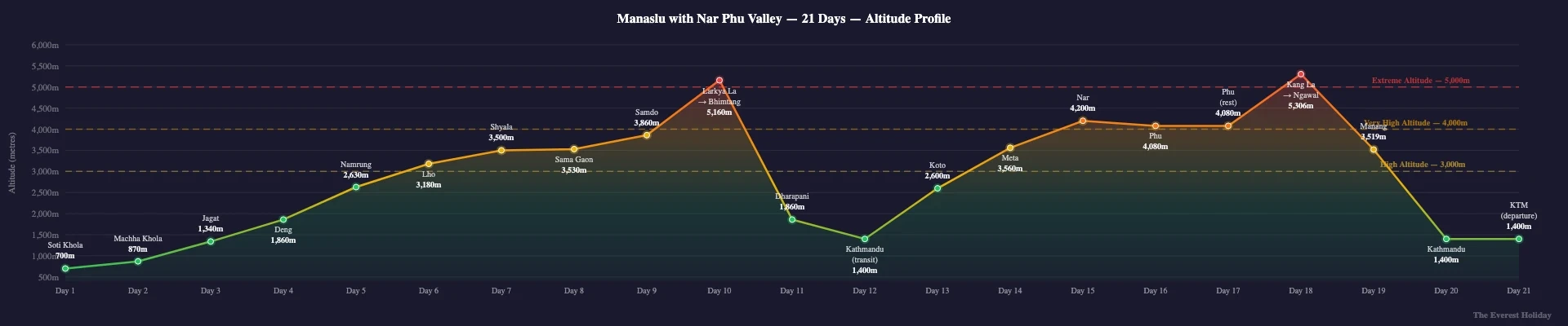
The 21-day Manaslu + Nar Phu Valley Trek is the most comprehensive restricted-area itinerary in Nepal. It combines the full Manaslu Circuit (following the Budhi Gandaki river through Soti Khola, Jagat, Namrung, Shyala, Sama Gaon, Samdo and over Larkya La) with a detour into the Nar Phu Valley, accessed via Kang La Pass (5,306m / 17,408ft). Two restricted areas. Two high passes above 5,000 metres. Three weeks of walking through landscapes and cultures that most trekkers will never see. It is designed by Shreejan Simkhada for experienced Himalayan trekkers who have done the standard circuits and want something that tests them in every way.
What Makes This Trek Special
- Cross TWO high passes above 5,000 metres: Larkya La (5,160m / 16,929ft) on the Manaslu Circuit and Kang La (5,306m / 17,408ft) connecting to the Nar Phu Valley, the highest trekking pass in this region
- Enter the Nar Phu Valley, one of Nepal's most remote restricted areas, where the semi-arid terrain resembles the Tibetan Plateau and the Lo-Pa people have maintained their Tibetan Buddhist traditions in near-total isolation
- Trek through TWO restricted areas (Manaslu and Nar Phu), each requiring special permits and each offering a completely different cultural and geographic experience
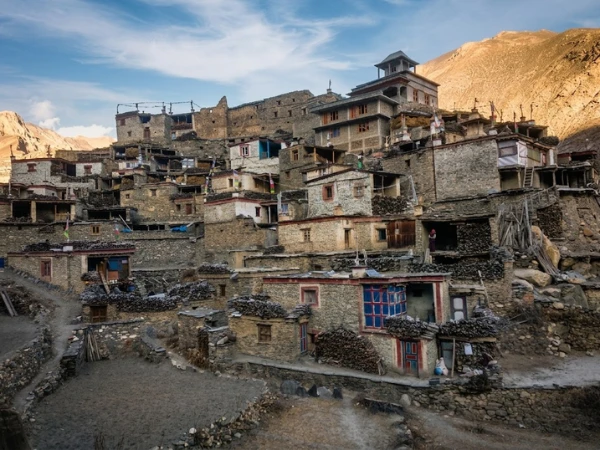
- Visit Nar Village (4,110m) and Nar Phedi Monastery, perched on a cliff above the valley where monks still perform daily pujas and the gompa's murals have survived centuries of wind and snow
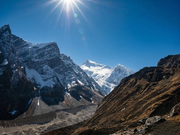
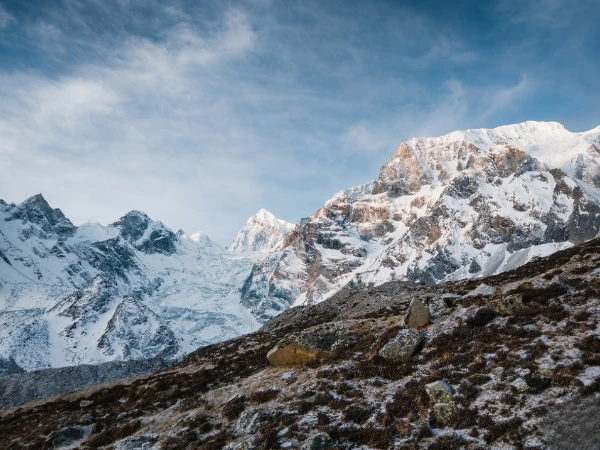
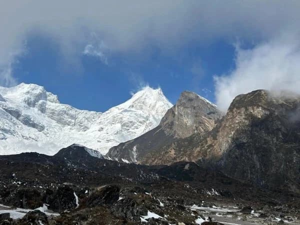
- Trek beneath the massive south face of Manaslu (8,163m) from Sama Gaon, close enough to hear the ice calving from hanging glaciers, before pushing over Larkya La at dawn
- Walk through Bhimtang's alpine meadows after the Larkya La crossing, then continue through Ngawal and other Annapurna Conservation Area villages as you complete the Nar Phu section
- Complete the longest and most challenging trek in the Manaslu region: 21 days of walking through subtropical gorges, Tibetan Buddhist villages, glacial moraines, and high-altitude desert, with two pass crossings that test every skill you have developed as a Himalayan trekker
21-Day Manaslu + Nar Phu Valley Trek Overview
Twenty-one days. Two restricted areas. Two high passes. This is the expedition-grade trek for trekkers who have done Everest Base Camp, the Annapurna Circuit, or the standard Manaslu Circuit and want something that pushes them further. The route combines Nepal's two most remote restricted valleys into a single journey that covers more cultural and geographic ground than any other trekking itinerary in the country.
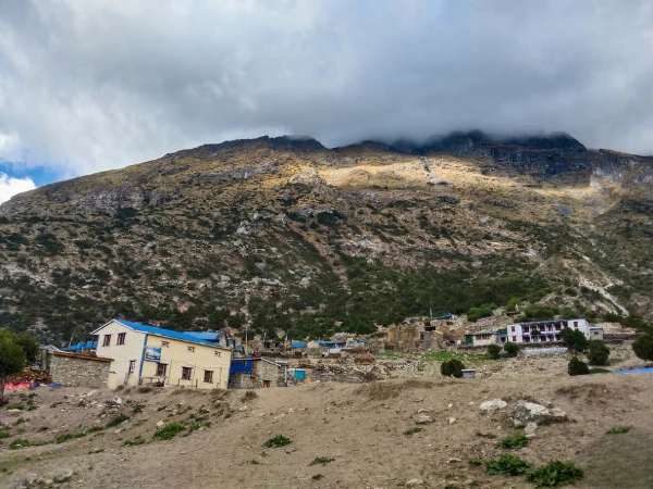
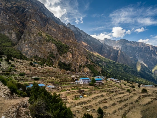
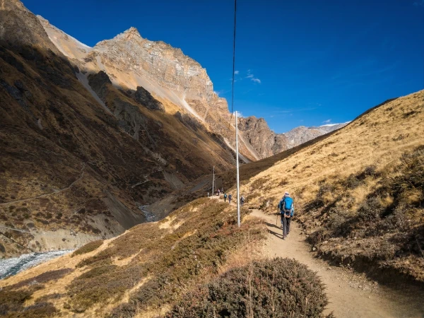
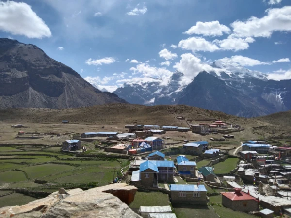
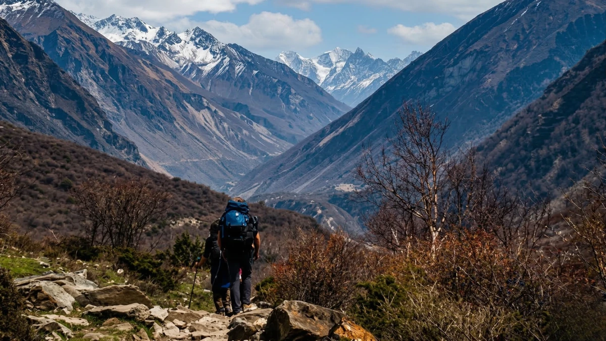
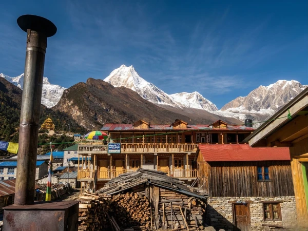
The first section follows the classic Manaslu Circuit: a drive from Kathmandu to Soti Khola, then walking up the Budhi Gandaki gorge through Jagat, Namrung, Shyala, Sama Gaon and Samdo. You spend time acclimatising beneath Manaslu's south face, hiking to Birendra Tal and exploring the Tibetan border settlements. The culture here is Nubri, with Tibetan Buddhist gompas, mani walls and prayer wheels at every turn. The Larkya La crossing (5,160m) comes next: a long, cold day that starts before dawn and ends in the alpine meadows of Bhimtang.
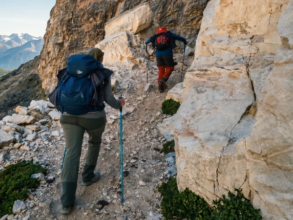
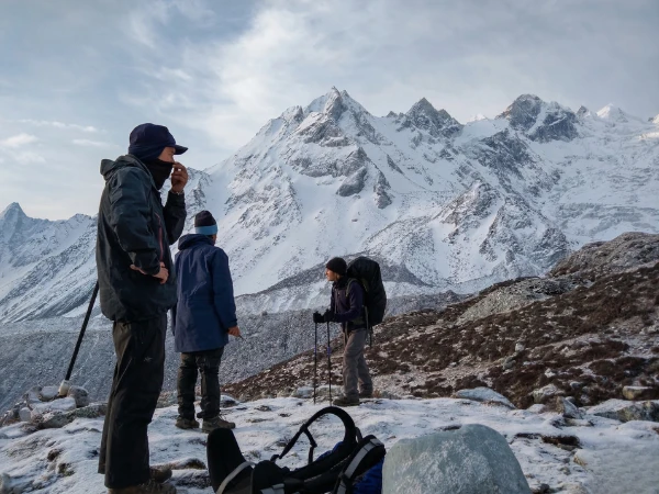
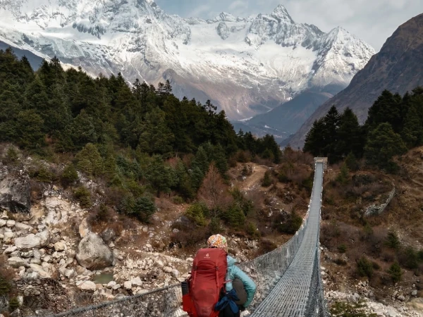
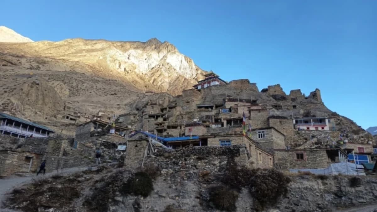
From Bhimtang, instead of descending to Dharapani and heading home, you continue to the Kang La base. The Kang La crossing (5,306m / 17,408ft) is the crux of this trek: steeper and more technical than Larkya La, with sections of fixed rope and a demanding descent into the Nar Phu Valley. The landscape on the other side is startlingly different. Where the Manaslu side is green, glacial and forested, the Nar Phu side is dry, rocky and windswept. The villages of Nar and Phu sit in a landscape that looks like it belongs in the trans-Himalayan rain shadow of Mustang. The people here are Lo-Pa, ethnically Tibetan, with their own dialect, their own festivals, and a way of life that has barely changed in centuries.
After exploring the Nar Phu Valley, including Nar Phedi Monastery and the ancient village of Nar, you descend through the Annapurna Conservation Area via Ngawal and the Marshyangdi Valley to Besisahar, where you drive back to Kathmandu. The acclimatisation profile of this itinerary is excellent: the Manaslu Circuit section gradually builds your altitude tolerance, and by the time you face Kang La (the higher of the two passes), your body has been above 4,000 metres for over a week.
Arrive by 4:00 PM on Day One
Please arrive in Kathmandu by 4 PM the day before your trek. This gives you time for a final gear check, a comprehensive briefing with your guide covering both the Manaslu and Nar Phu sections, and a good night's rest before the drive to Soti Khola.
Online Trip Briefing
After you book, we schedule a video call to walk you through every section of this 21-day itinerary: the Manaslu Circuit approach, the Larkya La crossing, the Kang La crossing (including what technical sections to expect), what the accommodation is like in the Nar Phu Valley (very basic), and how the two restricted-area permits work. This is also when you share your Kathmandu hotel preferences.
Note to Hikers
Both the Manaslu and Nar Phu areas are restricted zones. You must travel with an organised group (minimum two trekkers) and hold special permits for each area, which we arrange as part of your package. The Kang La crossing may require crampons and rope depending on conditions. Our guides carry all necessary technical equipment. All treks are private, your group only, no strangers added without your permission.
Kathmandu Accommodation
Your hotel in Kathmandu is not included in the trek package. During the online briefing, tell us what you prefer and we will arrange it. Your trek package begins the moment you leave Kathmandu for the mountains.
Compare Our Three Packages
| Feature | Budget | Standard | Luxury |
|---|---|---|---|
| Price from | USD $1,438 | USD $2,135 | USD $2,300 |
| Meals | Not included (order and pay at teahouses) | 3 meals daily + tea, fruits and 2L water | All meals + all drinks (except alcohol) |
| Room | Shared teahouse room | Private twin with attached bathroom | Private deluxe with bed heater |
| Porter | Not included | 1 porter per 2 trekkers | 1 porter per trekker (carry nothing) |
| Guide | 1 guide per group (assistant at 8+) | 1 guide per 6 trekkers (assistant at 6+) | 1 guide per 2 trekkers |
| Transport | Local vehicle | Private tourist vehicle | Luxury private vehicle |
| SIM & Data | SIM card only | SIM with limited data | SIM with unlimited data |
| Best for | Experienced backpackers with high-altitude experience | Seasoned trekkers wanting full support on a 3-week expedition | Premium experience seekers who want to carry nothing |
Himalayas for Every Budget. Same expert guides, same safety, three comfort levels. Every tier includes all permits (Manaslu Restricted Area Permit, Nar Phu Restricted Area Permit, ACAP, TIMS), a Nepal government well-trained guide, airport transfers and 24/7 emergency support. Note: accommodation in both the upper Manaslu Circuit and the Nar Phu Valley is the most basic available on any standard trekking route in Nepal. Above Samdo and throughout Nar Phu, all tiers share the best available lodge. Hot showers and electricity may be unavailable for several consecutive days. Carry a good sleeping bag even in Luxury tier.
Difficulty: Very Challenging (5 out of 5)
This is the most demanding standard trekking route in the Manaslu region. You will cross two high passes above 5,000 metres (Larkya La at 5,160m and Kang La at 5,306m), walk for 21 consecutive days, and spend extended periods above 4,000 metres. The Kang La crossing is steeper and more technical than Larkya La, with sections that may require crampons and fixed rope depending on conditions. Both pass days start before dawn in freezing temperatures.
The length alone makes this trek serious. Twenty-one days of sustained effort at altitude requires exceptional cardiovascular fitness and mental resilience. The trail includes narrow gorge sections between Jagat and Deng, glacial moraine above Samdo, and exposed rocky terrain above Nar Village. Altitude sickness is a serious concern. Our guides carry pulse oximeters, technical equipment and first aid supplies, and they monitor your condition every day. Previous high-altitude trekking experience is essential. You should have completed at least one trek above 5,000 metres before attempting this itinerary. Travel insurance with helicopter evacuation cover is mandatory.
Twenty-one days of trekking, one year of schooling
This is our longest combined route, and the longer the trek, the more money it puts into the Nagarjun Learning Center. The centre is the school my mother helped set up in 2019 in the village of Saldum, where seventy children attend on free places and eat two hot meals a day in the school canteen. We are a registered Nepalese charity and you can find us listed on the UN Partner Portal. A single 21-day Manaslu + Nar Phu booking covers more than a full year of one child’s education.