There are passes in Nepal that thousands cross. Thorong La on the Annapurna Circuit. Larkya La on the Manaslu Circuit. Cho La connecting Everest and Gokyo. These passes have teahouses below them, trails worn smooth by decades of trekking boots, and the specific infrastructure, cairns, prayer flags, emergency shelters, that high-traffic crossings accumulate. And then there is Sele La. A pass at 4,290 metres on the Kanchenjunga circuit that perhaps a few hundred people cross each year, in a region so remote that the trail is sometimes more suggestion than path and the infrastructure is whatever the weather and the forest have left standing since the last trekking season.
Sele La connects the Ghunsa Khola valley (the main Kanchenjunga trekking corridor) with the Simbua Khola valley (the approach to the south base camp). Trekkers who cross it are typically on the full Kanchenjunga circuit, visiting both the north and south base camps in a single trek, and the pass is the link between the two valleys that makes the circuit possible without retracing the entire approach.
The crossing is not technically difficult. There is no glacier. No ropes. No crampons required in normal conditions. What makes Sele La challenging is the combination of altitude (4,290 metres), remoteness (no teahouses, no shelters, no other trekkers), weather exposure (the pass is a broad, open ridge that wind scours without obstruction), and the specific demands of navigating a trail that receives so few visitors that natural overgrowth can obscure sections between seasons.
How Do You Get to Sele La Pass?
The approach to Sele La from the Ghunsa side begins below Ghunsa village, where a trail diverges from the main Kanchenjunga route and heads southwest into the forest. The trail climbs through dense rhododendron and bamboo forest, the kind of old-growth Himalayan forest that the more visited trekking regions have thinned through firewood harvesting but that the Kanchenjunga region, with its minimal trekking traffic, has preserved.
The forest climb takes a full day, from approximately 2,800 metres to a camp at around 3,500 metres, where the forest thins and the first views of the surrounding ridges appear. The trail is rough. Fallen trees, muddy sections, and the specific tangle of roots and rocks that old forest produces make the walking slow and demanding. In monsoon season, this section is leech territory, the warm, wet forest floor provides ideal conditions for the small land leeches that attach to exposed skin.
The second day climbs from the forest camp to the pass. The vegetation transitions from forest to alpine scrub to the bare rock and grass of the pass itself. The gradient is steady rather than steep, Sele La is not a wall but a long, gradual climb across open terrain. The weather on the approach is critical, cloud or rain on the exposed upper slopes makes navigation difficult, and the pass itself is a broad ridge where the trail disappears into grass and rock when visibility drops.
What Is Sele La Pass Like to Cross?
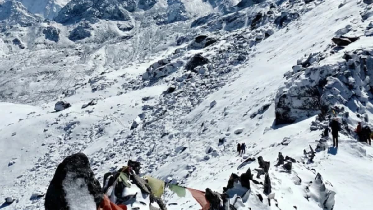
Sele La at 4,290 metres is marked by cairns and a few prayer flags, the offerings of the small number of trekkers and porters who cross each season. The pass is not dramatic in the way that Thorong La or Larkya La are dramatic, there is no single moment of arrival, no narrow notch between ridges, no wall of prayer flags snapping in concentrated wind. Sele La is a broad, gradual ridge that you cross over minutes rather than seconds, and the satisfaction of the crossing is the quiet satisfaction of having navigated a route that most of Nepal's trekking community does not know exists.
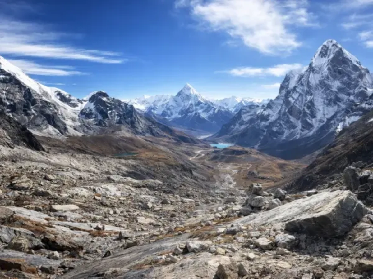
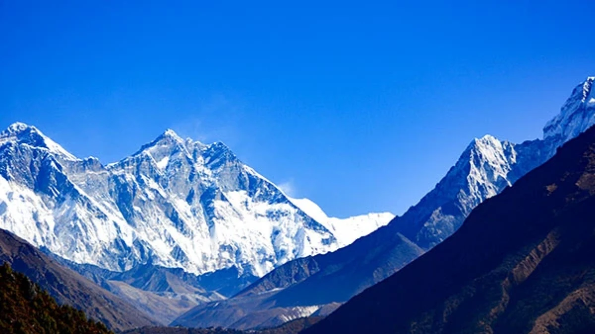
The views from the pass depend on weather. On clear days, the peaks of the Kanchenjunga region are visible, the southern approaches to the mountain, the ridges that separate the Ghunsa and Simbua drainages, and the forested valleys below that hold the trail you have walked and the trail you will walk. On cloudy days, which are common, particularly in the afternoon, the views are limited to the immediate surroundings: grass, rock, cairns, and the wind.
What Is the Descent from Sele La Like?
The descent from Sele La into the Simbua Khola valley drops through the same ecological zones in reverse, alpine scrub to rhododendron forest to the valley floor. The descent is steeper than the approach and takes most of a day. The trail connects with the south base camp approach at Tseram (3,870 metres), from where trekkers can continue to Oktang (south base camp) or descend toward the exit at Taplejung.
The forest on the Simbua side is particularly beautiful, dense rhododendron that in spring (April-May) blooms in crimson and pink against the backdrop of the Kanchenjunga south face. The spring crossing of Sele La, through blooming forest, over a high pass, and into a valley dominated by the south face of the world's third highest mountain, is one of the most spectacular multi-day walking experiences in Nepal, seen by almost nobody.
What Do You Need to Know Before Crossing Sele La?
Altitude: 4,290 metres. Duration: two to three days from Ghunsa valley to Simbua valley (or reverse). Difficulty: moderate to challenging, not technical but remote and exposed. Season: October-November (best), March-May (good, rhododendrons). Camping required, no teahouses on the pass route.
The Sele La crossing is included in the full Kanchenjunga circuit itinerary (eighteen to twenty-one days). It is not a standalone trek, it connects the north and south approaches as part of the complete Kanchenjunga experience. Your trekking company arranges camping logistics, food, and the guide who knows the route.
Why Is Sele La Pass Worth the Effort?
Sele La is the pass that nobody talks about. Not because it is unworthy of discussion, the crossing is beautiful, the forest is ancient, and the connection it provides between the two faces of Kanchenjunga is the link that makes the full circuit possible. But because the Kanchenjunga region itself is talked about so rarely that a pass within it, a pass that connects two valleys that most Nepal trekkers have never heard of, exists in a category of obscurity that even the trekking press has not penetrated.
For the trekkers who cross Sele La, on a full Kanchenjunga circuit, through forest and over ridge, from the north face valley to the south face valley, the pass is the quiet pivot of the trek. The point where the mountain changes face. The point where the trail transitions from the Sherpa culture of Ghunsa to the rhododendron forests of the Simbua. And the point where the specific, deep, almost private satisfaction of walking where almost nobody walks becomes the experience that defines the Kanchenjunga circuit, not the base camps, not the mountain views, but the passage between them, over a ridge that the rest of the trekking world does not know exists.
Sele La is a high pass on the Kanchenjunga Base Camp Trek, connecting the north and south base camp routes.
Sele La Pass at 4,290 metres is the high-altitude ridge crossing on the Kanchenjunga Circuit that nobody talks about because Kanchenjunga itself steals all the attention. But the views from the pass — the eastern Himalaya stretching in every direction — are genuinely world-class. And you will probably have them entirely to yourself.
Sele La is on our Kanchenjunga Base Camp Trek.
WhatsApp:+977 9810351300
Email:[email protected]
Written by Shreejan Simkhada, CEO of The Everest Holiday and third-generation Himalayan guide. TAAN Member #1586.
Sele Le is the Kanchenjunga ridge pass. Our Kanchenjunga Base Camp Trek (19 Days) is private (your group only, no strangers), 2026 dates open, From USD $2499. WhatsApp us for tailored 2026 dates and current departures.