The alarm does not ring. Your guide knocks on the tent wall at three in the morning, and the cold that enters through the thin nylon is the kind of cold that makes you question every decision that led to this moment. Minus fifteen. Maybe colder. The air inside the tent holds the fog of your breathing from six hours of fitful sleep at 4,460 metres. Your sleeping bag is the only warm thing in the universe. And somewhere above you, invisible in the pre-dawn darkness, the Larkya La waits — 5,160 metres of scree, snow, and frozen wind that you will cross in the next eight hours or turn back from, depending on the weather, your fitness, and the specific, non-negotiable judgment of the guide who knocked on your tent.
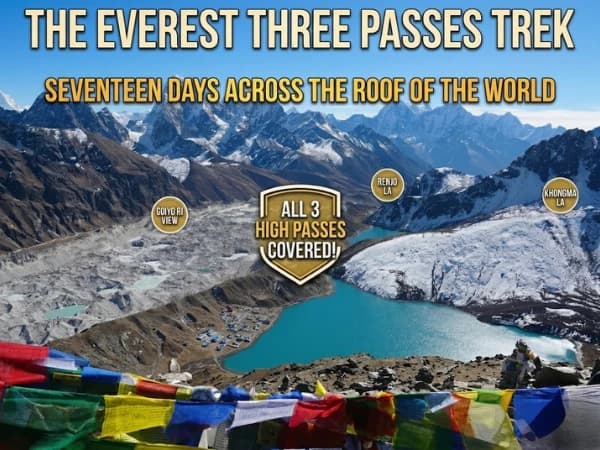
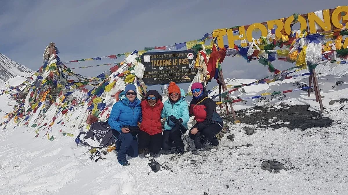
The Larkya La is the crux of the Manaslu Circuit — the moment when two weeks of walking through valleys and along rivers and through forests converge on a single day of sustained uphill effort at extreme altitude. It is not the highest pass in Nepal trekking — Thorong La on the Annapurna Circuit is 256 metres higher. But it is, by most accounts, the more demanding crossing: steeper on the approach, rockier on the descent, and — because the Manaslu Circuit is quieter than the Annapurna — lonelier. At Thorong La, you cross with dozens of other trekking groups. At Larkya La, you may cross with your group alone.
How Should You Prepare the Night Before Larkya La?
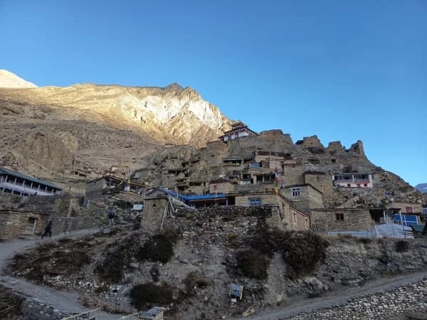
Dharamsala, also called Larkya Base Camp, sits at 4,460 metres on a rocky platform beneath the pass. It is the last stop before the crossing, and it is austere in a way that no other teahouse on the Manaslu Circuit prepares you for. The "teahouse" is a collection of stone shelters with tin roofs, built to survive the wind that pours over the pass and through the camp with a constancy that makes conversation difficult and sleep aspirational.
You arrive at Dharamsala in the early afternoon from Samdo (3,860 metres), a walk of four to five hours that gains six hundred metres and crosses terrain that transitions from alpine scrub to bare rock and moraine. The landscape is lunar. The vegetation has ended. The world is grey stone, blue sky, and white peaks, and the silence, broken only by wind and the occasional crack of a rock falling from a distant face, is the silence of altitude, where the air is too thin to carry sound far and too dry to hold moisture.
The evening at Dharamsala is preparation. Your guide briefs you on tomorrow: departure time, expected conditions, what to carry, what to leave. You pack your daypack with everything you will need for eight to ten hours: water (at least two litres, in insulated bottles to prevent freezing), snacks (energy bars, chocolate, nuts), warm layers (everything you have), gloves (both pairs, liners and insulated), headlamp (fresh batteries), and sunglasses (essential, snow blindness at 5,000 metres is fast and painful).
Dinner is dal bhat. You eat it because your body needs fuel, not because you are hungry, appetite at 4,460 metres is a memory of something your body used to do at lower altitudes. You drink three cups of tea. You set your gear beside your sleeping bag. And you lie down, knowing you will not sleep well, knowing the alarm will come at three, knowing that tomorrow is the day you have been walking toward for twelve days.
What Is It Like to Cross Larkya La Pass?
Three AM. Tea and biscuits in the shelter. The stove throws flickering light on the stone walls. Your guide checks your gear: headlamp working, water bottles full, warm layers on. Outside, the stars are brilliant, the Milky Way arching overhead with a density and brightness that only extreme altitude and zero light pollution can produce. The wind has dropped. This is a good sign. Your guide nods. You walk.
The first two hours are in darkness. The trail, marked by cairns that your headlamp finds twenty metres at a time, climbs steadily through a boulder field. The gradient is moderate but the altitude makes every step require conscious effort. Breathe. Step. Breathe. Step. The rhythm is the only thought. The darkness reduces the world to a three-metre circle of headlamp light, and within that circle, nothing exists except the next rock, the next step, and the next breath.
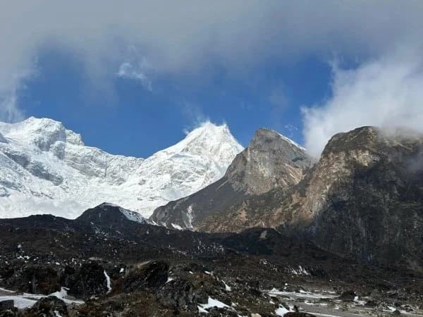
Dawn arrives around five-thirty. The sky lightens in the east. The peaks emerge, Manaslu's north face to the north, massive and close, its ice walls catching the first grey light. The Himalchuli range to the south. The pass itself, visible now as a notch in the ridge above, marked by prayer flags that are just visible as dark specks against the snow, is perhaps two hours away. The sight of the pass is both motivating and demoralising: motivating because it is visible and therefore real, demoralising because it looks impossibly far above and the altitude between here and there will be the hardest altitude of the entire trek.
The final approach to the pass is across a snowfield, in October, typically hard-packed snow that crampons or microspikes grip well but that unstable footing makes treacherous. The gradient steepens. The breathing becomes audible, not just yours but everyone's, a chorus of laboured respiration that the thin air carries with surprising clarity. Your guide watches you. The guide has crossed this pass a hundred times and reads your body language, the pace of your steps, the set of your shoulders, the frequency of your rest stops, with an accuracy that no verbal report can match.
The prayer flags at the pass appear suddenly, one moment they are above, the next they are beside you, snapping in the wind that pours through the notch from the far side. You are at 5,160 metres. The view opens to the west, a completely different landscape from the one you have been walking through. The dry, brown valleys of the Marsyangdi drainage stretch toward the Annapurna range. The transition from the Budhi Gandaki (east) to the Marsyangdi (west) happens at this notch, and the geological and ecological change is visible in a single panoramic sweep.
The emotion at the pass varies. Some trekkers weep. Some cheer. Some stand silently and look at the mountains. Some collapse on the nearest rock and breathe. All of them have earned the moment. Twelve days of walking. Six hundred metres of climbing in the dark. And now, standing at 5,160 metres with prayer flags snapping overhead and the highest mountains on earth arrayed around them, they are at the highest point of their lives.
How Long Is the Descent from Larkya La?
The descent from Larkya La is steeper than the ascent. The western side of the pass drops sharply through loose scree and rock, terrain that demands attention from legs that are tired, a brain that is oxygen-depleted, and knees that have been absorbing downhill impact for hours. Trekking poles are essential. The scree slides underfoot. The exposure, steep drops on the trail's downhill side, requires concentration that altitude makes difficult to sustain.
The trail descends approximately 1,600 metres from the pass to Bhimtang (3,590 metres), the first settlement on the western side. The descent takes four to five hours and passes through a landscape that transforms as altitude drops: from snow and rock at the pass, through glacial moraine, past alpine meadows, and into the upper reaches of forest that feels like arriving on a different planet after the bare, austere landscape of the pass.
Bhimtang is a broad, flat valley with several teahouses and views of Manaslu's massive west face. The air is thick, or rather, it feels thick after the thin air of the pass. Your appetite returns. Your headache fades. Your body, which has been operating at the edge of its capacity for eight hours, suddenly remembers how to function normally. The relief is physical, measurable, and profound. And the dal bhat at Bhimtang, the same dal bhat you have eaten every night for twelve days, tastes better than any meal you have ever eaten, because your body knows it survived and is celebrating in the only language it has: hunger.
What Makes Larkya La Different From Other High Passes?
Every high pass in Nepal trekking has its character. Thorong La on the Annapurna Circuit is higher but more gradual, with a well-worn trail and dozens of trekking groups providing a sense of social safety. Cho La in the Khumbu is shorter but more technical, with a glacier crossing that requires ropes. The Larkya La is neither the highest nor the most technical. What it is, is the most remote.
The Manaslu Circuit's restricted area permit limits trekker numbers. The trail infrastructure is thinner than the Annapurna Circuit's. The rescue options are fewer, a helicopter from Dharamsala takes longer to arrive than one from Thorong High Camp. And the pass itself, particularly in early or late season, when snow conditions are unpredictable, requires a guide whose judgment about weather, timing, and trekker fitness is the primary safety system.
This remoteness is the Larkya La's gift. The crossing feels like a genuine mountain achievement, not a tourist attraction with safety nets, but a passage through genuine high-altitude wilderness where the decisions matter and the consequences are real. The trekker who crosses Larkya La has done something that fewer than eight thousand people do each year, compared to over fifty thousand on the Annapurna Circuit. The exclusivity is not manufactured. It is the natural consequence of a pass that is harder to reach, harder to cross, and harder to rescue from than its more famous counterparts.
How Should You Prepare for Larkya La?
The Larkya La crossing requires specific preparation beyond standard trekking fitness.
Acclimatisation: The Manaslu Circuit's approach, twelve days from Soti Khola to Dharamsala, gaining altitude gradually, provides excellent acclimatisation for the pass. The rest day at Samagaon (3,530 metres) and the night at Samdo (3,860 metres) are the critical acclimatisation stops. Do not skip them. Do not rush to Dharamsala. The pass will wait. Your lungs will not.
Gear: Warm layers for minus fifteen to minus twenty degrees. Microspikes or light crampons for the snowfield on the final approach. Trekking poles (essential for the scree descent). Sunglasses (category 3 or 4, snow blindness is a real risk). Wind-proof shell jacket. Balaclava or buff for face protection. Insulated water bottles or thermos (water freezes in uncovered bottles within an hour at the pass).
Fitness: The pass day is eight to ten hours of sustained effort at extreme altitude. You need the cardiovascular fitness to walk uphill for four hours in air that provides fifty percent of sea-level oxygen, and the leg strength to descend steep, loose terrain for four hours afterward. Train with stair climbing and loaded hiking for at least eight weeks before the trek.
Mental preparation: The pass day starts in the dark, crosses terrain that is intimidating, and demands sustained effort through discomfort. The trekkers who cross successfully are not always the fittest. They are the ones who can break the day into small pieces, one cairn at a time, one switchback at a time, and who trust their guide's judgment about when to push and when to rest.
The Prayer Flags
The prayer flags at the Larkya La are not decoration. They are offerings, placed by trekkers, guides, and monks to bless the crossing and to carry mantras into the wind that scours the pass. Each flag is printed with prayers in Tibetan script. Each time the wind moves the flag, the prayer is released into the world. The flags at the pass have been placed over years, faded, shredded, bleached by UV and wind and cold, and they accumulate in layers, the newest bright and whole, the oldest reduced to threads that flutter like the ghosts of prayers already spoken.
When you stand at the pass, tired and cold and breathing hard, looking at the mountains and the flags and the trail you climbed, you are standing where thousands of people have stood before you and where thousands will stand after. The flags remember them all. The prayers carry for all of them. And the wind, which does not distinguish between the prayer of a monk and the gasping breath of a trekker, carries both equally, over the mountains, into the valleys, and out into a world that is larger than the pass, larger than the trek, and larger than any single human standing at 5,160 metres with tears freezing on their cheeks.
Larkya La (5,160m) is the highest point of the Manaslu Circuit Trek. For the extended route including Tsum Valley, see our 19-day Tsum Valley and Manaslu Circuit.
Larkya La is the pass that makes the Manaslu Circuit worth every rupee of the restricted area permit. At 5,160 metres, with Manaslu on one side and the Annapurna range on the other, you stand between two of the greatest mountain ranges on earth. The crossing takes seven to nine hours. You will be exhausted. You will also never forget it.
Larkya La is the big day on our Manaslu Circuit Trek.
WhatsApp:+977 9810351300
Email:[email protected]
Written by Shreejan Simkhada, CEO of The Everest Holiday and third-generation Himalayan guide. TAAN Member #1586.
Larkya La is the Manaslu Circuit summit day. Our Manaslu Circuit Trek (12 Days) is private (your group only, no strangers), 2026 dates open, From USD $799. WhatsApp us for tailored 2026 dates and current departures.