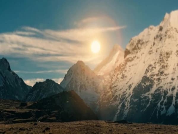
What is Gyabla village on the Kanchenjunga Base Camp Trek?
The trail drops through a cathedral of rhododendron and oak, the canopy so thick overhead that the morning sun reaches you only in broken coins of light scattered across the forest floor. You've been walking for hours through the Ghunsa Khola valley, the river's roar a constant companion somewhere below, when the trees thin just enough to reveal a handful of stone buildings tucked into the hillside. A thread of smoke rises from one roof. A chicken crosses the path with absolute indifference to your existence. This is Gyabla, one of the quietest, most overlooked stops on the Kanchenjunga Base Camp trek, and one of the most important.
Sitting at approximately 2,730 metres in the Kanchenjunga Conservation Area, Gyabla (sometimes written Gyaabla) is the kind of place most trekkers pass through without fully understanding what they're walking into. It's not a destination in the conventional sense. There's no famous monastery, no dramatic viewpoint, no signpost announcing anything remarkable. But if you pay attention, to the forest, to the faces, to the subtle shift in everything around you, you'll realise that Gyabla is where the entire character of the Kanchenjunga trek begins to change.
The Trail to Gyabla, Between Amjilosha and Ghunsa
Most trekkers reach Gyabla from Amjilosha (also called Shekathum by some older maps), walking north through the Ghunsa Khola valley. The trail follows the river upstream, crossing it occasionally on wooden bridges that creak with a kind of tired familiarity. The walking is moderate, not the lung-burning climbs that come later, but the terrain is uneven and the forest dense enough that you lose sight of the sky for long stretches.
From Amjilosha, the walk to Gyabla takes roughly four to five hours depending on your pace and the condition of the trail. The path gains altitude gradually, climbing from around 2,200 metres to Gyabla's 2,730 metres through a series of gentle ascents and short descents that follow the contours of the valley. It's not a difficult day by Kanchenjunga standards, but the remoteness of the trail and the density of the forest make it feel longer than the distance suggests.
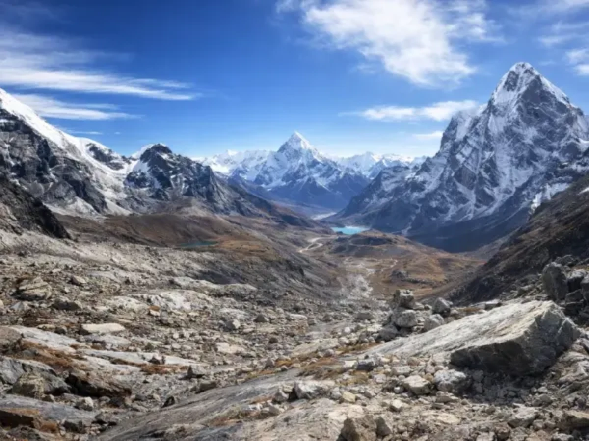
From Gyabla, the next major stop is Ghunsa, another four to six hours further up the valley, where the altitude pushes past 3,400 metres and the world above the treeline begins to open up. Gyabla sits squarely in the middle of this journey, a resting point between the lower valleys you've left behind and the high-altitude terrain that lies ahead.
What the walking is actually like
The trail between Amjilosha and Gyabla is narrow and often muddy, particularly during the spring months when snowmelt feeds every gully and stream crossing. You'll walk through sections where the path is carved into the hillside with a steep drop to the river below, nothing technical, but it demands attention. Tree roots cross the trail like tripwires, and in places the undergrowth crowds in so close that you're brushing past ferns and rhododendron branches with every step.
There are no dramatic river crossings on this section, but several smaller streams need to be hopped across on stones. After rain, some of these become ankle-deep wades. Good waterproof boots aren't optional here, they're essential.
The reward for this quiet, forest-enclosed walking is a sense of solitude that's increasingly rare on Nepal's popular trekking routes. On busy days in the Everest or Annapurna regions, you might pass dozens of other trekking groups. On this stretch of the Kanchenjunga trail, you might not see another soul for hours.
What ethnic groups live around Gyabla on the Kanchenjunga trek?
Here's what makes Gyabla genuinely fascinating, even if no guidebook spends more than a sentence on it: this village sits right on the cultural boundary between two of eastern Nepal's most distinctive communities.
Below Gyabla, in the lower Tamor and Ghunsa Khola valleys, the villages are predominantly Limbu. The Limbu people are one of Nepal's oldest indigenous groups, with their own script, their own shamanic traditions, and a relationship with the eastern hills that stretches back centuries before Nepal existed as a unified country. Their homes tend to be wooden, their agriculture centres on rice and millet in the lower elevations, and their cultural life revolves around festivals, oral histories, and a deep connection to the landscape of the eastern Terai and middle hills.
Above Gyabla, particularly from Ghunsa onwards, the culture shifts to Tibetan Buddhist Sherpa communities. The architecture changes to stone. Prayer flags appear on ridgelines. Mani walls line the trail. The language shifts. The food changes. The entire feeling of the trek transforms.
Gyabla sits right in the overlap. You might see a Limbu-style house next to a building with Tibetan prayer flags. The people here live in the space between two worlds, and their daily lives reflect that, a blend of highland and lowland traditions that you won't find neatly described in any ethnography textbook.
For trekkers who are paying attention, this transition is one of the most culturally rich experiences on any trek in Nepal. It happens gradually, you don't cross a line on a map and find everything different on the other side. But by the time you leave Gyabla and continue toward Ghunsa, you'll notice that the world around you has shifted in ways both obvious and subtle. The transition started here, in this quiet village with its one or two teahouses and its chickens crossing the trail.
What forests grow around Gyabla on the Kanchenjunga trek?
At 2,730 metres, Gyabla sits at one of Nepal's most interesting ecological boundaries. Below this altitude, the Ghunsa Khola valley is lush with subtropical and warm-temperate vegetation, banana plants in the lowest sections, bamboo thickets, and broadleaf forests dripping with moisture. Above this altitude, the forest shifts to temperate species: rhododendron, oak, birch, and eventually the hardy juniper and dwarf shrubs of the alpine zone.
The forest around Gyabla is where this transition happens. Walking through it, you'll notice the canopy changing above you. The massive rhododendrons here, some of them ancient trees with trunks thicker than your arms can reach around, are covered in moss and lichen, giving the forest a primeval, almost enchanted quality. In spring (March to May), these same trees explode into bloom. Red, pink, and white rhododendron flowers carpet the forest floor and fill the canopy with colour so vivid it looks artificial.
Mixed in with the rhododendrons are oak trees, their leaves smaller and tougher than the broadleaf species lower in the valley, adapted to the cooler temperatures and heavier snowfall at this altitude. Together, the rhododendron and oak create a dense, multi-layered canopy that supports an extraordinary diversity of bird and animal life.
What you'll hear before you see
The birdlife in these forests is remarkable. You're likely to hear the calls of laughingthrushes, minivets, and sunbirds long before you spot them moving through the branches. Blood pheasants, with their distinctive red breast feathers, inhabit the higher sections of this forest, though they're shy and more often heard rustling through undergrowth than seen in the open. If you're walking quietly and the forest is still, you might catch a Himalayan monal, Nepal's national bird, in an iridescent flash of green and copper as it takes flight from a branch above the trail.
Carry binoculars if you have them. The forest around Gyabla rewards patience and quiet observation more than almost any other stretch of the Kanchenjunga trek.
Can you see red pandas on the Kanchenjunga Base Camp Trek?
There's a creature living in these forests that most trekkers will never see, no matter how many times they walk through. The red panda, smaller than you'd expect, roughly the size of a large house cat, with russet fur and a banded tail, inhabits the temperate forests of the Kanchenjunga Conservation Area, and the rhododendron-oak forests around Gyabla are exactly the habitat it prefers.
Red pandas are crepuscular, meaning they're most active at dawn and dusk. During the day, they sleep curled up in the branches of trees, their reddish fur blending so perfectly with the moss-covered bark and the dead rhododendron leaves that they're virtually invisible even when you're looking directly at them. They feed primarily on bamboo, which grows in patches through these forests, along with berries, acorns, and occasionally bird eggs.
Your chances of actually spotting a red panda on the trail are slim. These are solitary, elusive animals that avoid human contact, and the Kanchenjunga Conservation Area's forests are dense enough to hide them completely. But knowing they're there, somewhere above you in the canopy, watching you pass with absolute disinterest, adds a layer of wildness to the forest that changes how you walk through it. You find yourself looking up more. Scanning the branches. Moving a little more quietly.
If you're genuinely interested in red pandas, ask your guide about recent sightings in the area. Local people and porters who walk these trails regularly are far more likely to have encountered them than any trekker passing through once. Occasionally, someone will have seen one crossing the trail early in the morning, or spotted one sleeping in a tree near the river. These stories are worth asking for.
What is the Kanchenjunga Conservation Area?
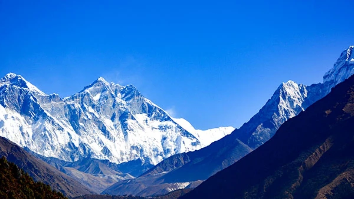
Gyabla sits within the Kanchenjunga Conservation Area (KCA), one of Nepal's most important protected areas and one of the least visited. Established in 1997, the KCA covers 2,035 square kilometres of eastern Nepal, from the subtropical valleys near the Indian border to the glaciated peaks of Kanchenjunga itself, the world's third-highest mountain at 8,586 metres.
What makes the KCA unusual among Nepal's protected areas is its management model. Unlike national parks, which are managed primarily by the government, the KCA is community-managed. Local communities, including both Limbu and Sherpa groups, have significant control over conservation decisions, resource management, and the regulation of trekking activities. This means that when you pay your conservation area permit fee, a meaningful portion of that money goes directly to the communities you're walking through.
The conservation area protects an extraordinary range of wildlife beyond red pandas. Snow leopards inhabit the higher elevations. Himalayan black bears live in the temperate forests. Musk deer, shy, solitary animals with distinctive elongated canine teeth, browse in the undergrowth near Gyabla's altitude. The forests also support clouded leopards, although sightings are so rare that many researchers have spent years in the area without confirming one.
For trekkers, the practical impact of walking through a conservation area rather than a national park is minimal, you still need a permit, and you still need to follow trail regulations. But the philosophical difference matters. You're walking through a landscape that's protected not by fences and wardens, but by the people who live in it. Gyabla's residents aren't just hosts for passing trekkers. They're stewards of one of the most biodiverse corridors in the eastern Himalayas.
Where Can You Stay in Gyabla?
Let's be honest about what Gyabla offers in terms of facilities: not much, and that's part of its appeal.
There are one or two basic teahouses in the village, offering simple rooms with thin mattresses and heavy blankets. Don't expect attached bathrooms, hot showers, or reliable electricity. The teahouses here are the kind where the family sleeps on one side of the building and trekkers sleep on the other, where dinner is dal bhat cooked over a wood fire, and where the toilet is a separate structure outside that requires a headtorch after dark.
This is the standard for much of the Kanchenjunga trek below Ghunsa, and it's worth setting your expectations before you arrive. If you've trekked the Everest Base Camp or Annapurna Circuit routes, you'll have encountered teahouses with menus, charging stations, and sometimes even Wi-Fi. Gyabla has none of that. What it has instead is warmth, quiet, and the kind of genuine hospitality that exists in places where tourism hasn't yet become an industry.
What to bring
A few practical notes for the stretch of trail that includes Gyabla:
Sleeping bag: Essential. The blankets provided in teahouses at this altitude are not sufficient for most people, particularly in spring or autumn when nighttime temperatures can drop below freezing.
Water purification: Carry purification tablets or a filter. Bottled water is not reliably available on this section of the trek, and what is available is expensive and generates plastic waste in an area with no waste management infrastructure.
Snacks: Bring trail mix, energy bars, or biscuits from Kathmandu or Taplejung. Teahouse menus in Gyabla are limited, and there's no shop to resupply between villages.
Cash: There are no ATMs or card payment facilities anywhere on the Kanchenjunga trek. Bring all the Nepali rupees you'll need from Kathmandu or Taplejung.
Headtorch: Non-negotiable. You'll need it for the toilet, for early morning starts, and for any after-dark movement around the teahouse.
Layers: At 2,730 metres, Gyabla can be warm during the day (particularly in direct sunlight) and surprisingly cold after dark. Dress in layers you can easily add or remove.
When is the best time to trek the Kanchenjunga route?
The Kanchenjunga Base Camp trek is best undertaken in two windows: spring (March to May) and autumn (September to November).
In spring, the rhododendron forests around Gyabla are in full bloom, it's the most visually striking time to walk through this section of the trail. The weather is generally stable, though afternoon cloud and occasional rain are common. Leeches can be present on the lower sections of the trail, particularly in the warmer, wetter weeks of April and May.
In autumn, the skies are clearer, the air is drier, and the mountain views from higher on the trail are at their best. The forest around Gyabla takes on golden-brown tones as the oak leaves turn, and the walking conditions are generally excellent. Nights are colder than in spring, but the days are comfortable.
The monsoon months (June to August) make the Kanchenjunga trek extremely difficult and potentially dangerous due to landslides, swollen rivers, and leech-infested trails. Winter (December to February) brings heavy snow to the higher sections and can close the passes entirely. Both seasons are best avoided unless you have significant Himalayan experience.
Is Gyabla worth visiting on the Kanchenjunga trek?
On a trek as long and demanding as the Kanchenjunga Base Camp route, it's easy to focus on the big moments, the first view of the mountain, the arrival at base camp, the crossing of a high pass. Those moments are extraordinary, and they're the reason most people undertake the trek in the first place.
But the Kanchenjunga trek is not just about its highest points. It's about the journey between them, the gradual shift through lowland rice terraces, up into glaciers, past Hindu-animist villages and into Tibetan Buddhist country. Gyabla is where that shift becomes tangible. You arrive from the warmer, greener world below, and you leave heading into the colder, starker world above. The forest around you is changing. The culture is changing. The air itself is changing, thinner, drier, carrying the faint mineral smell of snow even though the snowline is still days away.
Most trekkers will spend one night in Gyabla and move on. That's fine, the trail demands it, and there's a long way still to go. But take an hour in the evening, if you can, to sit outside the teahouse and watch the light fade from the forest. Listen to the river. Watch the smoke rise. Notice how the mountains above the valley catch the last of the sun long after the valley floor has fallen into shadow.
This is what trekking in Nepal is actually about, not the summit photos and the achievement badges, but the quiet moments in places like Gyabla where the land itself tells you something you couldn't have learned any other way.
How much does the Kanchenjunga Base Camp Trek cost?
The Kanchenjunga Base Camp trek is one of Nepal's most rewarding, and most logistically demanding, routes. It requires proper permits, experienced guides familiar with the eastern Nepal trail network, and careful planning around food, fuel, and accommodation in areas where teahouse facilities are basic.
At The Everest Holiday, we've been running treks in Nepal since 2016, building on three generations of Himalayan experience. Our guides know the Kanchenjunga route intimately, not just the trail itself, but the communities along it, the best teahouses to stop at, and the places where you need to slow down and let the landscape come to you.
Every Kanchenjunga trek we run is led by TAAN-certified guides with wilderness first aid training. We handle all permits, logistics, and accommodation arrangements so you can focus on the walking. And a portion of every booking supports the Nagarjun Learning Center, providing free education and hot meals to 70 children in rural Nepal.
If you're considering the Kanchenjunga Base Camp trek, we'd be glad to help you plan it properly. Reach out to us on WhatsApp at +977 9810351300 or email [email protected], we typically respond within 30 minutes during Nepal business hours.
Gyabla is on the Kanchenjunga Base Camp Trek, the last village before the trail climbs into alpine terrain towards Ghunsa.
Gyabla sits between Phole and Kambachen on Kanchenjunga. Our Kanchenjunga Base Camp Trek (19 Days) is private (your group only, no strangers), 2026 dates open, From USD $2499. WhatsApp us for tailored 2026 dates and current departures.
Continue planning your trek
This is one stop on the Kanchenjunga Base Camp trail. For the full route, read our Kanchenjunga gateway guide. When you are ready for dates and prices, see the Kanchenjunga Base Camp Trek (19 days) or WhatsApp us directly. We reply personally.