Tsum Valley and Manaslu Circuit trek -19day

Quick Overview
Duration19 Days
Trip GradeStrenuous
CountryNepal
Maximum Altitude5160m/ 16,752 ft at larkya la pass
Group Size2-20
StartsKathmandu
EndsKathmandu
Activitieslodge-to-lodge trekking
Best TimeMar, April, May, June, Sep, Oct, & Nov

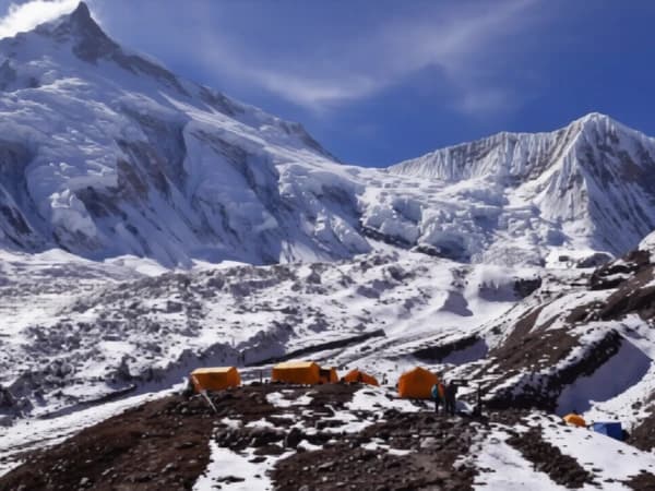
The Tsum Valley and Manaslu Circuit Trek goes around Mount Manaslu, which is the eighth-highest mountain in the world. The path goes past traditional villages and notable Buddhist sites and crosses the high Larkya La Pass, which is 5,106 m (16,751 ft) high. You will also visit Tsum Valley, a secret part of the Manaslu Conservation Area where the Tsumba people live and have a unique culture.

Highlight 

  • Enjoy a scenic drive from Kathmandu to Soti Khola through hills and rivers.
  • Visit Mu Gompa and Lungdang Gompa, two beautiful monasteries in Tsum Valley.
  • Explore Milarepa’s Piren Phu Cave, a sacred site also known as the Pigeon Cave.
  • Trek around Mount Manaslu (8,163m/26,781 ft), the world’s eighth-highest peak.
  • Take a rest day in Samagaun with options to hike to Birendra Lake, Punhyen Glacier, or Manaslu Base Camp.
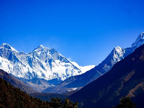
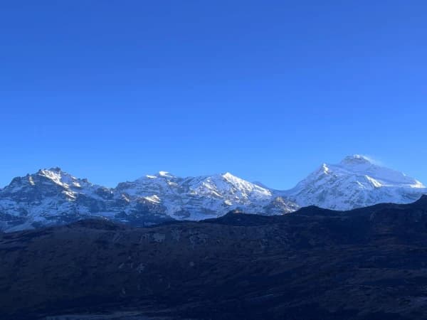
  • Enjoy stunning views of glaciers, lakes, cliffs, and high peaks like Manaslu, Himchuli, and Ganesh Himal near the Nepal-Tibet border.
  • Cross Larkya La Pass (5,106m/16,751 ft), one of the longest and most scenic passes in the Himalayas.
  • Experience the unique mix of cultures from the Tibetan-influenced Nupri people and the local Gurung community.
  • Visit ancient Buddhist stupas and monasteries, and see traditional Tibetan ways of life.
  • Walk along peaceful, less crowded trails.
  • Follow part of an old trade route that once connected Nepal and Tibet.

Manaslu Tsum Valley (19 Days) Overview

The Manaslu Tsum Valley Trek is a unique 19-day tour that takes you to stunning, hard-to-reach locales. You will walk through the "Valley of Happiness," a quiet location with strong spiritual traditions and stunning views of the Alps. You might learn about the rich Buddhist culture that surrounds it while you visit.

As you enter the quiet and untouched Tsum Valley, you’ll get a rare chance to see life in one of Nepal’s most hidden areas. Surrounded by mountains like Ganesh Himal and Sringi Himal, the valley is shaped like a gentle horseshoe, with rivers like the Shar Khola and Budi Gandaki adding to its natural beauty. Along the way, you’ll visit ancient monasteries like Mu Gompa (3,700m) and Rachen Gompa, which keep the valley’s Tibetan Buddhist heritage alive among the stunning Himalayan views.

The trek starts with a scenic drive from Kathmandu to Soti Khola, then follows the Budhi Gandaki River through green hills, deep valleys, and across suspension bridges. As the trail climbs higher, you pass through peaceful Buddhist villages. Places like Jagat, Lokpa, Chumling, Chhokangparo, and Nile offer a deep look into local culture, with colorful prayer flags, monasteries, and chortens (stone shrines). Life here is simple and traditional, untouched by the modern world. A short hike to Milarepa’s Piren Phu Cave, a sacred meditation site, adds a special spiritual experience to the journey.

The hike goes on past Tsum Valley to Deng, Namrung, and Sama Gaon. You can see the huge peak of Mount Manaslu from there. You can climb to Pungyen Gompa or the Manaslu Base Camp on your day off at Sama Gaon. The path then goes to Dharamsala, which is the final halt before crossing the beautiful and high Larkya La Pass.

The trek reaches its highest point at Larkya La Pass (5,160m), where you’re rewarded with breathtaking views of Himlung Himal, Manaslu, Annapurna II, and other snow-covered peaks. From here, the trail descends to Bhimtang, entering the Annapurna Conservation Area. This part of the trek is filled with green forests, open meadows, and lively villages with a mix of cultures. As the journey comes to an end, the final walk from Gho to Tal leads to a beautiful drive back to Kathmandu, wrapping up a truly unforgettable trek—one that challenges the body and uplifts the spirit. 

Reminder

For a smooth and stress-free start, we highly recommend arriving in Kathmandu by 4 PM the day before we leave. This gives you enough time for a final gear check, a trip briefing with your guide, and to make sure you have everything you need before heading to the trek. 

Online briefing 

This is like our first coffee before the trip, but online!  This online meeting is our chance to show you everything that will happen on the trip.  We'll talk about everything from what gear to bring to what each day on the route will be like and how it will feel, and we'll answer any questions you have.  After you book, we'll send you an email with a couple of times when we can talk. We'll set up the meeting after the booking process is completed. Also, our trek itinerary does not include your hotel stay in Kathmandu. During the online meeting, please share your preferences, budget, and the standard of the hotel you would like to stay at in Kathmandu. We will arrange it for you accordingly. 

Note to Hikers

Experience the Himalayas on your terms. We create personal, intimate treks for groups of two or more. Whether you select our Budget, Standard, or Luxury package, your adventure will be exclusively for you and your companions, ensuring a comfortable and personal journey from start to finish.

Short Itinerary
Day 01: Trek starts by a drive from Kathmandu (1,324 m/4,344 ft) via Arughat to Seti Khola (730 m/2,896 ft), usually around 7 - 8 hours with total elevation change 594m – 1448ft.
Day 02: After breakfast, the trek begins with a 9.7 km / 6miles  walk from Machha Khola (730 m/2,896 ft) to Machha Khola (870 m/2,854 ft), usually around 6 -7 hours with a total elevation change of 530m - 1739 ft.
Max Altitude: 890m / 2,965 ft
Day 03: Trek starts with a 22 km/ 13.7 Machha Khola (870 m/2,854 ft) to Jagat (1,400 m/4,593 ft), usually around 5 -6 hours with a total elevation change of 530m - 1739 ft.
Max Altitude: 1,400 m / 4,593 ft
Day 04: Trek starts with a 17.5 km / 10.8miles walk from Jagat (1,400 m/4,593 ft) to Lokpa (2,040m m/4,493 ft), usually around 6 – 7 hours with a total elevation change of 640m – 100ft.
Max Altitude: 2,040 m/4,493 ft.
Day 05: Trek starts with a 6.3km / 3.9 miles walk from Lokpa (2,040m m/4,493 ft) to Chumling (2,386m / 6,692ft), usually around 6 – 7 hours with a total elevation change of 346m – 2,199ft.
Max Altitude: 2,386m / 6,692 ft
Day 06: Trek starts with an 8.4 km / 5.2 miles walk from Chmling (2,386m / 6,692ft) to Chhokangparo (3,010m / 9,875ft), usually around 5 – 6 hours with a total elevation change of 4,306m – 3,183ft.
Max Altitude: 3,010m / 9,875 ft
Day 07: Trek starts with a 9.7 km / 6 miles walk from chhokangparo (3,101m / 9,875ft) to Nile (3,361m / 11,026ft) via Milarepa Piren phu Cave, usually around 4 -5 hours with a totel elevation chamge of 260m / 1151ft.
Max Altitude: 3,361 m/11,026 ft.
Day 08: Trek  starts with a 7.9km / 4.9-mile walk from Nile (3,361 m / 9,875ft) to Mu Gompa (3,700m / 11,026ft), usually around 3 -4 hours with a total elevation change of 339m / 1,151 ft.
Max Altitude: 3,700 m/11,026 ft.
Day 09: Trek starts with a 13 km / 8 mile walk from Mu Gompa (3,700m / 11,026ft) to Chhokangparo (3,010m / 9,903ft), usually around 6 hours with the total elevation change 690m / 2,263 ft.
Max Altitude: 3,700 m/11,026 ft.
Day 10: Trek starts with an 8.4 km / 5.2 mile walk from Chhokangparo (3,010m / 9,903ft), to Chumling (2,386m / 7,827ft), usually around 5–6 hours with a total elevation change of 624m – 2,076ft.
Max Altitude: 3,700 m/11,026 ft.
Day 11: Trek starts with an 8 km / 5 mile walk from Chumling (2,386m / 7,827ft) to Deng (1,860m / 6,101ft), usually around 5–6 hours with a total elevation change of 526m / 1,728 ft.
Max Altitude: 2386 m/7827 ft.
Day 12: Trek starts with a 6.5 km / 4 mile walk from Deng (1860m / 6101ft) to Namrung (2630m / 8628ft), usually around 6-7 hours, with the total elevation change 770m – 2527 ft.
Max Altitude: 1,860 m/6,101 ft.
Day 13: Trek starts with a 17.7 km / 11 miles walk from namrung (2630m / 8628ft) to Sama Gaon (3530 m / 11581 ft), usually around 8–7 hours with a total elevation of 900m – 2953ft.
Max Altitude: 3,530 m/11,581 ft.
Day 14: Accommodation in Samagaon (3,530 m/11,581 ft).
Day 15: Trek starts with an 18.5 km / 11.4 mile walk from Sama Gaon (3,530m / 11,581 ft) to Dharmasala (4,480m / 14,698ft), usually around 8–7 hours with a total elevation of 950 m / 3,111 ft.
Max Altitude: (4,480m / 14,698ft),
Day 16: Trek starts with a 24.7 km walk from Dharamsala (4,480m / 14,698ft) by crossing the Larkya La Pass (5,160m / 16,929ft) to Bhimtang (3,720m / 12,205ft), usually taking around 8 hours with a total elevation change of 1,440 m / 4,724 ft.
Max Altitude: 5,160 m/16,929 ft.
Day 17: Trek starts with a 10 km / 6.2 miles walk from Bhimtang (3,720m / 12,205ft) to Gho (2,550m / 8,367ft), usually around 6-5 hours with a total elevation change of 1,170m / 3,838 ft.
Max Altitude: 3720 m/12,205 ft.
Day 18: Trek starts with a 13 km / 8 mile walk from Gho (2,550m / 8,367ft) to Tal (1,700m / 5,577ft), usually around 7-8 hours with a total elevation change of 850m / 2,790 ft.
Max Altitude: 2,550 m/8,367 ft.
Day 19: Drive from tal (1,700m / 5,577ft) to Besishar, then Kathmandu, usually around 9–10 hours.
Expand
Detailed Itinerary
Day 01:

Your journey begins with an early morning drive from Kathmandu, heading west along the Prithvi Highway. The road takes you through scenic countryside, with views of terraced farms, flowing rivers, green hills, and charming villages. You’ll cross the Trishuli River to reach Dhading Bensi and then continue toward Arughat. The drive follows the Dorandi Khola River, moving north through the Gorkha region. Along the way, you'll catch your first glimpses of Manaslu and Ganesh Himal on clear days. From Arughat, it's another two hours on a rougher road before reaching Soti Khola, where the trek officially begins.

Meals: Breakfast, Lunch, and DinnerAccommodation: Teahouse or LodgeDuration: 7 – 8 hoursDistance: 160km / 99.5 milesElevation: 594m – 1448ft
Day 02:

After breakfast, we begin our first day of trekking by heading north through a narrow valley alongside the Budhi Gandaki River. The trail winds through lush forest and small hillside villages, with occasional views of the distant Himalayan peaks. As we move ahead, the valley slowly opens up, and we pass several streams and waterfalls. One of the highlights of the day is reaching Lapubesi (880m), a quiet village with beautiful scenery. You may hear or see monkeys, birds, and other forest animals along the way. From there, we descend along a gentle, curving trail that brings us to Machha Khola, where we stop for the night. 

Max Altitude: 890m / 2,965 ftMeals: Breakfast, Lunch, and DinnerAccommodation: Teahouse or LodgeDuration: 6-7 hoursDistance: 9.7 km/6 milesElevation: 530m-1739 ft
Day 03:

You will hike upstream from Tharo Khola to Kholabeni, seeing beautiful rock formations and waterfalls along the way. The trail takes you through landslide-affected areas and across a bridge to reach Kholabesi. Ahead, you’ll find the hot springs of Tatopani, where you can take a short break.  After leaving, you'll continue on a mix of stone stairways, rocky footpaths, and forested sections, gradually ascending through villages like Dhovan, where you’ll stop for rest or lunch. At Jagat, the entrance to the Manaslu Conservation Area, we will register our permits at a local police checkpoint. 

Max Altitude: 1,400 m / 4,593 ftMeals: Breakfast, Lunch, and DinnerAccommodation: Teahouse or LodgeDuration: 5-6 hoursDistance: 22 km / 13.7 milesElevation: 530m - 1739 ft
Day 04:

Today, we officially enter the restricted region of Manaslu. The trek begins with a short climb up to Salleri, offering beautiful views of the surrounding hills. From there, the trail continues along the Budhi Gandaki River, and we cross a long suspension bridge. As we move ahead, the valley opens up near Philim, a lively village with terraced fields and friendly locals.

Passing through Ekle Bhatti, the trail splits one path heads toward the main Manaslu Circuit, while the other leads us into Tsum Valley. We take the route toward Tsum, hiking through forested paths and small village settlements. As the trail goes higher, the rivers become narrower, and you’ll reach the point where the Syar River from Tsum Valley joins the Budhi Gandaki.

From here, we continue on the right side of the valley, climbing gently until we reach Lokpa, the first village in Tsum Valley. Lokpa is peaceful and offers the first clear views of the Manaslu Range, including Himalchuli and Boudha Himal. This area is known as a hidden valley, believed to be blessed by Padmasambhava, one of the key figures in Tibetan Buddhism. Lokpa gives you a real sense of entering a sacred and quiet Himalayan world, untouched by modern life.

Max Altitude: 2,040 m/4,493 ft.Meals: Breakfast, Lunch, and DinnerAccommodation: Teahouse or LodgeDuration: 6-7 hoursDistance: 17.5 km / 10.8 milesElevation: 640m – 100ft
Day 05:

After breakfast in Lokpa, we begin the trek toward Chumling, following a quiet and remote trail into Tsum Valley. On a clear day, you’ll be treated to amazing views of Baudha Himal (6,672m) and Ganesh Himal VI, which appear above the forested hills along the trail.

First, the path descends to the Lungwa River Valley, then climbs steadily through a lush forest filled with rhododendron and pine trees. This part of the trail feels peaceful and untouched, as there are no villages between Lokpa and Chumling. So, you will need to carry the lunch package during the trek. We cross a bridge over the Syar Khola River and soon arrive at Chumling, a small but important village with a health post and three traditional Buddhist monasteries: Panago Gumba, Mani Dhungyur, and Gurwa Gumba.

Max Altitude: 2,386m / 6,692 ftMeals: Breakfast, Lunch, and DinnerAccommodation: Teahouse or LodgeDuration: 4-5 hoursDistance: 6.3 km/3.9 milesElevation: 346m – 2,199ft.
Day 06:

Today, the trek takes us deeper into the upper Tsum Valley, entering a more remote and peaceful part of the inner Himalayas. The trail follows the Syar River, passing through beautiful forested areas and small farmlands. We eventually reach Domje, the largest settlement in Tsum Valley. From Domje, the path climbs steadily uphill until we reach Chhokangparo. On clear days, you’ll get breathtaking views of Himalchuli and Ganesh Himal. In Chhokangparo, you’ll experience the warm hospitality of the Tsombo people, a local Tibetan-influenced community.

Max Altitude: 3,010m / 9,875 ftMeals: Breakfast, Lunch, and DinnerAccommodation: Teahouse or LodgeDuration: 5-6 hoursDistance: 8.4 km/ 5.2 milesElevation: 4,306m – 3,183ft
Day 07:

After breakfast, we continue trekking through the upper part of Tsum Valley, passing through small farming villages and open fields. As you walk through Ngakyu Leru, you’ll see local people working in their fields. After passing Lamagaon, from there we take a short hike to visit the famous Milarepa’s Piren Phu Cave, where his footprint is said to be preserved in rock. The cave, also called Piren Phu (Pigeon Cave), is one of the holiest places in the valley. There are two small Buddhist monasteries built into the cliff, with beautiful wall paintings, prayer flags, and ancient scriptures, making this spot spiritually and culturally significant.  After the visit, we will cross  a suspension bridge over the Shiar River and continue walking through a few more quiet villages before reaching Nile.

Max Altitude: 3,361 m/11,026 ft.Meals: Breakfast, Lunch, and DinnerAccommodation: Teahouse or LodgeDuration: 5-6 hoursDistance: 9.7 km / 6 milesElevation: 260m / 1,151 ft.
Day 08:

The hike today is shorter, but it's important since we're going to the highest point of the Tsum Valley. The trail goes from Nile to the western side of the valley, where it becomes closer to the border with Tibet. As we go into the dry, open highlands, the scenery changes. You will witness pastures where yaks are raised and stunning views of the Himalayas. The trail takes us to Mu Gompa, which is one of the most important and tallest monasteries in the area. Mu Gompa is in a quiet, rural location, and there are chortens (Buddhist shrines) all around it. The view of the mountains and valleys around it is excellent. There is also Dhephu Doma Gompa, which is another old monastery. You can truly experience the Tibetan Buddhist culture that influences life in this remote section of the Himalayas. There is a lot of magic in this area.

Max Altitude: 3,700 m/11,026 ft.Meals: Breakfast, Lunch, and DinnerAccommodation: Teahouse or LodgeDuration: 3-4hoursDistance: 9.7 km / 6 milesElevation: 339m / 1,151 ft.
Day 09:

Leaving Mu Gompa behind, the trail winds down toward Rachen Gompa, a serene monastery located near the border of Nepal and Tibet, surrounded by towering Himalayan peaks. From there, the route continues through the quiet villages of Chhule and Phurbe. These villages offer an authentic look at Tibetan-influenced mountain culture. If you're lucky, you might spot blue sheep (bharal) grazing along the rocky slopes or even the rare Himalayan marmot and birds such as Himalayan griffons and snow pigeons. As the landscape gradually changes, trekkers move into a lush, forested area before finally arriving at the peaceful settlement of Chhokangparo, where the day’s journey concludes.

Max Altitude: 3,700 m/11,026 ft.Meals: Breakfast, Lunch, and DinnerAccommodation: Teahouse or LodgeDuration: 6 hoursDistance: 13 km/8 miles.Elevation: 690m / 2,263 ft
Day 10:

Trek starts with an 8.4 km / 5.2 mile walk from Chhokangparo (3,010m / 9,903ft), to Chumling (2,386m / 7,827ft), usually around 5–6 hours with a total elevation change of 624m – 2,076ft. 
Trek Distance: 8.4 km/5.2 miles.
Highest Altitude: 3,700 m/11,026 ft.
Trek Duration: 5-6 hours
Leaving Chhokangparo behind, you descend through terraced fields and traditional stone villages until you reach Gho, a quiet hamlet nestled along the hillside. Here, you’ll cross a swaying suspension bridge, offering incredible views of the river below. The trail continues toward Rainjam Village, a small, peaceful stop where locals live simple lives rooted in Tibetan culture and farming traditions. From Rainjam, the path leads you further down into the lower Tsum Valley, where the air grows warmer and the forests denser. After a full day of walking through changing landscapes, rich with cultural heritage, mountain views, and natural beauty, You’ll arrive at Chumling, a charming village surrounded by pine forests and rolling hills, where you'll settle in for the night.

Max Altitude: 3,700 m/11,026 ft.Meals: Breakfast, Lunch, and DinnerAccommodation: Teahouse or LodgeDuration: 5-6 hoursDistance: 8.4 km/5.2 miles.Elevation: 624m – 2,076ft.
Day 11:

The trail starts with a downhill section, which makes the trek easier than it was the last few days. You walk along the calm banks of the Shiar Khola until you reach Lokpa Village, a well-known intersection where the Tsum Valley trail meets the main Manaslu Circuit. On clear days, you might see big groups of sheep and goats with local herders. The trail goes down to the Budhi Gandaki River after Lokpa. You cross a strong bridge and enter a tight gorge that is really dramatic. You will cross another river on a suspension bridge, which will take you into the Nupri region. This is the point at which the culture changes, and you enter a region more influenced by Tibetan culture. The last part of the journey goes through thick bamboo forests, and then you arrive at Deng, a small but friendly Gurung village where you'll spend the night. You'll be surrounded by the sounds of the jungle and the rushing river.

Max Altitude: 2386 m/7827 ft.Meals: Breakfast, Lunch, and DinnerAccommodation: Teahouse or LodgeDuration: 5-6 hoursDistance: 8 km/5 miles.Elevation: 526m / 1,728 ft.
Day 12:

We go from Deng to Rana Village (1,910 m), which is surrounded by calm scenery, peaceful settlements by terraced fields, and rolling green hills. The trail goes through green valleys and over Serang Khola before ending in Bhiphedi (2,130 m). We walk through bamboo and rhododendron forests, cross rivers, and climb difficult slopes to get to Ghap (2,160 m). You may also pass ancient mani walls, Tibetan prayer flags, and small Buddhist shrines (chortens), which are the entryway to the Nupri region of the Himalayas. After reaching Namrung, you will see a gateway to the upper Manshu region. 

Max Altitude: 1,860 m/6,101 ft.Meals: Breakfast, Lunch, and DinnerAccommodation: Teahouse or LodgeDuration: 6-7 hrsDistance: 6.5 km/4 miles.Elevation: 770m – 2527 ft.
Day 13:

The walk from Namrung takes you through a series of Buddhist mani walls, entrance gates, and little gompas. This shows how spiritual this area is. As you go higher, the scenery gets better and better, with wide alpine valleys and excellent vistas of the Alps. The path goes past Sho Village, which is noted for its huge herds of yaks and beautiful views of Manaslu (8,163m) and Manaslu North (7,157m). 
Following the river's right bank, you'll slowly rise in height while taking in stunning views of Ngadi Chuli (Peak 29). A few hours of trekking through fragrant pine and rhododendron forests brings you to Shyala Village, a charming settlement with jaw-dropping panoramas of Phungi, Manaslu, and Himal Chuli. The villagers depend on yaks, potatoes, and barley to survive the high-altitude climate. As we continue hiking, you will see Ganesh himal, Himalchuli and Manaslu.  After a certain amount of time, you will reach Samagaon, and you’ll also spend an extra day here to acclimatize before continuing toward higher altitudes.

Max Altitude: 3,530 m/11,581 ft.Meals: Breakfast, Lunch, and DinnerAccommodation: Teahouse or LodgeDuration: 7 - 8 hrsDistance: 17.7 km/11 miles.Elevation: 900m – 2953ft.
Day 14:

At Samagaon, we take a day to acclimatize to the higher altitude and thinner air. During this time, we explore the village and learn about local life and Buddhist culture. Trekkers also have the option to hike to Manaslu Base Camp or visit Birendra Lake (Tal) and climb the ridge to Pungyen Monastery. Pungyen Monastery, located south of Samagaon, is about a 4- to 5-hour hike and offers spectacular views of the surrounding glaciers. Birendra Tal, a glacial lake at 3,450 m, is famous for the dramatic sight of ice blocks falling into the lake.

Meals: Breakfast, Lunch, and DinnerAccommodation: Teahouse or Lodge
Day 15:

Trek starts with an 18.5 km / 11.4 mile walk from Sama Gaon (3,530m / 11,581 ft) to Dharmasala (4,480m / 14,698ft), usually around 8–7 hours with a total elevation of 950 m / 3,111 ft.
 Trek Distance: 18.5 km/11.4 miles
Highest Altitude (4,480m / 14,698ft),
Trek Duration: 7 - 8 hrs
The day begins with an early morning departure from Sama Gaon, following a gentle trail that winds through terraced fields and alongside ancient mani walls, a constant reminder of the deep spiritual roots of this region. After crossing a wooden bridge over the Budhi Gandaki River, the trail begins to gradually climb toward Samdo Valley, a remote area not far from the Tibetan border. Along the way, you’ll cross two glacial streams and get your first close-up views of the Larkya Glacier, a vast river of ice flowing down from the high peaks. You will arrive at Dharmasal, also known as Larkya La Phedi, which is not a lodge but rather a rest area to prepare for crossing Larkya La Pass the following day.

Max Altitude: (4,480m / 14,698ft),Meals: Breakfast, Lunch, and DinnerAccommodation: Teahouse or LodgeDuration: 7 - 8 hrsDistance: 18.5 km/11.4 milesElevation: 950 m / 3,111 ft.
Day 16:

Today is an exciting day as we cross Larkya La Pass (5,160 m). We leave Dharamsala, trek over the moraine, and descend to a small lake. The trail becomes rough and steep as we navigate the south side of a grassy slope."

The trail follows the moraine to a point marked by two landmarks, with prayer flags guiding our way as we descend past four frozen lakes. We then climb again to reach Larkya La Pass (5,160 m / 16,929ft), which offers breathtaking views of Himlung, Cheo, Kang Guru, and Annapurna II."

After enjoying the views from Larkya La Pass, we follow the moraine west along steep, rough bends. The trail then descends more gently into a small meadow. As the valley widens, we pass many walls and small houses before arriving at Bhimtang. 

Max Altitude: 5,160 m/16,929 ft.Meals: Breakfast, Lunch, and DinnerAccommodation: Teahouse or LodgeDuration: 7 - 8 hrsDistance: 24.7km/15.3milesElevation: 1,440 m / 4,724 ft.
Day 17:

After leaving Bhimtang, the trail climbs over a glacial moraine and down to the dudh khola. You cross a little wooden bridge and enter a gorgeous, green woodland with blooming rhododendrons and pine trees. You will see wonderful vistas of the mountains as you descend down, including Phungi, Manaslu, Manaslu North, Cheo Himal, and Himlung Himal. The peaceful Sangure Kharka meadow is only a short walk away. It's a beautiful location to relax and is surrounded by alpine vegetation. After there, you'll go through a landslide region and up a short but steep hill to a ridge where there are prayer flags.  Once you get to the riverbank at gho, you'll stay here.

Max Altitude: 3720 m/12,205 ft.Meals: Breakfast, Lunch, and DinnerAccommodation: Teahouse or LodgeDuration: 5-6 hrsDistance: 10 km/6.2 miles.Elevation: 1,170m / 3,838 ft.
Day 18:

Trek starts with a 13 km / 8 mile walk from Gho (2,550m / 8,367ft) to Tal (1,700m / 5,577ft), usually around 7-8 hours with a total elevation change of 850m / 2,790 ft. 
Trek Distance: 13 km/8 miles.
Highest Altitude: 2,550 m/8,367 ft.
Trek Duration 7-8hrs
Today, the trail is full of different things, going past open fields, thick rhododendron and oak forests, and small towns on the hills. After a hike, you arrive in Tilije, a lively village with people from many different cultures, including Gurung, Magar, and Tibetan. After there, you'll cross the Dudh Khola and take a beautiful trail along its bank, slowly going down through a forest of scrubby trees. On the route, you go through the village of Thonje. You cross a wooden bridge and go under an arch that looks like a chorten, which is a symbolic entrance to this spiritually rich area. A long suspension bridge over the Marsyangdi River leads you into Dharapani. After a continuous trek, you will see prayer flags, mani walls, and chortens. you will reach Tal.

Max Altitude: 2,550 m/8,367 ft.Meals: Breakfast, Lunch, and DinnerAccommodation: Teahouse or LodgeDuration: 7-8hrsDistance: 13 km/8 miles.Elevation: 850m / 2,790 ft
Day 19:

In the morning, we take a local jeep or bus from Tal (1,700m/5,577ft) to Besisahar. It takes four to five hours to get there. We may glimpse the last of the native hillside life along the way in little towns and villages like Bhulbhule and Khudi. We need to arrive to Besisahar before 3 p.m. so we can catch the last bus or jeep to Kathmandu. It takes 5 to 6 more hours to drive from Besisahar to Kathmandu. We leave the highlands and follow the beautiful Marsyangdi River. As we drive along the Prithvi Highway to Kathmandu, the road meets the Trishuli River. This is where our spectacular journey over the Himalayas comes to an end.

Duration: 9–10 hours
Couldn't find what you're after?Reach out to our travel experts.
Customize Trip

Equipment Lists

We recommend that you only pack the essential clothing and gear for the trek. You can store your excess luggage at the Everest holiday for free. Porters will carry your main trekking bag, but the weight limit is 10 kg for each trekker. Since one porter carries the luggage for two people, we suggest that you and a trekking partner share one large duffle bag (over 60 liters).

  • Sun hat (wide-brimmed)
  • Beanie (for warmth)
  • A neck gaiter or buff (for warmth and sun protection)
  • Sunglasses with UV protection
  • Insulated gloves or mittens (for cold weather)
  • Waterproof gloves (for wet conditions)
  • A thick-wool or synthetic pair of moisture-wicking socks
  • waterproof hiking boots with ankle support and excellent traction
  • Sandals (for camp use or river crossings)
  • Gaiters protect from mud, water, and debris.
  • Moisture-wicking t-shirts (short and long sleeves)
  • Thermal base layer (for colder conditions)
  • Fleece jacket and down jacket (Mandatory)
  • Lightweight puffy jacket (for extra warmth)
  • Waterproof and windproof jacket (Gore-Tex or similar)
  • Raincoat
  • Lightweight, breathable long-sleeve shirt
  • Polypropylene underwear (four)
  • Quick-drying pants/trousers (convertible or full-length)
  • Insulated pants (for colder conditions)
  • Lightweight cotton pants
  • Wear long underwear or thermal leggings when it is cold.
  • Two pairs of thermal/trekking trousers (pants)
  • Biodegradable bar soap
  • Toothbrush and toothpaste
  • Medium-sized drying towel
  • Wet wipes or hand sanitizers
  • The toilet paper is stored in a Ziplock bag.
  • Feminine hygiene products
  • Travel-sized shampoo
  •  Nail clippers
  • Small mirror
  • A duffel bag with a capacity of over 60 liters is intended for porters, with one duffel bag for every trekker.
  • An individual's daypack or backpack with a 20- or 30- liter capacity should be plenty.
  • Adjustable and lightweight poles (preferably collapsible)
  • A two-liter water bladder or bottle (with a protective cover for cold climates)
  • Use water purification methods such as purification tablets, filter bottles, or UV filters.
  • A warm covering to the sleeping bag (ideally between -10 and -15 degrees)
  • Camera/smartphone (extra memory cards and batteries)
  • A portable charger, spare batteries, or a battery pack
  • Two-pin charging plug
  • Basic first aid supplies include band-aids, antiseptic wipes, pain relievers, and Diamox (which is used to prevent or lessen symptoms related to mountain sickness).
  • Personal medications (inhalers, allergy meds, etc.)
  • Few passport-size photos
  • Passport photocopies
  • Notebook and pen
  • Binoculars
  • Water purification (tablets, filter bottle, UV filter)
  • Energy bar
  • Basic first aid kit (band-aids, antiseptic wipes, pain relievers, etc.)
  • Diamox (for altitude sickness prevention/relief)
  • Personal medications (inhalers, allergy meds, etc.)
  • Lightweight headlamp (with adjustable brightness)
  • Face wipes
  • An extra pair of batteries
Essential Information

Manaslu Tsum Valley (19 Days) information 

We offer free airport pickup and drop-off. Share your flight details with us, and our representative will meet you at Tribhuvan International Airport holding a placard with your name. Our team will welcome you with a marigold garland or khada and transfer you to your hotel by private vehicle. While on your trip back, our member will transfer you from the hotel to the airport.

You should plan to arrive in Kathmandu at least two days before the trek begins. Please make sure one of those days is a weekday, as we need a working day to arrange the special permit required for the Manaslu trek. To apply for this permit, we will need your passport and a valid Nepal visa. On the third day, we will drive from Kathmandu to Soti Khola, where the trek officially begins.

Accommodation 

During the trek, you’ll stay in lodges and teahouses, featuring private bathrooms and standard rooms (whenever available). Electricity for charging devices, Wi-Fi access, and hot showers are generally available in most lodges, though they may require an extra fee. You need to stay in Kathmandu before and after the trek, but this is not included in the package.

Meals 

We provide three standard meals throughout the trek. The menu changes depending on how high you are; at higher altitudes, there will be fewer alternatives. We suggest different teas, garlic soup, and fresh veggies because it's crucial to stay hydrated at high elevations. For your health, we suggest that you stay away from dairy, meat, and drinks that have alcohol or caffeine in them. This bundle does not include hot, cold, or alcoholic drinks.

Luggage 

We will provide two trekkers for one porter during the trek. The total weight limit for the porter is 20 kg, which means each trekker has a 10 kg luggage allowance. Hence, team up with a fellow traveler and pack your things in a duffel bag of over sixty liters. We expect you to only carry a small personal backpack for your essentials, like a camera, water, snacks, and valuables. You can leave any extra bags at your hotel or at our Kathmandu office for free.

Facilities and Essentials 

Water 

You can buy a water bottle from shops along the trail or obtain boiled/filtered water at lodges. It is advised to bring a refillable water bottle and fill it up with boiled water. Avoid drinking untreated tap, well, or river water. For safety, please consider using a water purifying tablet, or you can buy one in the shops along the trail.

Communication

We will provide you with a SIM card in Kathmandu and teach you how to obtain data and recharge cash on it; however, mobile signals may be weak at higher altitudes. For your safety, our lead guide maintains daily contact with all trekking teams via mobile. We are fully prepared to handle emergencies, and our guides are trained to assist whenever needed. Additionally, we use walkie-talkies and satellite phones in areas without network coverage to ensure constant communication.

Travel Essentials

Visa

Except for citizens of India, all foreigners need a visa to enter Nepal. The Kathmandu International Airport can provide visas upon arrival for most nationalities. You will need a password that is valid for at least 6 months, one passport-sized photo, and cash for the visa fee (US $50 for 30 days).

Travel insurance

Having comprehensive travel insurance is mandatory for this trek. Our policy must cover medical expenses and emergency helicopter rescues up to 5,000meters. Before the trek begins, you will need to provide us with a copy of your insurance policy.

Currency Exchange

The Nepali Rupee (NPR) is the country's official currency; one US dollar is equivalent to around 130 NPR. In Kathmandu, you may find banks and approved money exchange centers where you can exchange major foreign currencies. ATMs are widely available to withdraw NPR, but extra service fees may apply. Make sure your notes are new and undamaged, as old or torn bills may be refused. Only the 100 INR note from India is legally accepted in Nepal. Before traveling to trekking regions, it's best to exchange money in Kathmandu, as there are few exchange options in remote areas.

Extra Expense

While our package covers most of your expenses during the trek, you will need to budget for some personal items like meals and accommodation in Kathmandu, visa fees, snacks, hot showers, personal equipment, tips for the crew, etc. We recommend that you budget approximately $20 USD per day for these personal expenses during the trek.

Trek Season and Weather Conditions

The  Manaslu Tsum Valley   is open from March to May and September to November, and it is the safe season for trekking. Spring (March–May) is ideal, with clear skies, blooming rhododendrons, and views of Mt. Manaslu. Daytime temperatures range from 18–24 °C, dropping to -4 °C at night. Autumn (September–November) also offers stable weather and beautiful mountain views, with temperatures from 15–25 °C and nighttime lows around -6 °C. Snow increases from December. 

Trek booking

Personal trek 

We can only provide a personal trek, so you will only be trekking with your own group. We will never add strangers to your treks. All the treks are customizable per your schedule.

Individual to Group bookings 

Our treks are organized with a minimum of 2 people, so if anyone is alone and does not have a friend or family joining them, we can organize a group trek open to all. If you prefer to join a group, we can also help you connect with other trekkers. Once you confirm, your group trek will be posted on our website, so others can join too. 
This is our policy to make every trek into your own personal holiday in the Himalayas. 

Trust trek booking

The Everest Holiday is a registered and bonded trekking operator, ensuring a secure booking process. We are proudly members of the Trekking Agency Association of Nepal (TAAN) and the Nepal Mountaineering Association (NMA). Our Founder, Mr. Ganesh Simkhada, was a former Director of the Nepal Tourism Board (NTB) and former General Secretary of the Nepal Mountaineering Association (NMA). To confirm your booking, we require a 10% advance payment. Payment options include the Himalayan Bank online portal (on our website), major credit cards, bank transfers, Wise, and Western Union. After you arrive in Kathmandu, you can pay the remaining balance. Please send us your important travel documents, such as a passport copy, within one week of booking. Please make sure your passport has a minimum of 6 months of validity remaining at your arrival date in Nepal.

Last-minute booking

We recommend booking your trek in advance. However, we also offer a last-minute booking option, which requires full payment 24 hours before departure. For the last-minute booking, please contact Shreejan (Joe) at +977-9810351300 or email us at info@theeverestholiday.com. Please note that last-minute treks may face delays due to circumstances beyond our control.

Flexible Schedule

Our trip schedule is determined by your travel date, and you can make any changes to it. If our scheduled trek dates don't work for you, please let us know, and we will be happy to arrange a trip according to your time and schedule.

Trip Extension

You can easily extend your stay with other adventures. We can arrange exciting activities for you, such as a jungle safari (Chitwan and Bardiya), bungee jumping (Pokhara, Everest, Bhote Koshi, and Kushma), rafting (Bhote Koshi, Trishuli, and Seti rivers), kayaking (Trishuli and Pokhara), paragliding (Pokhara and Kathmandu), zip-flying (Kathmandu, Pokhara, and Kushma), canyoning (Pokhara and Sukhuta Beach), and hot ballooning (Pokhara), according to your interests. We can also set up sightseeing tours around the Kathmandu Valley if you're interested in culture and history. These tours will take you to UNESCO World Heritage sites like Bhaktapur Durbar Square, Patan Durbar Square, Kathmandu Durbar Square, Swayambhunath (Monkey Temple), Boudhanath Stupa, and Pashupatinath Temple. We suggest a trip to Nagarkot and Dhulikhel, hill stations just outside of Kathmandu, around sunrise for a serene getaway. We can also set up spiritual trips for Buddhists and Hindus that take you to temples, stupas, monasteries, and meditation centers. When you're booking a trip, please have a look at our ADD-ON package for an amazing adventure during the trek.

Ecotourism practices

We ask that you join our eco-friendly hiking practice because we are very dedicated to keeping the Everest region's fragile beauty safe. At the start of our excursion, each person will obtain their own eco-waste bag. Please put all of your rubbish that can't be composted, like snack wrappers, plastic bottles, and batteries, in this bag. Don't leave anything on the trail, please. Instead, take this bag with you as we walk down, and our guides will show you where to find the public trash cans and recycling bins where you can throw it away correctly. We need your help to keep the Himalayas clean and lovely for the next generation.

TEH Family

We are a family firm that has been in the tourism business in Nepal for three generations. We believe that all of our employees and teams are family. We started as porters and now run an agency. Our professional and experienced guides and Sherpas will be with you the whole time to make sure your trek is safe and memorable. They know first aid, rock climbing, and mountain safety. They also speak excellent English. They are from the upper Himalayas, so they know the area well. We take care of their insurance, food, housing, and medical expenses. Please treat our workers like family, and don't hesitate to ask for help or have questions at any time.

Trip conclusion

Farewell Dinner

We'll have a farewell dinner in Kathmandu after the hike to celebrate your success. This is a great time for you to tell us about your trip and what you thought of it. We will also send you a certificate of success to indicate how proud we are of what you did.

Departure

To organize your airport transfer, please share your hotel name, room number, and flight details with us. We will pick you up from your hotel and drop you at Tribhuvan International Airport so you can catch your flight home comfortably. We hope you had a wonderful journey in Nepal and look forward to welcoming you back for another adventure soon.

Tipping culture

Tipping is a common way to show appreciation for good service. It’s not required, but it’s a nice gesture at the end of the trek. It’s best to give tips as a group, and the amount can depend on the quality of service, the length of the trek, and the overall cost.